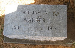
| Birth | : | 5 Mar 1849 Big Springs, Blount County, Tennessee, USA |
| Death | : | 12 Apr 1939 Maryville, Blount County, Tennessee, USA |
| Burial | : | Östra Vemmerlöv Cemetery, Ostra Vemmerlov, Simrishamns kommun, Sweden |
| Coordinate | : | 55.5796100, 14.2357100 |
| Description | : | She married Leander McCulloch on 24 March 1867 in Maryville, Blount County, Tennessee. They were divorced on 21 September 1870 in Washington County, Iowa. She married 2-time widower, John Wesley Kizer on 12 February 1885 in Blount County, Tennessee. |
frequently asked questions (FAQ):
-
Where is Mary Lucinda Walker Kizer's memorial?
Mary Lucinda Walker Kizer's memorial is located at: Östra Vemmerlöv Cemetery, Ostra Vemmerlov, Simrishamns kommun, Sweden.
-
When did Mary Lucinda Walker Kizer death?
Mary Lucinda Walker Kizer death on 12 Apr 1939 in Maryville, Blount County, Tennessee, USA
-
Where are the coordinates of the Mary Lucinda Walker Kizer's memorial?
Latitude: 55.5796100
Longitude: 14.2357100
Family Members:
Parent
Spouse
Siblings
Children
Flowers:
Nearby Cemetories:
1. Östra Vemmerlöv Cemetery
Ostra Vemmerlov, Simrishamns kommun, Sweden
Coordinate: 55.5796100, 14.2357100
2. Östra Wemmerlöv
Garsnas, Simrishamns kommun, Sweden
Coordinate: 55.5800533, 14.2358324
3. Old Gladsax Cemetery
Gladsax, Simrishamns kommun, Sweden
Coordinate: 55.5613000, 14.2865700
4. Stiby Cemetery
Stiby, Simrishamns kommun, Sweden
Coordinate: 55.5556400, 14.1718000
5. Östra Tommarp New Cemetery
Ostra Tommarp, Simrishamns kommun, Sweden
Coordinate: 55.5329100, 14.2382400
6. Östra Tommarp Old Cemetery
Ostra Tommarp, Simrishamns kommun, Sweden
Coordinate: 55.5329100, 14.2382400
7. Järrestads kyrkogård
Jarrestad, Simrishamns kommun, Sweden
Coordinate: 55.5380560, 14.2855560
8. Rörum North Cemetery
Rorum, Simrishamns kommun, Sweden
Coordinate: 55.6308800, 14.2488200
9. Simrishamn Northern Cemetery
Simrishamn, Simrishamns kommun, Sweden
Coordinate: 55.5652780, 14.3350560
10. Simris nya kyrkogård
Simris, Simrishamns kommun, Sweden
Coordinate: 55.5342230, 14.3198200
11. Simris gamla kyrkogård
Simris, Simrishamns kommun, Sweden
Coordinate: 55.5352780, 14.3216670
12. Östra Nöbbelöv Old Cemetery
Ostra Nobbelov, Simrishamns kommun, Sweden
Coordinate: 55.5178100, 14.3045800
13. Smedstorp Cemetery
Smedstorp, Tomelilla kommun, Sweden
Coordinate: 55.5613000, 14.1094000
14. Vallby Cemetery
Simrishamns kommun, Sweden
Coordinate: 55.4976700, 14.2058300
15. Södra Mellby Cemetery
Sodra Mellby, Simrishamns kommun, Sweden
Coordinate: 55.6629360, 14.2180900
16. Ravlunda kyrkogård
Simrishamn, Simrishamns kommun, Sweden
Coordinate: 55.7137160, 14.1508980
17. Brösarps Kyrkogård
Brosarp, Tomelilla kommun, Sweden
Coordinate: 55.7242190, 14.1050490
18. Felestads kyrkogård
Felestad, Svalövs kommun, Sweden
Coordinate: 55.5792629, 13.8935620
19. Vollsjö Lutheran Church Cemetery
Vollsjo, Sjöbo kommun, Sweden
Coordinate: 55.6939190, 13.7756540
20. Långaröds kyrkogård
Hörby kommun, Sweden
Coordinate: 55.7877780, 13.8380560
21. Öveds Kyrkogård
Vollsjo, Sjöbo kommun, Sweden
Coordinate: 55.6886928, 13.6440773
22. Blentarps Kyrkogård
Blentarp, Sjöbo kommun, Sweden
Coordinate: 55.5815241, 13.6079149
23. Villie kyrkogård
Villie, Skurups kommun, Sweden
Coordinate: 55.4790177, 13.5976917
24. Örsjö Kyrkogård
Orsjo, Skurups kommun, Sweden
Coordinate: 55.4652780, 13.5650000


