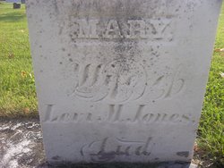
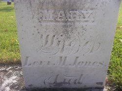
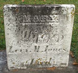
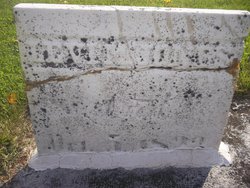
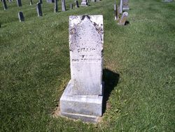
Mary M. “Polly” Thomas Jones
| Birth | : | 7 Feb 1784 Buckingham County, Virginia, USA |
| Death | : | 20 Dec 1848 Centerville, Wayne County, Indiana, USA |
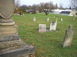
| Burial | : | Hamilton Lawn Cemetery, Hamilton, Southern Grampians Shire, Australia |
| Coordinate | : | -37.7166210, 141.9958450 |
| Plot | : | Section, Old Row 4, Grave 17 |
| Inscription | : | Information taken from book entitled "Poems and Sketches" by George P. Emswiler dated 1897 |
| Description | : | Levi M. Jones after his marriage (to Mary Thomas) continued farming in West Virginia until March, 1815, when he started for Wayne County, Indiana. He journeyed down the Ohio river on a flatboat to Cincinnati, and then drove across country to Wayne County. He first located at Old Salisbury and a year later bought 160 acres in Center Township of Wayne County. Two years later he sold that property and bought lots in Centerville, where he built a hotel, and in 1819 constructed the first brick house in the town. This brick house became associated with many important events in... Read More |
frequently asked questions (FAQ):
-
Where is Mary M. “Polly” Thomas Jones's memorial?
Mary M. “Polly” Thomas Jones's memorial is located at: Hamilton Lawn Cemetery, Hamilton, Southern Grampians Shire, Australia.
-
When did Mary M. “Polly” Thomas Jones death?
Mary M. “Polly” Thomas Jones death on 20 Dec 1848 in Centerville, Wayne County, Indiana, USA
-
Where are the coordinates of the Mary M. “Polly” Thomas Jones's memorial?
Latitude: -37.7166210
Longitude: 141.9958450
Family Members:
Spouse
Children
Flowers:
Nearby Cemetories:
1. Hamilton Lawn Cemetery
Hamilton, Southern Grampians Shire, Australia
Coordinate: -37.7166210, 141.9958450
2. Hamilton Cemetery
Hamilton, Southern Grampians Shire, Australia
Coordinate: -37.7292360, 142.0042510
3. Hamilton South Lutheran Cemetery
Hamilton, Southern Grampians Shire, Australia
Coordinate: -37.7448250, 142.0551370
4. Byaduk North Cemetery
Byaduk North, Southern Grampians Shire, Australia
Coordinate: -37.8860830, 141.9613400
5. Cavendish Tannery Cemetery
Cavendish, Southern Grampians Shire, Australia
Coordinate: -37.5473050, 142.0412610
6. Branxholme Cemetery
Branxholme, Southern Grampians Shire, Australia
Coordinate: -37.8396270, 141.8293930
7. Cavendish Old Cemetery
Cavendish, Southern Grampians Shire, Australia
Coordinate: -37.5254459, 142.0319975
8. Tabor Lutheran Cemetery
Tabor, Southern Grampians Shire, Australia
Coordinate: -37.8340270, 142.2048500
9. Cavendish Cemetery
Cavendish, Southern Grampians Shire, Australia
Coordinate: -37.5145080, 142.0358390
10. Herrnhut Cemetery
Tarrington, Southern Grampians Shire, Australia
Coordinate: -37.8362950, 142.2346290
11. Byaduk Cemetery
Byaduk, Southern Grampians Shire, Australia
Coordinate: -37.9476250, 141.9640300
12. Byaduk Lutheran Cemetery
Byaduk, Southern Grampians Shire, Australia
Coordinate: -37.9434620, 141.9163240
13. Boram Boram Cemetery
Penshurst, Southern Grampians Shire, Australia
Coordinate: -37.8372140, 142.2774160
14. Dunkeld New Cemetery
Dunkeld, Southern Grampians Shire, Australia
Coordinate: -37.6336550, 142.3451840
15. Coleraine Cemetery
Coleraine, Southern Grampians Shire, Australia
Coordinate: -37.5974900, 141.6631400
16. Dunkeld Old Cemetery
Dunkeld, Southern Grampians Shire, Australia
Coordinate: -37.6652230, 142.3738270
17. Myamyn and Condah Public Cemetery
Condah, Glenelg Shire, Australia
Coordinate: -37.9634660, 141.7333370
18. Macarthur Cemetery
Macarthur, Moyne Shire, Australia
Coordinate: -38.0388500, 142.0225200
19. Merino Cemetery
Merino, Glenelg Shire, Australia
Coordinate: -37.6908180, 141.5434050
20. Hotspur Cemetery
Hotspur, Glenelg Shire, Australia
Coordinate: -37.9297580, 141.5866650
21. Rifle Ranges Pastoral Run
Digby, Glenelg Shire, Australia
Coordinate: -37.7813184, 141.5104222
22. Brie Brie Cemetery
Glenthompson, Southern Grampians Shire, Australia
Coordinate: -37.7201260, 142.4926370
23. Digby Cemetery
Digby, Glenelg Shire, Australia
Coordinate: -37.8196840, 141.5040810
24. Sandford Cemetery
Sandford, Glenelg Shire, Australia
Coordinate: -37.6290998, 141.4562576

