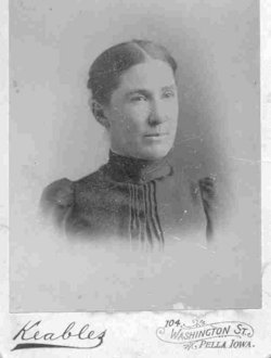
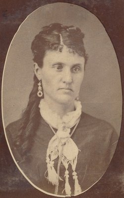
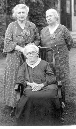
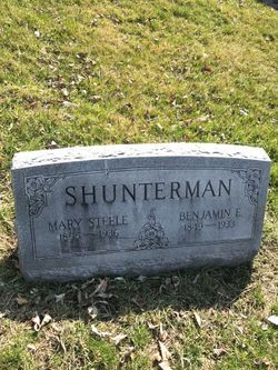
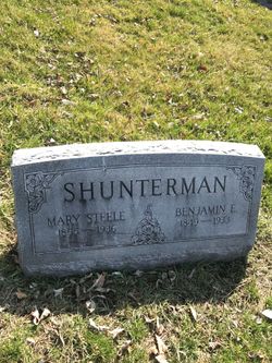
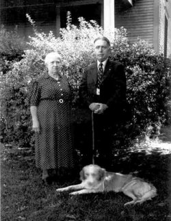
Mary “Mollie” Steele Shunterman
| Birth | : | 16 Nov 1855 Lee County, Iowa, USA |
| Death | : | 8 May 1936 Washington County, Iowa, USA |
| Burial | : | Maple Hill Cemetery, Jefferson County, USA |
| Coordinate | : | 43.9383011, -75.8063965 |
| Description | : | Mrs. Mary Shunterman died at the home of her daughter, Mrs. Ralph Lytle near Washington, Iowa. She had been in poor health and death was due to heart trouble. Mary Steele was born in Lee county, Nov. 16, 1855, the daughter of William and Elizabeth (Stutsman) Steele. They moved to Missouri when she was a small girl, returning to Iowa sometime after the Civil War. She grew up and went to school near Batavia, Iowa. She married Benjamin F. Shunterman in November, 1870. They lived in the Batavia and Eldon communities until 1892 when they moved... Read More |
frequently asked questions (FAQ):
-
Where is Mary “Mollie” Steele Shunterman's memorial?
Mary “Mollie” Steele Shunterman's memorial is located at: Maple Hill Cemetery, Jefferson County, USA.
-
When did Mary “Mollie” Steele Shunterman death?
Mary “Mollie” Steele Shunterman death on 8 May 1936 in Washington County, Iowa, USA
-
Where are the coordinates of the Mary “Mollie” Steele Shunterman's memorial?
Latitude: 43.9383011
Longitude: -75.8063965
Family Members:
Parent
Spouse
Siblings
Children
Flowers:
Nearby Cemetories:
1. Maple Hill Cemetery
Jefferson County, USA
Coordinate: 43.9383011, -75.8063965
2. Rutland Hollow Cemetery
Black River, Jefferson County, USA
Coordinate: 43.9838982, -75.8031006
3. Clark Cemetery
Black River, Jefferson County, USA
Coordinate: 43.9869003, -75.7930984
4. South Champion Cemetery
Jefferson County, USA
Coordinate: 43.9169006, -75.7418976
5. Graves Cemetery
Black River, Jefferson County, USA
Coordinate: 43.9852982, -75.7502975
6. Black River Cemetery
Rutland Center, Jefferson County, USA
Coordinate: 44.0068000, -75.7842100
7. Glass Road Cemetery
Rutland Center, Jefferson County, USA
Coordinate: 44.0019980, -75.7590980
8. East Rodman Cemetery
East Rodman, Jefferson County, USA
Coordinate: 43.8721400, -75.8515000
9. Crandall Hill Cemetery
Rodman, Jefferson County, USA
Coordinate: 43.8871670, -75.8854170
10. Degel Israel Cemetery
Jefferson County, USA
Coordinate: 43.9342003, -75.9163971
11. Felts Mills Cemetery
Felts Mills, Jefferson County, USA
Coordinate: 44.0186200, -75.7638900
12. Hillside Cemetery
Champion, Jefferson County, USA
Coordinate: 43.9664001, -75.6924973
13. Champion Huddle Cemetery
Champion, Jefferson County, USA
Coordinate: 44.0001500, -75.7123900
14. Pinckney Corners Cemetery
Pinckney Corners, Lewis County, USA
Coordinate: 43.8675400, -75.7249900
15. Sandy Loam Cemetery
Calcium, Jefferson County, USA
Coordinate: 44.0099983, -75.8925018
16. Sanford Corners Cemetery
Calcium, Jefferson County, USA
Coordinate: 44.0313988, -75.8339005
17. Fassetts Cemetery
Rodman, Jefferson County, USA
Coordinate: 43.8619400, -75.8919500
18. Riverside Cemetery Annex
Copenhagen, Lewis County, USA
Coordinate: 43.8961790, -75.6688740
19. Bentley Family Cemetery
Champion, Jefferson County, USA
Coordinate: 44.0229080, -75.7113900
20. Riverside Cemetery
Copenhagen, Lewis County, USA
Coordinate: 43.8964200, -75.6668300
21. Sunnyside Cemetery
Great Bend, Jefferson County, USA
Coordinate: 44.0275002, -75.7164001
22. Plank Cemetery
Copenhagen, Lewis County, USA
Coordinate: 43.9152985, -75.6547012
23. Fairview Cemetery
Copenhagen, Lewis County, USA
Coordinate: 43.8885994, -75.6675034
24. Quaker Cemetery
Jefferson County, USA
Coordinate: 44.0498428, -75.7729187

