

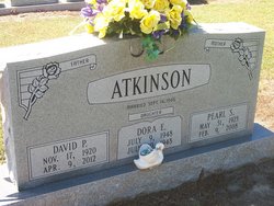
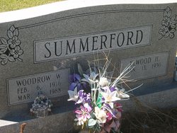
Mary Pearl Summerford Atkinson
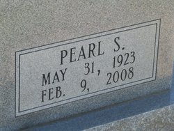
| Birth | : | 31 May 1923 Florence County, South Carolina, USA |
| Death | : | 9 Feb 2008 Brittons Neck, Marion County, South Carolina, USA |
| Burial | : | Nebo Baptist Church Cemetery, Gresham, Marion County, USA |
| Coordinate | : | 33.9364000, -79.3442920 |
| Inscription | : | "Mother" |
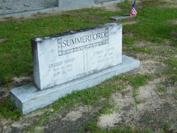
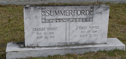
| Description | : | Daughter of Charles Robert and Emily Powell Summerford. Mary married David Power Atkinson on September 14, 1946. Mary Pearl Summerford Atkinson, 84, of Brittons Neck, wife of David P. Atkinson, died Saturday, Feb. 9, 2008, in her home, after an illness. Services were held at 3 p.m. on Feb. 11 in Nebo Baptist Church, with the Rev. Shafter M. Johnston officiating. Burial followed in Nebo Baptist Church Cemetery, directed by Smith-Collins Funeral Home of Marion. Mrs. Atkinson was born May 31, 1923 in Florence County, a daughter of the late Charles R. and Emily Powell Summerford. She retired from Sara Lee Hosiery as... Read More |
frequently asked questions (FAQ):
-
Where is Mary Pearl Summerford Atkinson's memorial?
Mary Pearl Summerford Atkinson's memorial is located at: Nebo Baptist Church Cemetery, Gresham, Marion County, USA.
-
When did Mary Pearl Summerford Atkinson death?
Mary Pearl Summerford Atkinson death on 9 Feb 2008 in Brittons Neck, Marion County, South Carolina, USA
-
Where are the coordinates of the Mary Pearl Summerford Atkinson's memorial?
Latitude: 33.9364000
Longitude: -79.3442920
Family Members:
Parent
Spouse
Siblings
Children

Flowers:


Nearby Cemetories:
1. Nebo Baptist Church Cemetery
Gresham, Marion County, USA
Coordinate: 33.9364000, -79.3442920
2. Richardson Family Cemetery
Brittons Neck, Marion County, USA
Coordinate: 33.9346310, -79.3362370
3. Antley Richardson Cemetery
Centenary, Marion County, USA
Coordinate: 33.9454500, -79.3386667
4. Antley Cemetery
Gresham, Marion County, USA
Coordinate: 33.9473751, -79.3367195
5. Watson Cemetery
Brittons Neck, Marion County, USA
Coordinate: 33.9221410, -79.3347220
6. Brittons Neck Cemetery
Brittons Neck, Marion County, USA
Coordinate: 33.9216750, -79.3348070
7. Hickory Hill Free Will Baptist Church Cemetery
Gresham, Marion County, USA
Coordinate: 33.8952050, -79.3848740
8. Beach Field Cemetery
Brittons Neck, Marion County, USA
Coordinate: 33.8822600, -79.3518200
9. Pee Dee Baptist Church Cemetery
Gresham, Marion County, USA
Coordinate: 33.9277200, -79.4123300
10. Soul Chapel A.M.E. Cemetery
Gresham, Marion County, USA
Coordinate: 33.9104300, -79.4094700
11. White Hill Missionary Baptist Church Cemetery
Gresham, Marion County, USA
Coordinate: 33.9346000, -79.4215300
12. Souls Chapel Cemetery
Gresham, Marion County, USA
Coordinate: 33.9182600, -79.4186200
13. Old Neck Cemetery
Brittons Neck, Marion County, USA
Coordinate: 33.8630700, -79.3312500
14. Alison Graveyard
Kingsburg, Florence County, USA
Coordinate: 33.8788600, -79.4018400
15. True Gospel Church Cemetery
Brittons Neck, Marion County, USA
Coordinate: 33.8625600, -79.3285000
16. Friendship AME Church Cemetery
Gresham, Marion County, USA
Coordinate: 33.9900970, -79.4180260
17. Palmer Cemetery
Marion County, USA
Coordinate: 34.0205994, -79.3458023
18. Gethsemane Freewill Baptist Church Cemetery
Galivants Ferry, Horry County, USA
Coordinate: 33.9615400, -79.2397900
19. Centerville Baptist Church Cemetery
Centenary, Marion County, USA
Coordinate: 34.0302990, -79.3608240
20. Red Hill Methodist Church Cemetery
Galivants Ferry, Horry County, USA
Coordinate: 34.0001800, -79.2578170
21. Baptist Colored Cemetery
Galivants Ferry, Horry County, USA
Coordinate: 33.9906830, -79.2469640
22. Pisgah United Methodist Church Cemetery
Galivants Ferry, Horry County, USA
Coordinate: 33.9650860, -79.2316450
23. Johnson Family Cemetery
Galivants Ferry, Horry County, USA
Coordinate: 33.9528650, -79.2279750
24. Mount Hermon Baptist Church Cemetery
Galivants Ferry, Horry County, USA
Coordinate: 33.9129660, -79.2277850