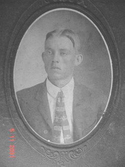
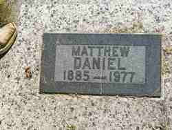
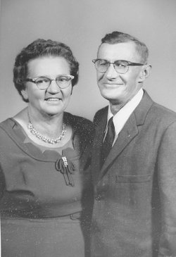
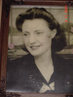
Matthew Daniel
| Birth | : | 4 May 1885 Fordland, Webster County, Missouri, USA |
| Death | : | 22 Aug 1977 Muscotah, Atchison County, Kansas, USA |
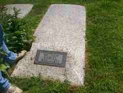
| Burial | : | Arkalon Cemetery, Arkalon, Seward County, USA |
| Coordinate | : | 37.1345100, -100.8143800 |
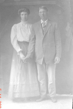
| Description | : | From Gene Daniels, who wrote a letter to my great Aunt, it has Matthew Daniels and Nora McDonald "they were married on Sept. 12, 1909, at the recorder of Deeds in Webster County, Mo. Two of the witness of there (sic) marriage was Uncle Joe Daniels and Uncle Tolly McDonald, "Dad's brother" and "Mom's brother". They were married at Uncle Tolley's house." They moved to Kansas in about 1913 or 1914 from Missouri. Settled in Muscotah, Kansas, where they lived until 1922 or so. They moved to Farmington, Kansas for a few years, then moved back to... Read More |
frequently asked questions (FAQ):
-
Where is Matthew Daniel's memorial?
Matthew Daniel's memorial is located at: Arkalon Cemetery, Arkalon, Seward County, USA.
-
When did Matthew Daniel death?
Matthew Daniel death on 22 Aug 1977 in Muscotah, Atchison County, Kansas, USA
-
Where are the coordinates of the Matthew Daniel's memorial?
Latitude: 37.1345100
Longitude: -100.8143800
Family Members:
Parent
Spouse
Children
Flowers:
Nearby Cemetories:
1. Arkalon Cemetery
Arkalon, Seward County, USA
Coordinate: 37.1345100, -100.8143800
2. Restlawn Cemetery
Liberal, Seward County, USA
Coordinate: 37.1117000, -100.9217000
3. Corlett Cemetery
Liberal, Seward County, USA
Coordinate: 37.2287180, -100.8485910
4. Kismet Cemetery
Kismet, Seward County, USA
Coordinate: 37.2041500, -100.7079400
5. Bixler Cemetery
Liberal, Seward County, USA
Coordinate: 37.0393982, -100.7050018
6. Liberal Cemetery
Liberal, Seward County, USA
Coordinate: 37.0555992, -100.9475021
7. Springfield Cemetery
Seward County, USA
Coordinate: 37.2792015, -100.8600006
8. Union Cemetery
Beaver County, USA
Coordinate: 36.9491997, -100.8189011
9. West Glendale Cemetery
Plains, Meade County, USA
Coordinate: 37.1196700, -100.5790100
10. Turpin Cemetery
Turpin, Beaver County, USA
Coordinate: 36.9216995, -100.7742004
11. Lonestar Cemetery
Woods, Stevens County, USA
Coordinate: 37.1703000, -101.0860800
12. Plains Cemetery
Plains, Meade County, USA
Coordinate: 37.2569800, -100.5824500
13. Banner Cemetery
Seward County, USA
Coordinate: 37.3591995, -100.8332977
14. Golden Plains Cemetery
Seward County, USA
Coordinate: 37.2718330, -101.0431556
15. Independence Cemetery
Turpin, Beaver County, USA
Coordinate: 36.8932991, -100.8818970
16. Midway Cemetery
Floris, Beaver County, USA
Coordinate: 36.8922600, -100.7240900
17. Zion Methodist Episcopal Church Cemetery
Stevens County, USA
Coordinate: 37.1076500, -101.1395140
18. Tyrone Cemetery
Tyrone, Texas County, USA
Coordinate: 36.9347000, -101.0453033
19. Young Family Cemetery
Liberal, Seward County, USA
Coordinate: 37.3518230, -101.0514950
20. Atwater Cemetery
Meade County, USA
Coordinate: 37.1411018, -100.4471970
21. Seward Cemetery
Meade, Meade County, USA
Coordinate: 37.1913600, -100.4346200
22. Nabisco Cemetery
Baker, Texas County, USA
Coordinate: 36.8488998, -100.9705963
23. Forgan Cemetery
Forgan, Beaver County, USA
Coordinate: 36.9174995, -100.5307999
24. Mertilla Cemetery
Meade County, USA
Coordinate: 37.3950100, -100.5612900

