
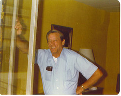
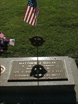
Matthew J Sedlak
| Birth | : | 4 Apr 1922 Plattsmouth, Cass County, Nebraska, USA |
| Death | : | 1 Oct 1996 Plattsmouth, Cass County, Nebraska, USA |
| Burial | : | Manahath Cemetery, Glassboro, Gloucester County, USA |
| Coordinate | : | 39.7154236, -75.1141129 |
| Inscription | : | S1 US Coast Guard World War II Lovingly Known as Mutz |
frequently asked questions (FAQ):
-
Where is Matthew J Sedlak's memorial?
Matthew J Sedlak's memorial is located at: Manahath Cemetery, Glassboro, Gloucester County, USA.
-
When did Matthew J Sedlak death?
Matthew J Sedlak death on 1 Oct 1996 in Plattsmouth, Cass County, Nebraska, USA
-
Where are the coordinates of the Matthew J Sedlak's memorial?
Latitude: 39.7154236
Longitude: -75.1141129
Family Members:
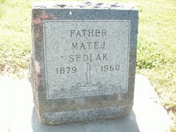
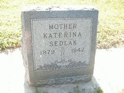
Parent
Spouse

Siblings
Flowers:


Nearby Cemetories:
1. Manahath Cemetery
Glassboro, Gloucester County, USA
Coordinate: 39.7154236, -75.1141129
2. Saint Thomas Episcopal Church Cemetery
Glassboro, Gloucester County, USA
Coordinate: 39.7079200, -75.1101500
3. First United Methodist Church Cemetery
Glassboro, Gloucester County, USA
Coordinate: 39.7068900, -75.1081300
4. Saint Bridgets Cemetery
Glassboro, Gloucester County, USA
Coordinate: 39.7023300, -75.1159000
5. Trinity Bible Cemetery
Glassboro, Gloucester County, USA
Coordinate: 39.7003610, -75.1133800
6. Cost Family Cemetery
Pitman, Gloucester County, USA
Coordinate: 39.7307100, -75.1332310
7. Hillcrest Memorial Park
Hurffville, Gloucester County, USA
Coordinate: 39.7491989, -75.1110992
8. Bunker Hill Presbyterian Church Cemetery
Gloucester County, USA
Coordinate: 39.7451600, -75.0849200
9. Richwood United Methodist Church Cemetery
Richwood, Gloucester County, USA
Coordinate: 39.7211100, -75.1667700
10. Land Of Canaan Cemetery
Glassboro, Gloucester County, USA
Coordinate: 39.6741982, -75.1085968
11. Bethel Methodist Church Cemetery
Hurffville, Gloucester County, USA
Coordinate: 39.7571983, -75.1110992
12. Aura Methodist Cemetery
Aura, Gloucester County, USA
Coordinate: 39.6725006, -75.1374969
13. Downer United Methodist Church Cemetery
Williamstown, Gloucester County, USA
Coordinate: 39.6929700, -75.0523200
14. Mount Zion Methodist Church Cemetery
Barnsboro, Gloucester County, USA
Coordinate: 39.7547540, -75.1629530
15. Driver Cemetery
Barnsboro, Gloucester County, USA
Coordinate: 39.7631000, -75.1554900
16. Cedar Green Cemetery
Clayton, Gloucester County, USA
Coordinate: 39.6613998, -75.0852966
17. Gloucester County Veterans Memorial Cemetery
Williamstown, Gloucester County, USA
Coordinate: 39.6521279, -75.1163586
18. Bunker Hill Presbyterian Church Cemetery
Sewell, Gloucester County, USA
Coordinate: 39.7767514, -75.0931293
19. Jesse Chew Cemetery
Gloucester County, USA
Coordinate: 39.7736800, -75.1498250
20. Cross Keys Methodist Cemetery
Williamstown, Gloucester County, USA
Coordinate: 39.7124800, -75.0273100
21. Saint Johns United Methodist Cemetery
Turnersville, Gloucester County, USA
Coordinate: 39.7598300, -75.0487100
22. Hardingville Cemetery
Hardingville, Gloucester County, USA
Coordinate: 39.6632100, -75.1790400
23. Alms House Cemetery
Lakeland, Camden County, USA
Coordinate: 39.7878700, -75.0823500
24. Grenloch First Presbyterian Church Memorial Garden
Grenloch Terrace, Gloucester County, USA
Coordinate: 39.7806000, -75.0587000