
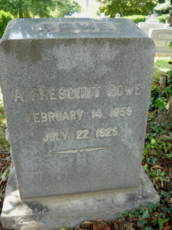
Maurice Broaddus Rowe
| Birth | : | 25 Feb 1850 Fredericksburg City, Virginia, USA |
| Death | : | 25 Mar 1925 Spotsylvania County, Virginia, USA |
| Burial | : | Lakewood Memorial Park, Hughson, Stanislaus County, USA |
| Coordinate | : | 37.6199760, -120.8975983 |
| Plot | : | Section 1, Lot 6, Grave 1 |
| Description | : | President of The Planters National Bank in Fredericksburg. Owner of "Brompton Stock Farm" |
frequently asked questions (FAQ):
-
Where is Maurice Broaddus Rowe's memorial?
Maurice Broaddus Rowe's memorial is located at: Lakewood Memorial Park, Hughson, Stanislaus County, USA.
-
When did Maurice Broaddus Rowe death?
Maurice Broaddus Rowe death on 25 Mar 1925 in Spotsylvania County, Virginia, USA
-
Where are the coordinates of the Maurice Broaddus Rowe's memorial?
Latitude: 37.6199760
Longitude: -120.8975983
Family Members:
Parent
Spouse
Siblings
Children

Flowers:


Nearby Cemetories:
1. Lakewood Memorial Park
Hughson, Stanislaus County, USA
Coordinate: 37.6199760, -120.8975983
2. Ceres Memorial Park
Ceres, Stanislaus County, USA
Coordinate: 37.5958214, -120.9634399
3. Saint Stanislaus Catholic Cemetery
Modesto, Stanislaus County, USA
Coordinate: 37.6473610, -120.9808440
4. Modesto County Cemetery
Modesto, Stanislaus County, USA
Coordinate: 37.6492400, -120.9813800
5. Modesto Pioneer Cemetery
Modesto, Stanislaus County, USA
Coordinate: 37.6473350, -120.9829040
6. Acacia Memorial Park
Modesto, Stanislaus County, USA
Coordinate: 37.6481080, -120.9836610
7. Modesto Citizens Cemetery
Modesto, Stanislaus County, USA
Coordinate: 37.6472930, -120.9845570
8. Denair Cemetery
Denair, Stanislaus County, USA
Coordinate: 37.5293999, -120.8199997
9. Martin Cemetery
Waterford, Stanislaus County, USA
Coordinate: 37.6684360, -120.7582160
10. Saint Francis Episcopal Church Columbarium
Turlock, Stanislaus County, USA
Coordinate: 37.5014300, -120.8368400
11. Turlock Memorial Park
Turlock, Stanislaus County, USA
Coordinate: 37.4937592, -120.8659821
12. Langworth Cemetery
Oakdale, Stanislaus County, USA
Coordinate: 37.7580986, -120.8957977
13. Good Shepherd Catholic Cemetery
Modesto, Stanislaus County, USA
Coordinate: 37.6853130, -121.0672890
14. Oakdale Citizens Cemetery
Oakdale, Stanislaus County, USA
Coordinate: 37.7624600, -120.8388800
15. Burwood Cemetery
Escalon, San Joaquin County, USA
Coordinate: 37.7616997, -120.9593964
16. Wood Colony Cemetery
Salida, Stanislaus County, USA
Coordinate: 37.6893730, -121.0682144
17. Oaklawn Memorial Park
Oakdale, Stanislaus County, USA
Coordinate: 37.7711945, -120.8486862
18. North Hilmar Cemetery
Hilmar, Merced County, USA
Coordinate: 37.4146614, -120.8864288
19. Valley Home Memorial Park
Oakdale, Stanislaus County, USA
Coordinate: 37.8275528, -120.9333267
20. Roberts Ferry Cemetery
Waterford, Stanislaus County, USA
Coordinate: 37.6408005, -120.6288986
21. Ripon Cemetery
Ripon, San Joaquin County, USA
Coordinate: 37.7420311, -121.1238708
22. Saint John's Catholic Cemetery
Escalon, San Joaquin County, USA
Coordinate: 37.7994537, -121.0705185
23. Grayson Cemetery
Grayson, Stanislaus County, USA
Coordinate: 37.5594559, -121.1802826
24. Patterson District Cemetery
Patterson, Stanislaus County, USA
Coordinate: 37.5268135, -121.1728287