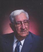
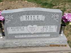
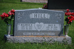
Max Dillion Hill
| Birth | : | 18 Apr 1920 Trenton, Henry County, Iowa, USA |
| Death | : | 5 Jan 2004 Washington, Washington County, Iowa, USA |
| Burial | : | Elm Grove Cemetery, Washington, Washington County, USA |
| Coordinate | : | 41.2861279, -91.7004451 |
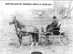
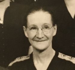
| Description | : | H/O Mildred Graf, Was in the army Air Corps WWII,Served in Siapan and Guam. Farmed near Fairfield and also was a truck driver.Parents: John and Bertha (Christner)Hill |
frequently asked questions (FAQ):
-
Where is Max Dillion Hill's memorial?
Max Dillion Hill's memorial is located at: Elm Grove Cemetery, Washington, Washington County, USA.
-
When did Max Dillion Hill death?
Max Dillion Hill death on 5 Jan 2004 in Washington, Washington County, Iowa, USA
-
Where are the coordinates of the Max Dillion Hill's memorial?
Latitude: 41.2861279
Longitude: -91.7004451
Family Members:
Parent
Spouse
Siblings
Children
Flowers:
Nearby Cemetories:
1. Elm Grove Cemetery
Washington, Washington County, USA
Coordinate: 41.2861279, -91.7004451
2. Woodlawn Cemetery
Washington, Washington County, USA
Coordinate: 41.2943300, -91.6968100
3. County Home Cemetery
Washington County, USA
Coordinate: 41.3125162, -91.7223905
4. Moore Cemetery
Washington, Washington County, USA
Coordinate: 41.2583511, -91.6668326
5. Pleasant Hill Cemetery
Washington, Washington County, USA
Coordinate: 41.2435989, -91.6474991
6. Shiloh Cemetery
Washington, Washington County, USA
Coordinate: 41.2250130, -91.6789390
7. Pattison Cemetery
West Chester, Washington County, USA
Coordinate: 41.3365000, -91.7534000
8. Memorial Miller Cemetery
Washington, Washington County, USA
Coordinate: 41.2400500, -91.7735900
9. Schrock-Eureka Cemetery
Washington County, USA
Coordinate: 41.2050018, -91.7125015
10. Benson Cemetery
Washington County, USA
Coordinate: 41.2376912, -91.6108355
11. Craven Cemetery
West Chester, Washington County, USA
Coordinate: 41.3444595, -91.7835035
12. Martin Cemetery
Marion Township, Washington County, USA
Coordinate: 41.2000194, -91.6668323
13. Custer Cemetery
Washington County, USA
Coordinate: 41.1921500, -91.7125900
14. Todd Cemetery
Franklin Township, Washington County, USA
Coordinate: 41.2555705, -91.8196155
15. Plains Cemetery
Washington, Washington County, USA
Coordinate: 41.3808632, -91.7000885
16. Bethel Mennonite Church Cemetery
Washington County, USA
Coordinate: 41.1963997, -91.6596985
17. Grace Hill Cemetery
Washington County, USA
Coordinate: 41.2593994, -91.8281021
18. Sommers Cemetery
Washington County, USA
Coordinate: 41.1927986, -91.6505966
19. Roberts Chapel Cemetery
West Chester, Washington County, USA
Coordinate: 41.3616982, -91.7893982
20. Gatlin Cemetery
Brighton, Washington County, USA
Coordinate: 41.2416818, -91.8251712
21. Ainsworth Cemetery
Ainsworth, Washington County, USA
Coordinate: 41.2943649, -91.5626373
22. Sandy Hook Cemetery
Brighton, Washington County, USA
Coordinate: 41.2050018, -91.7957993
23. West Chester Cemetery
West Chester, Washington County, USA
Coordinate: 41.3521996, -91.8146973
24. New Haven Cemetery
Washington County, USA
Coordinate: 41.2943993, -91.8480988

