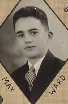
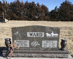
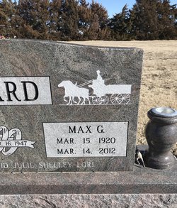
Max Griffith Ward
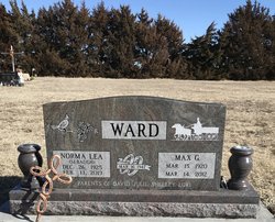
| Birth | : | 15 Mar 1920 Clayton, Norton County, Kansas, USA |
| Death | : | 14 Mar 2012 Oberlin, Decatur County, Kansas, USA |
| Burial | : | Clayton Cemetery, Decatur County, USA |
| Coordinate | : | 39.7546997, -100.1860962 |
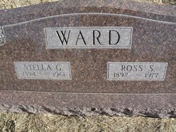
| Description | : | Max G. Ward, 92, died Wednesday (March 14, 2012), at Decatur Health Systems in Oberlin, Kansas. Max was born March 15, 1920,to Ross Smith and Stella Verna (Griffith) Ward, one mile west of Clayton, Kansas in his mother's home. Max attended rural Clayton grade school and graduated from Clayton High School in 1937. Max married Norma Sebaugh March 16, 1947, in Norcatur, Kansas. Max served in the U.S. Navy in World War II. He was a farmer/rancher. He was member of the Clayton United Methodist Church, American Legion and the Clayton and Jennings school boards. Max is preceded in death by his parents, Ross... Read More |
frequently asked questions (FAQ):
-
Where is Max Griffith Ward's memorial?
Max Griffith Ward's memorial is located at: Clayton Cemetery, Decatur County, USA.
-
When did Max Griffith Ward death?
Max Griffith Ward death on 14 Mar 2012 in Oberlin, Decatur County, Kansas, USA
-
Where are the coordinates of the Max Griffith Ward's memorial?
Latitude: 39.7546997
Longitude: -100.1860962
Family Members:
Parent
Spouse
Siblings
Children
Flowers:
Nearby Cemetories:
1. Clayton Cemetery
Decatur County, USA
Coordinate: 39.7546997, -100.1860962
2. Gettis Cemetery
Clayton, Norton County, USA
Coordinate: 39.6810989, -100.1327972
3. Norcatur Cemetery
Norton County, USA
Coordinate: 39.8432999, -100.1781006
4. Jennings Cemetery
Jennings, Decatur County, USA
Coordinate: 39.6824989, -100.3050003
5. Big Timber Cemetery
Decatur County, USA
Coordinate: 39.7546997, -100.3394012
6. Oronoque Cemetery
Norton, Norton County, USA
Coordinate: 39.7983017, -100.0117035
7. Shirley Cemetery
Norcatur, Decatur County, USA
Coordinate: 39.8999900, -100.1965000
8. Maple Grove Cemetery
Norton County, USA
Coordinate: 39.8871994, -100.0764008
9. Saint Joseph Cemetery
New Almelo, Norton County, USA
Coordinate: 39.5985985, -100.1159973
10. Kanona Cemetery
Kanona, Decatur County, USA
Coordinate: 39.8130989, -100.3949966
11. Immanuel Lutheran Cemetery
Norton, Norton County, USA
Coordinate: 39.8724700, -100.0202600
12. Prairie Gem Cemetery
Norton County, USA
Coordinate: 39.7117004, -99.9657974
13. Edwards Maple Cemetery
Norcatur, Decatur County, USA
Coordinate: 39.9007988, -100.3277969
14. Leoti Cemetery
Norton County, USA
Coordinate: 39.7839012, -99.9499969
15. Jackson Cemetery
Dresden, Decatur County, USA
Coordinate: 39.6727982, -100.4036026
16. Allison Cemetery
Decatur County, USA
Coordinate: 39.5741997, -100.2480011
17. Wray Cemetery
Norton, Norton County, USA
Coordinate: 39.9433100, -100.1507100
18. White Cemetery
Lyle, Decatur County, USA
Coordinate: 39.9371986, -100.3011017
19. Lyle Cemetery
Lyle, Decatur County, USA
Coordinate: 39.9578240, -100.2214560
20. Vallonia Cemetery
Oberlin, Decatur County, USA
Coordinate: 39.8792000, -100.4039001
21. Butler Cemetery
Devizes, Norton County, USA
Coordinate: 39.9652300, -100.1738200
22. Lenora East Cemetery
Lenora, Norton County, USA
Coordinate: 39.6035995, -99.9935989
23. Lenora South Cemetery
Lenora, Norton County, USA
Coordinate: 39.5956001, -100.0025024
24. Railsback Cemetery
Norton, Norton County, USA
Coordinate: 39.9725500, -100.1356700

