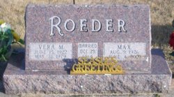
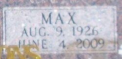
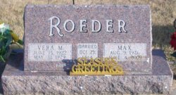
Max Roeder
| Birth | : | 6 Aug 1926 Des Moines, Polk County, Iowa, USA |
| Death | : | 4 Jun 2009 Oskaloosa, Mahaska County, Iowa, USA |
| Burial | : | East Dalton Oakhill Cemetery, North Muskegon, Muskegon County, USA |
| Coordinate | : | 43.3080700, -86.1872800 |
| Plot | : | Block XVIII Lot 19 |
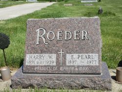
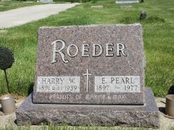
| Description | : | Max Roeder, 82, of What Cheer, IA, died Thursday, June 4, 2009 at the Mahaska County Hospital. Funeral services will begin at 10:30 am on Monday, June 8, 2009 at the Harden Funeral Chapel in What Cheer. Visitation will be held on Sunday evening from 5 to 7 PM at the funeral home. A committal service will be held at the Brooklyn Memorial Cemetery at 2:00 PM, Monday afternoon in Brooklyn. Max Roeder was born on August 9, 1926 in Des Moines, Iowa the son of Harry and Emma Story Roeder. Max grew up in Colfax and attended the Colfax High... Read More |
frequently asked questions (FAQ):
-
Where is Max Roeder's memorial?
Max Roeder's memorial is located at: East Dalton Oakhill Cemetery, North Muskegon, Muskegon County, USA.
-
When did Max Roeder death?
Max Roeder death on 4 Jun 2009 in Oskaloosa, Mahaska County, Iowa, USA
-
Where are the coordinates of the Max Roeder's memorial?
Latitude: 43.3080700
Longitude: -86.1872800
Family Members:
Parent
Spouse
Flowers:
Nearby Cemetories:
1. East Dalton Oakhill Cemetery
North Muskegon, Muskegon County, USA
Coordinate: 43.3080700, -86.1872800
2. Horton Cemetery
Twin Lake, Muskegon County, USA
Coordinate: 43.3157997, -86.1374969
3. Oakland Cemetery
Muskegon, Muskegon County, USA
Coordinate: 43.3463900, -86.2361100
4. Twin Lake Cemetery
Twin Lake, Muskegon County, USA
Coordinate: 43.3690000, -86.1650000
5. Forest Home Cemetery
Muskegon, Muskegon County, USA
Coordinate: 43.2441490, -86.2023930
6. Shady Rest Cemetery
Muskegon, Muskegon County, USA
Coordinate: 43.2383003, -86.1956024
7. Community United Methodist Church Memorial Gardens
North Muskegon, Muskegon County, USA
Coordinate: 43.2578420, -86.2656900
8. Fruitland Township Cemetery
Muskegon, Muskegon County, USA
Coordinate: 43.3269005, -86.2966995
9. Laketon Township Cemetery
North Muskegon, Muskegon County, USA
Coordinate: 43.2644005, -86.2830963
10. Old Indian Cemetery
Muskegon, Muskegon County, USA
Coordinate: 43.2375070, -86.2520680
11. Restlawn Cemetery
Muskegon, Muskegon County, USA
Coordinate: 43.2266998, -86.2288971
12. Central United Methodist Church Columbarium
Muskegon, Muskegon County, USA
Coordinate: 43.2341280, -86.2498210
13. Saint Pauls Episcopal Church Columbarium
Muskegon, Muskegon County, USA
Coordinate: 43.2344640, -86.2520210
14. Oakwood Cemetery
Muskegon, Muskegon County, USA
Coordinate: 43.2252998, -86.2313995
15. First Congregational Church Columbarium
Muskegon, Muskegon County, USA
Coordinate: 43.2305280, -86.2468650
16. Evergreen Cemetery
Muskegon, Muskegon County, USA
Coordinate: 43.2257996, -86.2356033
17. Sunrise Memorial Gardens
Muskegon, Muskegon County, USA
Coordinate: 43.2141991, -86.2007980
18. Saint Mary's Cemetery
Muskegon, Muskegon County, USA
Coordinate: 43.2178001, -86.2556000
19. Johnson Cemetery
Twin Lake, Muskegon County, USA
Coordinate: 43.3516585, -86.0583279
20. Saint Anthonys Cemetery
Cedar Creek Township, Muskegon County, USA
Coordinate: 43.3258018, -86.0441971
21. Sprague Cemetery
Whitehall, Muskegon County, USA
Coordinate: 43.3844400, -86.2905600
22. Egelston Township Cemetery
Muskegon, Muskegon County, USA
Coordinate: 43.2170440, -86.1032470
23. Ware Cemetery
Whitehall, Muskegon County, USA
Coordinate: 43.4119362, -86.2461056
24. Mona View Cemetery
Muskegon Heights, Muskegon County, USA
Coordinate: 43.1927986, -86.2300034

