

Maxine Elizabeth “Maxie” Moon Johnson
| Birth | : | 6 Sep 1941 Cumberland, Allegany County, Maryland, USA |
| Death | : | 9 Feb 2017 Cumberland, Allegany County, Maryland, USA |
| Burial | : | Rose Hill Cemetery, North Glade, Garrett County, USA |
| Coordinate | : | 39.4991989, -79.2450027 |
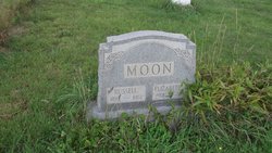
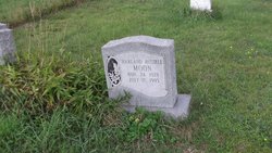
| Description | : | Johnson, Maxine 09/06/1941 - 02/09/2017 LAVALE—Maxine Elizabeth “Maxie” (Moon) Johnson, 75, of LaVale, passed away on Thursday, February 9, 2017 at the Allegany Health and Rehabilitation Center. Born in Cumberland, MD on September 6, 1941, she was the daughter of the late Russell and Elizabeth (Beckman) Moon. In addition to her parents, she was also preceded in death by a brother, Harland Moon. Maxine was a graduate of Allegany High School, class of 1959. While in school, she was a member of the National Honor Society. Maxine was a member of her class reunion committee, and she served as the class historian. Maxine... Read More |
frequently asked questions (FAQ):
-
Where is Maxine Elizabeth “Maxie” Moon Johnson's memorial?
Maxine Elizabeth “Maxie” Moon Johnson's memorial is located at: Rose Hill Cemetery, North Glade, Garrett County, USA.
-
When did Maxine Elizabeth “Maxie” Moon Johnson death?
Maxine Elizabeth “Maxie” Moon Johnson death on 9 Feb 2017 in Cumberland, Allegany County, Maryland, USA
-
Where are the coordinates of the Maxine Elizabeth “Maxie” Moon Johnson's memorial?
Latitude: 39.4991989
Longitude: -79.2450027
Family Members:
Parent

Siblings
Flowers:


Nearby Cemetories:
1. Rose Hill Cemetery
North Glade, Garrett County, USA
Coordinate: 39.4991989, -79.2450027
2. Alexander Lohr Family Cemetery
North Glade, Garrett County, USA
Coordinate: 39.5196991, -79.2472000
3. Pritts Cemetery
Garrett County, USA
Coordinate: 39.5353012, -79.2307968
4. Glendale Cemetery
Oakland, Garrett County, USA
Coordinate: 39.5085983, -79.2953033
5. Friend Cemetery
Altamont, Garrett County, USA
Coordinate: 39.4420950, -79.2955100
6. Wilson Cemetery
Altamont, Garrett County, USA
Coordinate: 39.4343600, -79.2764600
7. Beckman Cemetery
Garrett County, USA
Coordinate: 39.4350014, -79.2850037
8. Murphy Cemetery
Garrett County, USA
Coordinate: 39.5432000, -79.1673900
9. Evans Cemetery
Kitzmiller, Garrett County, USA
Coordinate: 39.4273500, -79.2201100
10. Barnard Cemetery
Garrett County, USA
Coordinate: 39.4850006, -79.1461029
11. Paradise Cemetery
Oakland, Garrett County, USA
Coordinate: 39.4712046, -79.3392075
12. Glotfelty Farm Cemetery
McHenry, Garrett County, USA
Coordinate: 39.5708800, -79.2905500
13. Mount Zion Cemetery
Garrett County, USA
Coordinate: 39.4393997, -79.1710968
14. Rodeheaver Cemetery
Oakland, Garrett County, USA
Coordinate: 39.4804680, -79.3521300
15. Ruckle Family Cemetery
Bittinger, Garrett County, USA
Coordinate: 39.5802600, -79.2821900
16. Glade Mennonite Cemetery
Bittinger, Garrett County, USA
Coordinate: 39.5826300, -79.2796700
17. Cherry Glade Cemetery
Accident, Garrett County, USA
Coordinate: 39.5827200, -79.2799500
18. Deer Park Cemetery
Deer Park, Garrett County, USA
Coordinate: 39.4275017, -79.3261032
19. Manor Cemetery
Garrett County, USA
Coordinate: 39.4286003, -79.1505966
20. Bumblebee Ridge Cemetery
McHenry, Garrett County, USA
Coordinate: 39.5774400, -79.3296800
21. Friend Cemetery
Oakland, Garrett County, USA
Coordinate: 39.4913500, -79.3778000
22. Bittinger Cemetery
Bittinger, Garrett County, USA
Coordinate: 39.6006012, -79.2189026
23. Meadow Mountain Mennonite Cemetery
Bittinger, Garrett County, USA
Coordinate: 39.6043890, -79.2603900
24. Orendorf Cemetery
Bittinger, Garrett County, USA
Coordinate: 39.6035700, -79.2197900