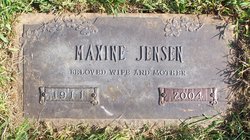
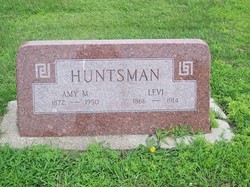
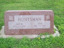
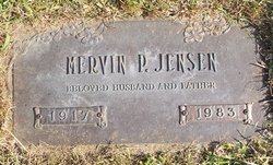
Maxine Huntsman Jensen
| Birth | : | 1911 Emerson, Mills County, Iowa, USA |
| Death | : | 20 Jan 2004 Council Bluffs, Pottawattamie County, Iowa, USA |
| Burial | : | Big Tygart Cemetery, Rockport, Wood County, USA |
| Coordinate | : | 39.1328011, -81.5457993 |
| Plot | : | Parklawn section, lot 022, grave 5 |
frequently asked questions (FAQ):
-
Where is Maxine Huntsman Jensen's memorial?
Maxine Huntsman Jensen's memorial is located at: Big Tygart Cemetery, Rockport, Wood County, USA.
-
When did Maxine Huntsman Jensen death?
Maxine Huntsman Jensen death on 20 Jan 2004 in Council Bluffs, Pottawattamie County, Iowa, USA
-
Where are the coordinates of the Maxine Huntsman Jensen's memorial?
Latitude: 39.1328011
Longitude: -81.5457993
Family Members:
Parent
Spouse
Siblings
Flowers:
Nearby Cemetories:
1. Big Tygart Cemetery
Rockport, Wood County, USA
Coordinate: 39.1328011, -81.5457993
2. Stephens Cemetery
Mineral Wells, Wood County, USA
Coordinate: 39.1371994, -81.5606003
3. Graham Cemetery
Wood County, USA
Coordinate: 39.1556015, -81.5468979
4. Brand Cemetery
Mineral Wells, Wood County, USA
Coordinate: 39.1247670, -81.5125000
5. Deem Cemetery
Mineral Wells, Wood County, USA
Coordinate: 39.1455994, -81.5017014
6. Stephens Cemetery
Mineral Wells, Wood County, USA
Coordinate: 39.1694000, -81.5432500
7. Reeder Cemetery
Wood County, USA
Coordinate: 39.1725006, -81.5419006
8. Naylor Cemetery
Wood County, USA
Coordinate: 39.1074982, -81.5896988
9. Compton Cemetery
Mineral Wells, Wood County, USA
Coordinate: 39.1749992, -81.5314026
10. Spencer Cemetery
Chesterville, Wood County, USA
Coordinate: 39.1576690, -81.4975690
11. Chesterville Cemetery
Mineral Wells, Wood County, USA
Coordinate: 39.1603310, -81.4998870
12. Mount Zion Cemetery
Mineral Wells, Wood County, USA
Coordinate: 39.1739100, -81.5062000
13. Central Cemetery
Rockport, Wood County, USA
Coordinate: 39.0887500, -81.5814700
14. Slate Baptist Cemetery
Slate, Wood County, USA
Coordinate: 39.1022400, -81.4887500
15. Cooper Family Cemetery
Mineral Wells, Wood County, USA
Coordinate: 39.1774380, -81.5066670
16. Amos Cemetery
Rockport, Wood County, USA
Coordinate: 39.0964012, -81.5986023
17. Dye Cemetery
Mineral Wells, Wood County, USA
Coordinate: 39.1545790, -81.4803500
18. Mount Pleasant Cemetery
Mineral Wells, Wood County, USA
Coordinate: 39.1842000, -81.5194000
19. Blair Cemetery
Wood County, USA
Coordinate: 39.1469002, -81.6149979
20. Butcher Cemetery
Mineral Wells, Wood County, USA
Coordinate: 39.1899986, -81.5464020
21. Slate Chapel Cemetery
Slate, Wood County, USA
Coordinate: 39.1067000, -81.4791000
22. Sams Cemetery
Wood County, USA
Coordinate: 39.1885986, -81.5730972
23. Slate Chapel Cemetery Old
Slate, Wood County, USA
Coordinate: 39.1084000, -81.4747000
24. Lott Cemetery
Wood County, USA
Coordinate: 39.1039009, -81.6157990

