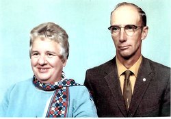
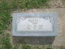
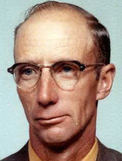
Maxine Lavone Kind Oesterreich
| Birth | : | 20 Jul 1925 Geary County, Kansas, USA |
| Death | : | 25 Feb 1973 Woodbine, Dickinson County, Kansas, USA |
| Burial | : | Forest Hill Memorial Park, Lexington, Davidson County, USA |
| Coordinate | : | 35.8275986, -80.2800980 |
frequently asked questions (FAQ):
-
Where is Maxine Lavone Kind Oesterreich's memorial?
Maxine Lavone Kind Oesterreich's memorial is located at: Forest Hill Memorial Park, Lexington, Davidson County, USA.
-
When did Maxine Lavone Kind Oesterreich death?
Maxine Lavone Kind Oesterreich death on 25 Feb 1973 in Woodbine, Dickinson County, Kansas, USA
-
Where are the coordinates of the Maxine Lavone Kind Oesterreich's memorial?
Latitude: 35.8275986
Longitude: -80.2800980
Family Members:
Flowers:
Nearby Cemetories:
1. Forest Hill Memorial Park
Lexington, Davidson County, USA
Coordinate: 35.8275986, -80.2800980
2. Grace Episcopal Church Columbarium
Lexington, Davidson County, USA
Coordinate: 35.8202780, -80.2572220
3. Meadowview Presbyterian Church Cemetery
Davidson County, USA
Coordinate: 35.8064003, -80.2810974
4. Lexington City Cemetery
Lexington, Davidson County, USA
Coordinate: 35.8280983, -80.2525024
5. First Reformed UCC Columbarium
Lexington, Davidson County, USA
Coordinate: 35.8235059, -80.2517930
6. Churchland Baptist Church Cemetery
Churchland, Davidson County, USA
Coordinate: 35.8469009, -80.2632980
7. North Lexington Baptist Church Cemetery
Lexington, Davidson County, USA
Coordinate: 35.8487778, -80.2664108
8. Raleigh Road Cemetery
Lexington, Davidson County, USA
Coordinate: 35.8253288, -80.2440567
9. Mabry Cemetery
Davidson County, USA
Coordinate: 35.8178825, -80.2448196
10. Arrington Heights Free Will BC Cemetery
Lexington, Davidson County, USA
Coordinate: 35.8474998, -80.2493973
11. South Lexington City Cemetery
Lexington, Davidson County, USA
Coordinate: 35.7972450, -80.2652969
12. Pauls Chapel Memorial Cemetery
Davidson County, USA
Coordinate: 35.8649830, -80.2922940
13. Finch-Gilchrist Cemetery
Davidson County, USA
Coordinate: 35.8037376, -80.2325745
14. Ebenezer Memorial Cemetery
Lexington, Davidson County, USA
Coordinate: 35.8677800, -80.2522000
15. Shiloh UMC Cemetery
Lexington, Davidson County, USA
Coordinate: 35.8651153, -80.3222114
16. Promiseland Baptist Church House Cemetery
Currytown, Davidson County, USA
Coordinate: 35.8756981, -80.3169708
17. Pilgrim Reformed Church Cemetery
Lexington, Davidson County, USA
Coordinate: 35.8530630, -80.2162610
18. Old Pilgrim Reformed Cemetery
Davidson County, USA
Coordinate: 35.8536740, -80.2136790
19. Maple Grove Church of the Brethren Cemetery
Davidson County, USA
Coordinate: 35.8793488, -80.3198013
20. Mount Tabor United Church of Christ Cemetery
Davidson County, USA
Coordinate: 35.8196411, -80.2053223
21. Owens Cemetery
Davidson County, USA
Coordinate: 35.7633018, -80.2735977
22. Becks Lutheran Church Cemetery
Lexington, Davidson County, USA
Coordinate: 35.7894300, -80.2154500
23. County Home Cemetery
Davidson County, USA
Coordinate: 35.8184200, -80.1985600
24. Center Hill Baptist Church Cemetery
Davidson County, USA
Coordinate: 35.7619100, -80.2630350


