
| Birth | : | 7 Oct 1920 Stratton, Hitchcock County, Nebraska, USA |
| Death | : | 10 Feb 2005 Benkelman, Dundy County, Nebraska, USA |
| Burial | : | Kaizenji-temple, Katsuyama-shi, Japan |
| Coordinate | : | 36.0630390, 136.4985930 |
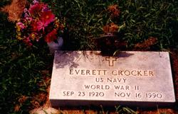
| Description | : | Daughter of John & Edith (Ward) Randall. Married to Everett Crocker in Lincoln, NE. She attended Stratton Public Schools. After graduating from Stratton High School, Maxine attended Kearney Teachers College, where she earned her teaching certificate. She then taught school for many years, having taught at several country schools, and then at Indianola, Grand Island and Lincoln. ∼Maxine Viola Crocker STRATTON - Maxine Viola Crocker, 84, of Stratton, mother of Christine Ochoa of North Platte died Feb. 10, 2005, at Dundy County Hospital in Benkelman.Cards, letters and memorials will reach the family at Forch Funeral Chapel, P.O. Box 97, Stratton, NE 69043.Memorial... Read More |
frequently asked questions (FAQ):
-
Where is Maxine Viola Randall Crocker's memorial?
Maxine Viola Randall Crocker's memorial is located at: Kaizenji-temple, Katsuyama-shi, Japan.
-
When did Maxine Viola Randall Crocker death?
Maxine Viola Randall Crocker death on 10 Feb 2005 in Benkelman, Dundy County, Nebraska, USA
-
Where are the coordinates of the Maxine Viola Randall Crocker's memorial?
Latitude: 36.0630390
Longitude: 136.4985930
Family Members:
Parent

Spouse
Siblings
Flowers:


Nearby Cemetories:
1. Kaizenji-temple
Katsuyama-shi, Japan
Coordinate: 36.0630390, 136.4985930
2. Zendoji-temple
Ōno-shi, Japan
Coordinate: 35.9876690, 136.4920160
3. Eiheiji-temple
Yoshida-gun, Japan
Coordinate: 36.0565800, 136.3568920
4. Tenryuji-temple
Yoshida-gun, Japan
Coordinate: 36.0905550, 136.2996650
5. Former Site of Castle of Ichijodani
Fukui-shi, Japan
Coordinate: 35.9994420, 136.2959270
6. Kogakuji-temple
Sakai-shi, Japan
Coordinate: 36.1484230, 136.2831770
7. Honkoin-temple
Sakai-shi, Japan
Coordinate: 36.1480950, 136.2734680
8. Byakudoji-temple
Sakai-shi, Japan
Coordinate: 36.1478350, 136.2727940
9. Shonenji-temple
Sakai-shi, Japan
Coordinate: 36.1437790, 136.2514870
10. Saikoji-temple
Fukui-shi, Japan
Coordinate: 36.0584340, 136.2131810
11. Kokenji-temple
Fukui-shi, Japan
Coordinate: 36.0580070, 136.2108840
12. Sokoji-temple
Fukui-shi, Japan
Coordinate: 36.0622570, 136.2073670
13. Jisshoin-temple
Kaga-shi, Japan
Coordinate: 36.2984920, 136.3085120
14. Bankeiji-temple
Sabae-shi, Japan
Coordinate: 35.9415300, 136.1850010
15. Kyuhoji Temple Cemetery
Kaga-shi, Japan
Coordinate: 36.3003710, 136.3090540
16. Zenshoji-temple
Kaga-shi, Japan
Coordinate: 36.3013410, 136.3087090
17. Ryusenji-temple
Echizen-shi, Japan
Coordinate: 35.9034730, 136.1603460
18. Daijoji-temple
Kanazawa-shi, Japan
Coordinate: 36.5324100, 136.6590950
19. Nodayama Cemetery
Kanazawa, Kanazawa-shi, Japan
Coordinate: 36.5328166, 136.6671065
20. Jionzenji-temple
Gujō-shi, Japan
Coordinate: 35.7480750, 136.9616700
21. Hounji-temple
Ibi-gun, Japan
Coordinate: 35.5513150, 136.6289600
22. Kogonji-temple
Kanazawa-shi, Japan
Coordinate: 36.5721780, 136.6472750
23. Joshoji-temple
Gujō-shi, Japan
Coordinate: 35.6578240, 136.9595970
24. Graveyard of Menju Brothers
Nagahama-shi, Japan
Coordinate: 35.5637244, 136.1921563