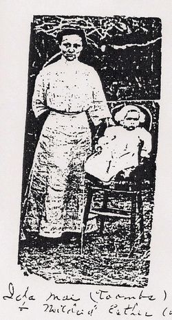
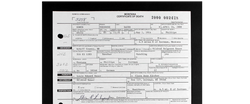
Mildred Esther “Dry Land Woman” Helgeson Bauer
| Birth | : | 2 Nov 1912 Lodge Pole, Blaine County, Montana, USA |
| Death | : | 6 Aug 2011 Zortman, Phillips County, Montana, USA |
| Burial | : | Bauer Cemetery, Roosevelt County, USA |
| Coordinate | : | 48.1486015, -104.6016998 |
| Description | : | ZORTMAN - Mildred (Helgeson) Bauer, 98, whose Indian name was Maka Bos'ya Wiya (Dry Land Woman), a homemaker and former hospital cook who loved flowers, gardening, canning, cooking, fishing and camping, and was the oldest member of the Assiniboine Tribe at Fort Belknap, died of natural causes Saturday, Aug. 6, at her home in Zortman. Her funeral is 11 a.m. Saturday at the Bauer Ranch on Bear Gulch Road, just past mile marker 4 on the way to Zortman, followed by burial in the family cemetery. Kirkwood Funeral Home of Malta is in charge of arrangements. Survivors include her 3... Read More |
frequently asked questions (FAQ):
-
Where is Mildred Esther “Dry Land Woman” Helgeson Bauer's memorial?
Mildred Esther “Dry Land Woman” Helgeson Bauer's memorial is located at: Bauer Cemetery, Roosevelt County, USA.
-
When did Mildred Esther “Dry Land Woman” Helgeson Bauer death?
Mildred Esther “Dry Land Woman” Helgeson Bauer death on 6 Aug 2011 in Zortman, Phillips County, Montana, USA
-
Where are the coordinates of the Mildred Esther “Dry Land Woman” Helgeson Bauer's memorial?
Latitude: 48.1486015
Longitude: -104.6016998
Family Members:
Flowers:
Nearby Cemetories:
1. Bauer Cemetery
Roosevelt County, USA
Coordinate: 48.1486015, -104.6016998
2. Hillside Cemetery
Culbertson, Roosevelt County, USA
Coordinate: 48.1472015, -104.5330963
3. Fort Kipp Cemetery
Fort Kipp, Roosevelt County, USA
Coordinate: 48.1523000, -104.7186000
4. Friedens Gemeinde Cemetery
Roosevelt County, USA
Coordinate: 48.2449000, -104.6275000
5. Lynd Cemetery
Richland County, USA
Coordinate: 48.0489006, -104.7928009
6. Ebenezer Lutheran Church Cemetery
McCabe, Roosevelt County, USA
Coordinate: 48.2439995, -104.3779984
7. Finnicum Burial Ground
Andes, Richland County, USA
Coordinate: 47.9690000, -104.6554500
8. South Froid Cemetery
Froid, Roosevelt County, USA
Coordinate: 48.3246994, -104.4985962
9. Andes Cemetery
Richland County, USA
Coordinate: 47.9617004, -104.5460968
10. Mona Cemetery
Richland County, USA
Coordinate: 47.9686012, -104.6977997
11. Saint Bernard Cemetery
Richland County, USA
Coordinate: 48.0407982, -104.8383026
12. Cherry Creek Cemetery
Richland County, USA
Coordinate: 47.9928017, -104.4167023
13. Riverview Cemetery
Brockton, Roosevelt County, USA
Coordinate: 48.1610985, -104.9139023
14. Kvile Cemetery
Froid, Roosevelt County, USA
Coordinate: 48.3452988, -104.4966965
15. Fisher Cemetery
Richland County, USA
Coordinate: 48.0588989, -104.8917007
16. Bainville Cemetery
Bainville, Roosevelt County, USA
Coordinate: 48.1418991, -104.2127991
17. Riverside Cemetery
Brockton, Roosevelt County, USA
Coordinate: 48.1063000, -104.9862000
18. Elmdale Cemetery
Richland County, USA
Coordinate: 47.9113998, -104.7617035
19. Big Lake Cemetery
Sheridan County, USA
Coordinate: 48.4178009, -104.4869003
20. Jacobson Cemetery
Sheridan County, USA
Coordinate: 48.4281006, -104.6306000
21. Lone Butte Cemetery
Richland County, USA
Coordinate: 47.8824997, -104.4281006
22. Grandview Cemetery
Froid, Roosevelt County, USA
Coordinate: 48.3600693, -104.2968216
23. Saint Peters Lutheran Cemetery
Richland County, USA
Coordinate: 47.8969002, -104.3300018
24. Zion Lutheran Church Cemetery
Brockton, Roosevelt County, USA
Coordinate: 48.3474998, -104.9642029


