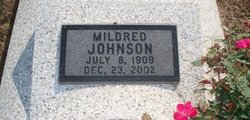
Mildred Hoskinson Johnson
| Birth | : | 8 Jul 1909 Vinland, Douglas County, Kansas, USA |
| Death | : | 23 Dec 2002 Baldwin City, Douglas County, Kansas, USA |
| Burial | : | Mariposa District Cemetery, Mariposa, Mariposa County, USA |
| Coordinate | : | 37.4913483, -119.9749832 |
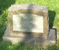
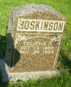
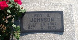
| Description | : | Mildred Johnson Published Wednesday, December 25, 2002 VINLAND -- Mildred Johnson, 93, Vinland, died Monday, Dec. 23, 2002, at a Baldwin City retirement home. Mrs. Johnson worked for Lawrence Paper Co. until 1942 and she owned and operated Service Grocery in Lawrence for 27 years. She and her husband also farmed in the Vinland area for many years. She was born July 8, 1909, in Vinland, the daughter of William "Gene" and Tabitha Stevens Hoskinson. She graduated from Vinland High School in 1927. She married Roy O. Johnson on Sept. 4, 1928. He died in 1979. Survivors include a son, Denny R. Johnson; three grandchildren;... Read More |
frequently asked questions (FAQ):
-
Where is Mildred Hoskinson Johnson's memorial?
Mildred Hoskinson Johnson's memorial is located at: Mariposa District Cemetery, Mariposa, Mariposa County, USA.
-
When did Mildred Hoskinson Johnson death?
Mildred Hoskinson Johnson death on 23 Dec 2002 in Baldwin City, Douglas County, Kansas, USA
-
Where are the coordinates of the Mildred Hoskinson Johnson's memorial?
Latitude: 37.4913483
Longitude: -119.9749832
Family Members:
Parent
Spouse
Flowers:
Nearby Cemetories:
1. Mariposa District Cemetery
Mariposa, Mariposa County, USA
Coordinate: 37.4913483, -119.9749832
2. Mariposa IOOF Cemetery
Mariposa, Mariposa County, USA
Coordinate: 37.4919100, -119.9749100
3. Mariposa Masonic Cemetery
Mariposa, Mariposa County, USA
Coordinate: 37.4925690, -119.9746399
4. Saint Josephs Catholic Church Cemetery
Mariposa, Mariposa County, USA
Coordinate: 37.4830513, -119.9648666
5. Agua Fria Cemetery
Agua Fria, Mariposa County, USA
Coordinate: 37.4961000, -120.0278100
6. Sherlock Cemetery
Midpines, Mariposa County, USA
Coordinate: 37.5595400, -120.0057500
7. Sarah Priest Cemetery
Midpines, Mariposa County, USA
Coordinate: 37.5651500, -119.9524100
8. Catheys Valley Cemetery
Catheys Valley, Mariposa County, USA
Coordinate: 37.4449997, -120.1022034
9. Briceburg Gravesite
Briceburg, Mariposa County, USA
Coordinate: 37.6172220, -120.0194440
10. Pea Ridge Cemetery
Mariposa County, USA
Coordinate: 37.3605800, -119.9650100
11. Bear Valley Odd Fellows Cemetery
Bear Valley, Mariposa County, USA
Coordinate: 37.5705690, -120.1139240
12. Bear Valley Cemetery
Bear Valley, Mariposa County, USA
Coordinate: 37.5700000, -120.1160000
13. White Rock Cemetery
Mariposa County, USA
Coordinate: 37.3330994, -120.0410995
14. Santa Cruz Cemetery
Indian Gulch, Mariposa County, USA
Coordinate: 37.4392014, -120.1977997
15. Givens Cemetery
Mariposa County, USA
Coordinate: 37.4857101, -120.2100983
16. Quartzburg Cemetery
Hornitos, Mariposa County, USA
Coordinate: 37.5399600, -120.2059800
17. Harris Family Cemetery
Mariposa, Mariposa County, USA
Coordinate: 37.4644200, -119.7374500
18. Lord Speaker Family Cemetery
Hornitos, Mariposa County, USA
Coordinate: 37.5258200, -120.2125700
19. Preston-Probasco Family Cemetery
Mariposa County, USA
Coordinate: 37.2910298, -119.9959401
20. Saint Catherines Catholic Church Cemetery
Hornitos, Mariposa County, USA
Coordinate: 37.5033600, -120.2372830
21. Hornitos Odd Fellows Cemetery
Hornitos, Mariposa County, USA
Coordinate: 37.5094500, -120.2392330
22. Pate Cemetery
Catheys Valley, Mariposa County, USA
Coordinate: 37.3502998, -120.1785965
23. Brewer's Green Mountain Cemetery
Mariposa County, USA
Coordinate: 37.2607840, -119.9622920
24. Round House Indian Cemetery
Ahwahnee, Madera County, USA
Coordinate: 37.3749320, -119.7222450


