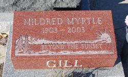
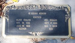
Mildred Myrtle Leppard Gill
| Birth | : | 17 Mar 1903 Molesworth, Perth County, Ontario, Canada |
| Death | : | 26 Oct 2003 Drumheller, Strathmore Census Division, Alberta, Canada |
| Burial | : | Drumheller Cemetery, Drumheller, Strathmore Census Division, Canada |
| Coordinate | : | 51.4522200, -112.6920800 |
| Plot | : | 817E,64 |
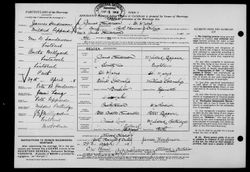
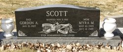
| Description | : | Mildred married James Henderson (1896-1979) in Ontario. James was the son of Peter B. Henderson and Jessie Lang. In 1936 she married Charles Gill, and they lived at Raymond, Alberta and later Caroline. She was predeceased by her husband, Charles, in 1954, sons Jerald in 1948 and Lester in 1993, and daughters, Alice Simpson in 1966 and Myra Scott in 1989; 4 brothers and 4 sisters. |
frequently asked questions (FAQ):
-
Where is Mildred Myrtle Leppard Gill's memorial?
Mildred Myrtle Leppard Gill's memorial is located at: Drumheller Cemetery, Drumheller, Strathmore Census Division, Canada.
-
When did Mildred Myrtle Leppard Gill death?
Mildred Myrtle Leppard Gill death on 26 Oct 2003 in Drumheller, Strathmore Census Division, Alberta, Canada
-
Where are the coordinates of the Mildred Myrtle Leppard Gill's memorial?
Latitude: 51.4522200
Longitude: -112.6920800
Family Members:
Parent
Spouse
Siblings
Children
Flowers:
Nearby Cemetories:
1. Drumheller Cemetery
Drumheller, Strathmore Census Division, Canada
Coordinate: 51.4522200, -112.6920800
2. Wayne Community Cemetery
Wayne, Strathmore Census Division, Canada
Coordinate: 51.3816120, -112.6602090
3. Munson Cemetery
Munson, Strathmore Census Division, Canada
Coordinate: 51.5463220, -112.7232240
4. Homeland Cemetery
Dunphy, Strathmore Census Division, Canada
Coordinate: 51.4819360, -112.8570370
5. Verdant Valley Hutterite Cemetery
Drumheller, Strathmore Census Division, Canada
Coordinate: 51.4702607, -112.4715843
6. Michichi Cemetery
Michichi, Strathmore Census Division, Canada
Coordinate: 51.5747290, -112.5357170
7. Dalum Lutheran Church Cemetery
Dalum, Strathmore Census Division, Canada
Coordinate: 51.3001500, -112.6324000
8. Hillview Hutterite Colony Cemetery
Rosebud, Strathmore Census Division, Canada
Coordinate: 51.3668406, -112.9574917
9. Knoll Hill Cemetery
Michichi, Strathmore Census Division, Canada
Coordinate: 51.6195878, -112.5181250
10. Zion Baptist Cemetery
Hesketh, Strathmore Census Division, Canada
Coordinate: 51.3876139, -113.0175028
11. Rosebud Cemetery
Rosebud, Strathmore Census Division, Canada
Coordinate: 51.3045500, -112.9581400
12. Morrin Cemetery
Morrin, Strathmore Census Division, Canada
Coordinate: 51.6775450, -112.7634160
13. Wilf Girletz Gravesite
Delia, Strathmore Census Division, Canada
Coordinate: 51.5744100, -112.3296900
14. Delia Cemetery
Delia, Strathmore Census Division, Canada
Coordinate: 51.6229700, -112.3666800
15. Neu Muehl Hutterite Cemetery
Delia, Strathmore Census Division, Canada
Coordinate: 51.4667792, -112.2634915
16. Sarcee Butte Cemetery
Drumheller, Strathmore Census Division, Canada
Coordinate: 51.6362400, -113.0056500
17. Bethel Carbon Cemetery
Carbon, Strathmore Census Division, Canada
Coordinate: 51.4164520, -113.1447840
18. Carbon Cemetery
Carbon, Strathmore Census Division, Canada
Coordinate: 51.5027520, -113.1452880
19. Rosebud Hutterite Colony Cemetery
Rockyford, Strathmore Census Division, Canada
Coordinate: 51.3134490, -113.1170667
20. Starland Colony Cemetery
Morrin, Strathmore Census Division, Canada
Coordinate: 51.7502047, -112.6044643
21. Freudental Carbon Cemetery
Carbon, Strathmore Census Division, Canada
Coordinate: 51.4165200, -113.1936200
22. Springvale Hutterite Colony Cemetery
Rockyford, Strathmore Census Division, Canada
Coordinate: 51.3193431, -113.1532530
23. Rowley Cemetery
Rowley, Strathmore Census Division, Canada
Coordinate: 51.7659000, -112.7679600
24. Wintering Hills Hutterite Colony Cemetery
Hussar, Strathmore Census Division, Canada
Coordinate: 51.1449400, -112.4919480

