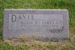
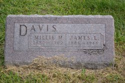
Millicent Malinda “Millie” Hollcroft Davis
| Birth | : | 22 Aug 1885 Saline, Mercer County, Missouri, USA |
| Death | : | 1 Jun 1962 Leon, Decatur County, Iowa, USA |
| Burial | : | Big Crabtree Cemetery, Estatoe, Mitchell County, USA |
| Coordinate | : | 35.9202285, -82.1490755 |
| Plot | : | 5 1-2 |
frequently asked questions (FAQ):
-
Where is Millicent Malinda “Millie” Hollcroft Davis's memorial?
Millicent Malinda “Millie” Hollcroft Davis's memorial is located at: Big Crabtree Cemetery, Estatoe, Mitchell County, USA.
-
When did Millicent Malinda “Millie” Hollcroft Davis death?
Millicent Malinda “Millie” Hollcroft Davis death on 1 Jun 1962 in Leon, Decatur County, Iowa, USA
-
Where are the coordinates of the Millicent Malinda “Millie” Hollcroft Davis's memorial?
Latitude: 35.9202285
Longitude: -82.1490755
Family Members:
Parent
Spouse
Siblings
Children
Flowers:
Nearby Cemetories:
1. Big Crabtree Cemetery
Estatoe, Mitchell County, USA
Coordinate: 35.9202285, -82.1490755
2. Cox Cemetery
Mitchell County, USA
Coordinate: 35.9039001, -82.1402969
3. Liberty Hill Baptist Church Cemetery
Spruce Pine, Mitchell County, USA
Coordinate: 35.9007600, -82.1272000
4. Edd Young Cemetery
Yancey County, USA
Coordinate: 35.9198600, -82.1834000
5. Conley Cemetery
Mitchell County, USA
Coordinate: 35.9397011, -82.1168976
6. Silvers Cemetery
Mitchell County, USA
Coordinate: 35.9042015, -82.1121979
7. Stafford Cemetery
Mitchell County, USA
Coordinate: 35.8950005, -82.1207962
8. Faith Fellowship Church Cemetery
Yancey County, USA
Coordinate: 35.9169300, -82.1913300
9. Rebels Creek Cemetery
Boonford, Mitchell County, USA
Coordinate: 35.9514008, -82.1697006
10. Bailey Cemetery
Penland, Mitchell County, USA
Coordinate: 35.9247017, -82.1050034
11. Blue Rock Baptist Church Old Cemetery
Burnsville, Yancey County, USA
Coordinate: 35.8893700, -82.1822740
12. Kona Baptist Church Cemetery
Kona, Mitchell County, USA
Coordinate: 35.9513790, -82.1838930
13. Silver Cemetery
Mitchell County, USA
Coordinate: 35.9514008, -82.1841965
14. Blue Rock Baptist Church New Cemetery
Burnsville, Yancey County, USA
Coordinate: 35.8854520, -82.1845440
15. Cook Cemetery
Mitchell County, USA
Coordinate: 35.9333000, -82.0919037
16. Snow Hill Cemetery
Bakersville, Mitchell County, USA
Coordinate: 35.9679600, -82.1402400
17. Wilson-Rector Hill Cemetery
Double Island, Yancey County, USA
Coordinate: 35.9230000, -82.2092300
18. A. J. Gus Robinson Cemetery
Yancey County, USA
Coordinate: 35.8858500, -82.1918800
19. Gouge Cemetery
Bandana, Mitchell County, USA
Coordinate: 35.9692001, -82.1722031
20. McHone Cemetery
Mitchell County, USA
Coordinate: 35.8974991, -82.0892029
21. Bear Creek Baptist Church Cemetery
Ledger, Mitchell County, USA
Coordinate: 35.9650002, -82.1106567
22. Tolley Cemetery
Spruce Pine, Mitchell County, USA
Coordinate: 35.9113998, -82.0824966
23. Hughes Cemetery
Double Island, Yancey County, USA
Coordinate: 35.9286003, -82.2164001
24. Fred Young Cemetery
Green Mountain, Yancey County, USA
Coordinate: 35.9396500, -82.2138200


