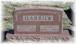
Minnie Marie Greer Darrow
| Birth | : | 16 Mar 1899 Crawford County, Kansas, USA |
| Death | : | 12 Sep 1974 Pittsburg, Crawford County, Kansas, USA |
| Burial | : | Linwood Park Cemetery, Boone, Boone County, USA |
| Coordinate | : | 42.0550003, -93.8850021 |
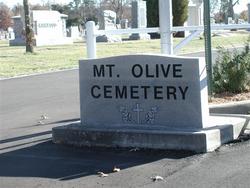
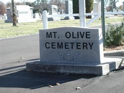
| Description | : | Minnie Marie Greer was born to George and Bessie Elisabeth Pickens Greer on March 16, 1899 in Crawford County, Kansas. She was the oldest of the five Greer siblings; Rosa Anna, James Delbert, Beulah Eva and Kathryn Marie Greer. On August 12, 1912 Minnie married David Ira Darrow at Benton County, Arkansas at the young age of thirteen. Together they had six children; Francis George, Lawrence Ira, Lucille Marie(who died in infancy), Waneta Eileen, Lorene Christine and Dorothy Dean Darrow. Minnie died on September 12, 1974 and was buried at Mount Olive Cemetery, Pittsburg, Kansas. |
frequently asked questions (FAQ):
-
Where is Minnie Marie Greer Darrow's memorial?
Minnie Marie Greer Darrow's memorial is located at: Linwood Park Cemetery, Boone, Boone County, USA.
-
When did Minnie Marie Greer Darrow death?
Minnie Marie Greer Darrow death on 12 Sep 1974 in Pittsburg, Crawford County, Kansas, USA
-
Where are the coordinates of the Minnie Marie Greer Darrow's memorial?
Latitude: 42.0550003
Longitude: -93.8850021
Family Members:
Parent
Spouse
Siblings
Children
Flowers:
Nearby Cemetories:
1. Linwood Park Cemetery
Boone, Boone County, USA
Coordinate: 42.0550003, -93.8850021
2. Latham Cemetery
Boone, Boone County, USA
Coordinate: 42.0489006, -93.8878021
3. Biblical College Cemetery
Boone, Boone County, USA
Coordinate: 42.0456009, -93.9113998
4. Sacred Heart Cemetery
Boone, Boone County, USA
Coordinate: 42.0485992, -93.9163971
5. Boone Memorial Gardens Cemetery
Boone, Boone County, USA
Coordinate: 42.0449982, -93.9152985
6. Sarah Dinwoodie Cemetery
Worth Township, Boone County, USA
Coordinate: 42.0278000, -93.8697000
7. Rose Hill Cemetery
Boone, Boone County, USA
Coordinate: 42.0419006, -93.9408035
8. Bass Point Cemetery
Boone, Boone County, USA
Coordinate: 42.0992012, -93.8957977
9. Oakwood Cemetery
Moingona, Boone County, USA
Coordinate: 42.0219002, -93.9396973
10. Squire Boone Cemetery
Luther, Boone County, USA
Coordinate: 42.0032997, -93.8531036
11. Buckley Cemetery
Boone, Boone County, USA
Coordinate: 42.0999810, -93.9418960
12. Hollaway Cemetery
Moingona, Boone County, USA
Coordinate: 42.0138720, -93.9530080
13. Quincy Cemetery
Boone, Boone County, USA
Coordinate: 42.0074997, -93.9503021
14. Hickory Grove Cemetery
Boone County, USA
Coordinate: 42.1074982, -93.9507980
15. Bluff Creek Cemetery
Boone, Boone County, USA
Coordinate: 42.0774994, -93.9796982
16. Sparks Cemetery
Boone County, USA
Coordinate: 41.9728012, -93.9191971
17. Hull Cemetery
Luther, Boone County, USA
Coordinate: 41.9603004, -93.8664017
18. Leininger Cemetery
Boone County, USA
Coordinate: 42.1492004, -93.8356018
19. Pleasant Hill Cemetery
Boone, Boone County, USA
Coordinate: 41.9618988, -93.9492035
20. Boone County Poor Farm Cemetery
Boone County, USA
Coordinate: 42.1591100, -93.9159000
21. Schlicht Cemetery
Fraser, Boone County, USA
Coordinate: 42.1444200, -93.9780100
22. Mitchell Cemetery
Boone County, USA
Coordinate: 42.1208000, -93.7544022
23. Saint Johns Catholic Cemetery
Ogden, Boone County, USA
Coordinate: 42.0344000, -94.0407000
24. Olive Branch Cemetery
Boone County, USA
Coordinate: 42.0080986, -93.7369003


