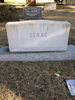
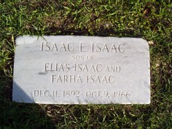
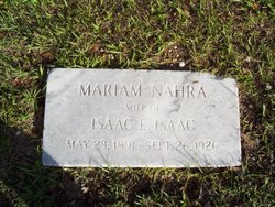
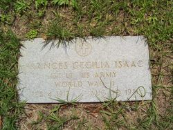
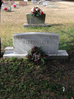
Minnie Martha “Mimi” Isaac
| Birth | : | 11 May 1915 Columbia, Richland County, South Carolina, USA |
| Death | : | 7 Jan 2002 Georgetown, Georgetown County, South Carolina, USA |
| Burial | : | Saint Thomas Cemetery, Potosi, Grant County, USA |
| Coordinate | : | 42.6953011, -90.7127991 |
| Description | : | ISAAC, Minnie GEORGETOWN - Minnie M. Isaac, 86, a retired accounting department employee with International Paper, died Monday, January 7, 2002, at her residence. A Mass of Christian Burial will be held Friday, January 11, 2002, at 11 a.m., in St. Mary Our Lady of Ransom Catholic Church. Officiating will be Rev. Edward Fitzgerald. Burial, directed by GRAHAM FUNERAL HOME, will follow in Elmwood Cemetery Annex. She was born May 11, 1915, in Georgetown County, a daughter of the late Isaac and Mariam Thomas Isaac. She was a member of the Quarter Century Club with International Paper. She... Read More |
frequently asked questions (FAQ):
-
Where is Minnie Martha “Mimi” Isaac's memorial?
Minnie Martha “Mimi” Isaac's memorial is located at: Saint Thomas Cemetery, Potosi, Grant County, USA.
-
When did Minnie Martha “Mimi” Isaac death?
Minnie Martha “Mimi” Isaac death on 7 Jan 2002 in Georgetown, Georgetown County, South Carolina, USA
-
Where are the coordinates of the Minnie Martha “Mimi” Isaac's memorial?
Latitude: 42.6953011
Longitude: -90.7127991
Family Members:
Parent
Siblings
Flowers:
Nearby Cemetories:
1. Saint Thomas Cemetery
Potosi, Grant County, USA
Coordinate: 42.6953011, -90.7127991
2. Old Irish Cemetery
Potosi, Grant County, USA
Coordinate: 42.6848390, -90.7121530
3. Van Buren Cemetery
Potosi, Grant County, USA
Coordinate: 42.6808014, -90.7241974
4. British Hollow Cemetery
British Hollow, Grant County, USA
Coordinate: 42.7044050, -90.6875150
5. Saint Andrews Cemetery
Tennyson, Grant County, USA
Coordinate: 42.6908300, -90.6817900
6. River Lane Road Family Cemetery
Potosi, Grant County, USA
Coordinate: 42.6629650, -90.7171400
7. Osceola Cemetery
Potosi, Grant County, USA
Coordinate: 42.6622009, -90.7043991
8. Hampton Cemetery
Rockville, Grant County, USA
Coordinate: 42.7510986, -90.7264023
9. Boice Creek Cemetery
Hurricane, Grant County, USA
Coordinate: 42.7621994, -90.7410965
10. Boice Prairie Cemetery
Lancaster, Grant County, USA
Coordinate: 42.7616997, -90.6813965
11. Oliver Cemetery
South Lancaster, Grant County, USA
Coordinate: 42.7723948, -90.7334961
12. Burton Cemetery
Burton, Grant County, USA
Coordinate: 42.7181000, -90.8197000
13. Kinney Cemetery
Hurricane, Grant County, USA
Coordinate: 42.7694016, -90.7621994
14. Blakely Cemetery
British Hollow, Grant County, USA
Coordinate: 42.7224300, -90.5976100
15. Hurricane Cemetery
Hurricane, Grant County, USA
Coordinate: 42.7766991, -90.7806015
16. Mount Zion Cemetery
Cornelia, Grant County, USA
Coordinate: 42.6897200, -90.5829100
17. Bonham Cemetery
Lancaster, Grant County, USA
Coordinate: 42.7888000, -90.7417100
18. Morrell Cemetery
Hurricane, Grant County, USA
Coordinate: 42.7821999, -90.7696991
19. Baily and McKinney Cemetery
Lancaster, Grant County, USA
Coordinate: 42.7891800, -90.6765100
20. Harrison Cemetery
Platteville, Grant County, USA
Coordinate: 42.7257996, -90.5830994
21. Sherrill United Methodist Church Cemetery
Sherrill, Dubuque County, USA
Coordinate: 42.6064000, -90.7853000
22. Saint Matthew Cemetery
Sherrill, Dubuque County, USA
Coordinate: 42.6020000, -90.7820000
23. Sherrill United Church of Christ Cemetery
Sherrill, Dubuque County, USA
Coordinate: 42.6010000, -90.7798000
24. Saints Peter and Paul Cemetery
Sherrill, Dubuque County, USA
Coordinate: 42.6037000, -90.7907000

