Miriam "Shorts" High Fastenau
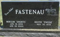
| Birth | : | 19 Apr 1935 Bertrand, Phelps County, Nebraska, USA |
| Death | : | 22 Apr 2000 Holdrege, Phelps County, Nebraska, USA |
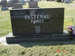
| Burial | : | Hope Lutheran Cemetery, Smithfield, Gosper County, USA |
| Coordinate | : | 40.5667500, -99.6800000 |
| Description | : | Miriam "Shorts" Fastenau, 65 of Bertrand, NE, passed on 4-22-2000 in Holdrege, NE. She was born 4-19-1935 in Bertrand, to parents Robert Frederick High and Bernice Philipina Nutzman High. On 12-2,3-1956, she was united in marriage with Keith LaVerne Fastenau of Bertrand. As parents, they operated a family farm and raised four children, Mary, Jane, Jim and Amy. She was preceded in death by her parents, her brother James Oliver High and her sister Joan Elizabeth Stevens. She is survived by her husband Keith, her brother Robert Warren High of Kearney, NE; her son James Frederick Fastenau of Bertrand, NE; three daughters, Mary... Read More |
frequently asked questions (FAQ):
-
Where is Miriam "Shorts" High Fastenau's memorial?
Miriam "Shorts" High Fastenau's memorial is located at: Hope Lutheran Cemetery, Smithfield, Gosper County, USA.
-
When did Miriam "Shorts" High Fastenau death?
Miriam "Shorts" High Fastenau death on 22 Apr 2000 in Holdrege, Phelps County, Nebraska, USA
-
Where are the coordinates of the Miriam "Shorts" High Fastenau's memorial?
Latitude: 40.5667500
Longitude: -99.6800000
Family Members:
Parent
Spouse
Siblings
Flowers:
Nearby Cemetories:
1. Hope Lutheran Cemetery
Smithfield, Gosper County, USA
Coordinate: 40.5667500, -99.6800000
2. Keely Cemetery
Smithfield, Gosper County, USA
Coordinate: 40.5727500, -99.6563500
3. Immanuel Cemetery
Bertrand, Phelps County, USA
Coordinate: 40.5682983, -99.6283035
4. Highland Cemetery
Bertrand, Phelps County, USA
Coordinate: 40.5194016, -99.6430969
5. Yoder Cemetery
Smithfield, Gosper County, USA
Coordinate: 40.4957000, -99.6845500
6. Sandstrom Cemetery
Phelps County, USA
Coordinate: 40.5983009, -99.5661011
7. Adullam Cemetery
Bertrand, Phelps County, USA
Coordinate: 40.6265000, -99.5856000
8. Robb Cemetery
Smithfield, Gosper County, USA
Coordinate: 40.6710691, -99.6996001
9. Quakerville Cemetery
Gosper County, USA
Coordinate: 40.6189003, -99.8097000
10. Fairfield Cemetery
Gosper County, USA
Coordinate: 40.4672012, -99.7549973
11. Plum Creek Massacre Cemetery
Phelps County, USA
Coordinate: 40.6726840, -99.6058220
12. Elwood Cemetery
Elwood, Gosper County, USA
Coordinate: 40.5999300, -99.8397300
13. Loomis Cemetery
Loomis, Phelps County, USA
Coordinate: 40.4801860, -99.5128300
14. Platte Valley Cemetery
Phelps County, USA
Coordinate: 40.6425018, -99.5028000
15. Shaw Cemetery
Phelps County, USA
Coordinate: 40.4303017, -99.5781021
16. Zion Cemetery
Gosper County, USA
Coordinate: 40.4085999, -99.7005997
17. Homerville Cemetery
Gosper County, USA
Coordinate: 40.4668999, -99.8593979
18. Williamsburg Cemetery
Phelps County, USA
Coordinate: 40.6490290, -99.4543150
19. McGuire Cemetery
Gosper County, USA
Coordinate: 40.4380989, -99.8664017
20. Moses Hill Cemetery
Loomis, Phelps County, USA
Coordinate: 40.5104490, -99.4388600
21. Evergreen Cemetery
Lexington, Dawson County, USA
Coordinate: 40.7639008, -99.6791992
22. Overton Cemetery
Overton, Dawson County, USA
Coordinate: 40.7317009, -99.5222015
23. Immanuel Lutheran Cemetery
Elwood, Gosper County, USA
Coordinate: 40.4206500, -99.8672000
24. Pleasant Grove Cemetery
Gosper County, USA
Coordinate: 40.4664001, -99.9250031


