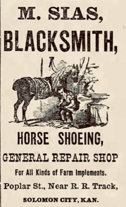
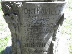
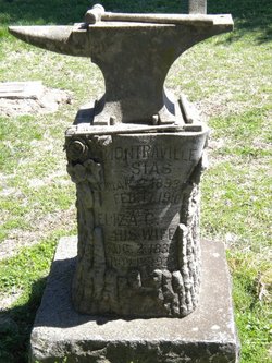
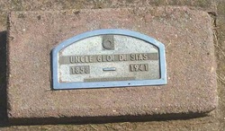
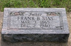
Montraville Sias
| Birth | : | 2 Mar 1833 Michigan, USA |
| Death | : | 17 Feb 1910 Solomon, Dickinson County, Kansas, USA |
| Burial | : | Green Haven Memorial Gardens, Canfield, Mahoning County, USA |
| Coordinate | : | 41.0625340, -80.7594670 |
| Plot | : | Sias |
| Description | : | PARENTS: Father: John Sias 1794-1876 Mother: Lucinda Dudley 1798-? Marriage: 8 February 1818 Dansville, Steuben, New York, USA ****** GRANDPARENTS: Solomon Sias 1754-1856 Delinda Eveline Collingwood 1809-? Marriage: about 1789 Danville, Caledonia, Vermont, USA |
frequently asked questions (FAQ):
-
Where is Montraville Sias's memorial?
Montraville Sias's memorial is located at: Green Haven Memorial Gardens, Canfield, Mahoning County, USA.
-
When did Montraville Sias death?
Montraville Sias death on 17 Feb 1910 in Solomon, Dickinson County, Kansas, USA
-
Where are the coordinates of the Montraville Sias's memorial?
Latitude: 41.0625340
Longitude: -80.7594670
Family Members:
Spouse
Children
Flowers:
Nearby Cemetories:
1. Green Haven Memorial Gardens
Canfield, Mahoning County, USA
Coordinate: 41.0625340, -80.7594670
2. Pet Haven Memorial Gardens
Canfield, Mahoning County, USA
Coordinate: 41.0647840, -80.7579190
3. Smith Corners Cemetery
Austintown, Mahoning County, USA
Coordinate: 41.0689011, -80.7613983
4. Infirmary Cemetery
Canfield, Mahoning County, USA
Coordinate: 41.0482500, -80.7792950
5. Old North Cemetery
Canfield, Mahoning County, USA
Coordinate: 41.0393982, -80.7600021
6. Old Brunstetter Cemetery
Austintown, Mahoning County, USA
Coordinate: 41.0946007, -80.7788696
7. Ohev Tzedek Cemetery
Canfield, Mahoning County, USA
Coordinate: 41.0607986, -80.7118988
8. Cornersburg Cemetery
Cornersburg, Mahoning County, USA
Coordinate: 41.0608900, -80.7117400
9. Sharethora Cemetery
Mahoning County, USA
Coordinate: 41.0567017, -80.7121964
10. Brunstetter Cemetery
Austintown, Mahoning County, USA
Coordinate: 41.0957830, -80.7788540
11. Cotton Family Cemetery
Austintown, Mahoning County, USA
Coordinate: 41.0988312, -80.7556000
12. Boardman Zion Cemetery
Boardman, Mahoning County, USA
Coordinate: 41.0566700, -80.7106730
13. Canfield Village Cemetery
Canfield, Mahoning County, USA
Coordinate: 41.0242830, -80.7536270
14. Dean Hill Cemetery
Canfield, Mahoning County, USA
Coordinate: 41.0353012, -80.7957993
15. Lanterman Moherman Cemetery
Austintown, Mahoning County, USA
Coordinate: 41.1018890, -80.7315540
16. Covenanter Cemetery
North Jackson, Mahoning County, USA
Coordinate: 41.0687270, -80.8201110
17. Resurrection Cemetery
Austintown, Mahoning County, USA
Coordinate: 41.1076584, -80.7328415
18. Rider Farm Cemetery
Youngstown, Mahoning County, USA
Coordinate: 41.0744930, -80.6937680
19. Saint Mary Catholic Cemetery
Youngstown, Mahoning County, USA
Coordinate: 41.1002350, -80.7004720
20. New Four Mile Cemetery
Austintown, Mahoning County, USA
Coordinate: 41.1177902, -80.7313004
21. Calvary Cemetery
Youngstown, Mahoning County, USA
Coordinate: 41.0971985, -80.6932983
22. Geeburg Methodist Church Cemetery
Ellsworth, Mahoning County, USA
Coordinate: 41.0487850, -80.8380010
23. Disciple Church Cemetery
Austintown, Mahoning County, USA
Coordinate: 41.1202621, -80.7321396
24. Hugh Baird Cemetery
Youngstown, Mahoning County, USA
Coordinate: 41.0714390, -80.6737550

