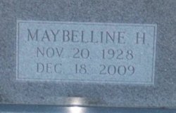
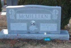
Mrs Maybelline Lillian Haynes McMillian
| Birth | : | 20 Nov 1928 Carroll County, Virginia, USA |
| Death | : | 18 Dec 2009 Cana, Carroll County, Virginia, USA |
| Burial | : | Waverley Cemetery, Waverley, South Taranaki District, New Zealand |
| Coordinate | : | -39.7675900, 174.6292700 |
| Description | : | Mrs. Maybelline Lillian Haynes McMillian, 81, of 7866 Wards Gap Road, Cana, VA, passed away Friday morning, December 18, 2009, at her home. Mrs. McMillian was born November 20, 1928, in Carroll County, VA, to the late Harvey and Rausie McMillian Haynes. She was a homemaker/farmer's wife and a member of Oak Ridge Baptist Church. Mrs. McMillian was a devoted wife, mother, and grandmother who enjoyed church, but, due to her health, had not been able to attend for sometime. She still enjoyed listening to gospel music. Surviving are her husband, Glenn McMillian of the home; three daughters and sons-in-law,... Read More |
frequently asked questions (FAQ):
-
Where is Mrs Maybelline Lillian Haynes McMillian's memorial?
Mrs Maybelline Lillian Haynes McMillian's memorial is located at: Waverley Cemetery, Waverley, South Taranaki District, New Zealand.
-
When did Mrs Maybelline Lillian Haynes McMillian death?
Mrs Maybelline Lillian Haynes McMillian death on 18 Dec 2009 in Cana, Carroll County, Virginia, USA
-
Where are the coordinates of the Mrs Maybelline Lillian Haynes McMillian's memorial?
Latitude: -39.7675900
Longitude: 174.6292700
Family Members:
Parent
Spouse
Siblings
Children
Flowers:
Nearby Cemetories:
1. Waverley Cemetery
Waverley, South Taranaki District, New Zealand
Coordinate: -39.7675900, 174.6292700
2. Patea General Cemetery
Patea, South Taranaki District, New Zealand
Coordinate: -39.7447980, 174.4685340
3. Pakaraka Māori Cemetery
Maxwell, Whanganui District, New Zealand
Coordinate: -39.8226300, 174.8460700
4. Maxwell Cemetery
Whanganui, Whanganui District, New Zealand
Coordinate: -39.8224020, 174.8530960
5. Manutahi Cemetery
Manutahi, South Taranaki District, New Zealand
Coordinate: -39.6594677, 174.3924181
6. Papanui Urupā
Kai Iwi, Whanganui District, New Zealand
Coordinate: -39.8435190, 174.9216230
7. Tiwhaiti Urupa (Taiporohenui Marae)
Hāwera, South Taranaki District, New Zealand
Coordinate: -39.5741843, 174.3216120
8. Brunswick Cemetery
Brunswick, Whanganui District, New Zealand
Coordinate: -39.8417750, 175.0216400
9. Hāwera Cemetery
Hāwera, South Taranaki District, New Zealand
Coordinate: -39.5897900, 174.2945500
10. Te Utinga Urupā
Normanby, South Taranaki District, New Zealand
Coordinate: -39.5330847, 174.2761055
11. Waihi Cemetery and Redoubt
Normanby, South Taranaki District, New Zealand
Coordinate: -39.5444930, 174.2566820
12. Heads Road Cemetery
Whanganui, Whanganui District, New Zealand
Coordinate: -39.9393300, 175.0473400
13. Putiki Urupā
Whanganui District, New Zealand
Coordinate: -39.9466140, 175.0499350
14. Aramoho Cemetery
Whanganui, Whanganui District, New Zealand
Coordinate: -39.8926494, 175.0922441
15. Ohawe Military Cemetery
Ohawe Beach, South Taranaki District, New Zealand
Coordinate: -39.5835138, 174.2003758
16. St. Mary's Anglican Church Cemetery
Upokongaro, Whanganui District, New Zealand
Coordinate: -39.8656100, 175.1132820
17. Weri Weri Urupa Aotearoa Marae
Okaiawa, South Taranaki District, New Zealand
Coordinate: -39.5190700, 174.2206700
18. Okaiawa Cemetery
Okaiawa, South Taranaki District, New Zealand
Coordinate: -39.5310220, 174.2042180
19. Jerusalem - Hiruhārama Urupā
Jerusalem, Whanganui District, New Zealand
Coordinate: -39.5521740, 175.0788340
20. Marshall Family Cemetery
Matahiwi, Whanganui District, New Zealand
Coordinate: -39.6757200, 175.1595964
21. Eltham Cemetery
Eltham, South Taranaki District, New Zealand
Coordinate: -39.4197140, 174.3251260
22. Matarawa Presbyterian Cemetery
Whanganui, Whanganui District, New Zealand
Coordinate: -39.9461300, 175.1433100
23. Manaia Cemetery
Manaia, South Taranaki District, New Zealand
Coordinate: -39.5575010, 174.1354470
24. Matarawa Cemetery
Fordell, Whanganui District, New Zealand
Coordinate: -39.9468100, 175.1452700

