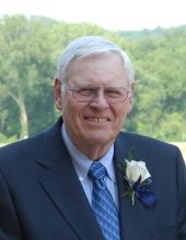
Myron Wilson “Miney” Hasstedt
| Birth | : | 28 Jan 1932 Ogden, Boone County, Iowa, USA |
| Death | : | 25 Jun 2021 Urbandale, Polk County, Iowa, USA |
| Burial | : | Glenwood Cemetery, Ogden, Boone County, USA |
| Coordinate | : | 42.0340000, -94.0440000 |
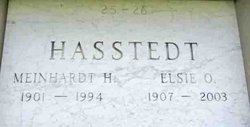
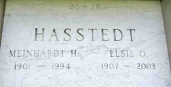
| Description | : | Myron "Miney" Wilson Hasstedt, 89 of Urbandale, Iowa lost his short battle with cancer on June 25, 2021 at his home surrounded by his loving family. He was born on January 28, 1932, on the family farm outside Ogden, Iowa. Myron was the youngest of two sons born to Meinhardt and Elsie (Wilson) Hasstedt. He married Janet Moeller on December 21, 1958. They enjoyed 62 wonderful years together while raising three sons. Early in life, Miney excelled in all sports, but especially basketball. He served in the army during the Korean War and afterwards owned and operated a... Read More |
frequently asked questions (FAQ):
-
Where is Myron Wilson “Miney” Hasstedt's memorial?
Myron Wilson “Miney” Hasstedt's memorial is located at: Glenwood Cemetery, Ogden, Boone County, USA.
-
When did Myron Wilson “Miney” Hasstedt death?
Myron Wilson “Miney” Hasstedt death on 25 Jun 2021 in Urbandale, Polk County, Iowa, USA
-
Where are the coordinates of the Myron Wilson “Miney” Hasstedt's memorial?
Latitude: 42.0340000
Longitude: -94.0440000
Family Members:
Parent
Siblings
Flowers:
Nearby Cemetories:
1. Glenwood Cemetery
Ogden, Boone County, USA
Coordinate: 42.0340000, -94.0440000
2. Saint Johns Catholic Cemetery
Ogden, Boone County, USA
Coordinate: 42.0344000, -94.0407000
3. Maple Grove Cemetery
Boxholm, Boone County, USA
Coordinate: 42.0793690, -94.0859890
4. Swede Valley Lutheran Church Cemetery
Ogden, Boone County, USA
Coordinate: 41.9770000, -94.0285000
5. Maas Cemetery
Boone County, USA
Coordinate: 42.0908012, -94.0618973
6. Bluff Creek Cemetery
Boone, Boone County, USA
Coordinate: 42.0774994, -93.9796982
7. Grand Ridge Cemetery
Beaver, Boone County, USA
Coordinate: 42.0786018, -94.1157990
8. Hollaway Cemetery
Moingona, Boone County, USA
Coordinate: 42.0138720, -93.9530080
9. Quincy Cemetery
Boone, Boone County, USA
Coordinate: 42.0074997, -93.9503021
10. Beaver Cemetery
Beaver, Boone County, USA
Coordinate: 42.0462000, -94.1446000
11. Rose Hill Cemetery
Boone, Boone County, USA
Coordinate: 42.0419006, -93.9408035
12. Oakwood Cemetery
Moingona, Boone County, USA
Coordinate: 42.0219002, -93.9396973
13. Sacred Heart Cemetery
Boone, Boone County, USA
Coordinate: 42.0485992, -93.9163971
14. Boone Memorial Gardens Cemetery
Boone, Boone County, USA
Coordinate: 42.0449982, -93.9152985
15. Biblical College Cemetery
Boone, Boone County, USA
Coordinate: 42.0456009, -93.9113998
16. Buckley Cemetery
Boone, Boone County, USA
Coordinate: 42.0999810, -93.9418960
17. Pleasant Hill Cemetery
Boone, Boone County, USA
Coordinate: 41.9618988, -93.9492035
18. Hickory Grove Cemetery
Boone County, USA
Coordinate: 42.1074982, -93.9507980
19. Union Cemetery
Boxholm, Boone County, USA
Coordinate: 42.1369019, -94.0852966
20. Sparks Cemetery
Boone County, USA
Coordinate: 41.9728012, -93.9191971
21. David Peoples Cemetery
Boone, Boone County, USA
Coordinate: 41.9210014, -94.0179977
22. Latham Cemetery
Boone, Boone County, USA
Coordinate: 42.0489006, -93.8878021
23. Linwood Park Cemetery
Boone, Boone County, USA
Coordinate: 42.0550003, -93.8850021
24. Renner Cemetery
Boone County, USA
Coordinate: 42.1380420, -94.1256570


