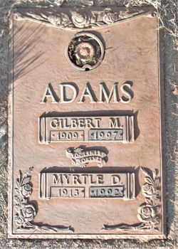
Myrtle Deloris McJimsey Adams
| Birth | : | 21 Dec 1913 Decatur City, Decatur County, Iowa, USA |
| Death | : | 31 Aug 1992 Butte County, California, USA |
| Burial | : | New Denver Village Cemetery, New Denver, Central Kootenay Regional District, Canada |
| Coordinate | : | 49.9949600, -117.3654000 |
| Plot | : | Garden of Peace, lot 280 sp 1 |
| Description | : | Birth and death dates and locations, mother's maiden name Pearl, from California Death Index Records. 78-year-old Myrtle Deloris Adams was interred, per the Glen Oaks Cemetery Burial Records, in the plot noted, on September 3, 1992. |
frequently asked questions (FAQ):
-
Where is Myrtle Deloris McJimsey Adams's memorial?
Myrtle Deloris McJimsey Adams's memorial is located at: New Denver Village Cemetery, New Denver, Central Kootenay Regional District, Canada.
-
When did Myrtle Deloris McJimsey Adams death?
Myrtle Deloris McJimsey Adams death on 31 Aug 1992 in Butte County, California, USA
-
Where are the coordinates of the Myrtle Deloris McJimsey Adams's memorial?
Latitude: 49.9949600
Longitude: -117.3654000
Family Members:
Parent
Spouse
Flowers:
Nearby Cemetories:
1. New Denver Village Cemetery
New Denver, Central Kootenay Regional District, Canada
Coordinate: 49.9949600, -117.3654000
2. Sandon Cemetery
Sandon, Central Kootenay Regional District, Canada
Coordinate: 49.9979190, -117.2545050
3. Hills Doukhobor Cemetery
Hills, Central Kootenay Regional District, Canada
Coordinate: 50.1081500, -117.4934500
4. Slocan Village Cemetery
Slocan, Central Kootenay Regional District, Canada
Coordinate: 49.7607200, -117.4665700
5. Kaslo Cemetery
Kaslo, Central Kootenay Regional District, Canada
Coordinate: 49.9113100, -116.9329100
6. Burton Cemetery
Nakusp, Central Kootenay Regional District, Canada
Coordinate: 49.9870000, -117.8768200
7. Burton Community Cemetery
Burton, Central Kootenay Regional District, Canada
Coordinate: 49.9889800, -117.8769900
8. Argenta Cemetery
Argenta, Central Kootenay Regional District, Canada
Coordinate: 50.1693333, -116.9154333
9. Perry Siding Doukhobor Cemetery
Perrys, Central Kootenay Regional District, Canada
Coordinate: 49.6603300, -117.5072000
10. Maple Cemetery
East Arrow Park, Central Kootenay Regional District, Canada
Coordinate: 50.0815950, -117.9186890
11. Glenbank Cemetery
Nakusp, Central Kootenay Regional District, Canada
Coordinate: 50.2529920, -117.7786300
12. Nakusp Cemetery
Nakusp, Central Kootenay Regional District, Canada
Coordinate: 50.2415600, -117.8124700
13. Ainsworth Cemetery
Ainsworth Hot Springs, Central Kootenay Regional District, Canada
Coordinate: 49.7333330, -116.9094190
14. Winlaw Doukhobor Cemetery
Winlaw, Central Kootenay Regional District, Canada
Coordinate: 49.6013000, -117.5800000
15. All Saints Anglican Church Cemetery
Longbeach, Central Kootenay Regional District, Canada
Coordinate: 49.6161600, -117.0695900
16. Balfour Cemetery
Balfour, Central Kootenay Regional District, Canada
Coordinate: 49.6283100, -116.9619100
17. Crawford Bay Cemetery
Crawford Bay, Central Kootenay Regional District, Canada
Coordinate: 49.6945390, -116.8138077
18. Fauquier Cemetery
Fauquier, Central Kootenay Regional District, Canada
Coordinate: 49.8693000, -118.0794000
19. Needles Cemetery
Needles, Central Kootenay Regional District, Canada
Coordinate: 49.8722780, -118.1013750
20. Slocan Park Doukhobor Cemetery
Slocan Park, Central Kootenay Regional District, Canada
Coordinate: 49.5274400, -117.6330200
21. Valley View Cemetery
Slocan, Central Kootenay Regional District, Canada
Coordinate: 49.5273200, -117.6327700
22. Whatshan Mennonite Cemetery
Needles, Central Kootenay Regional District, Canada
Coordinate: 49.9079287, -118.1395079
23. Nelson Memorial Park
Nelson, Central Kootenay Regional District, Canada
Coordinate: 49.4765205, -117.2859268
24. Gray Creek Cemetery
Gray Creek, Central Kootenay Regional District, Canada
Coordinate: 49.6259540, -116.7854990


