| Birth | : | 24 Feb 1882 Jefferson City, Cole County, Missouri, USA |
| Death | : | 14 Nov 1944 Osborne County, Kansas, USA |
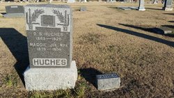
| Burial | : | Cedar Bluff Cemetery, Osborne County, USA |
| Coordinate | : | 39.2496986, -98.8431015 |
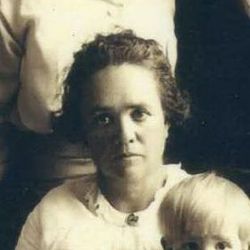
| Description | : | Page 5 of The Osborne Farmer Journal, published in , on Thursday, November 23rd, 1944: Myrtle Mary Hughes was born Feb 24, 1882, at Jefferson City, MO. She came to Kansas when a child of four years with her parents and settled in Victor township in the IXL community and there grew to young womanhood and received her education. On Nov. 18, 1900, she was united in marriage to Daniel Winder at Osborne. To this union were born six children. They lived on a farm southwest of Covert where five of their children... Read More |
frequently asked questions (FAQ):
-
Where is Myrtle Mary Hughes Winder's memorial?
Myrtle Mary Hughes Winder's memorial is located at: Cedar Bluff Cemetery, Osborne County, USA.
-
When did Myrtle Mary Hughes Winder death?
Myrtle Mary Hughes Winder death on 14 Nov 1944 in Osborne County, Kansas, USA
-
Where are the coordinates of the Myrtle Mary Hughes Winder's memorial?
Latitude: 39.2496986
Longitude: -98.8431015
Family Members:
Parent
Spouse
Siblings
Children
Flowers:
Nearby Cemetories:
1. Victor Cemetery
Osborne County, USA
Coordinate: 39.2380981, -98.8613968
2. Cole Cemetery
Osborne County, USA
Coordinate: 39.2352982, -98.8060989
3. Covert Cemetery
Osborne County, USA
Coordinate: 39.2896996, -98.8107986
4. IXL Cemetery
Natoma, Osborne County, USA
Coordinate: 39.2491989, -98.9218979
5. Round Mound Cemetery
Osborne County, USA
Coordinate: 39.2630997, -98.9636002
6. Vincent Cemetery
Osborne, Osborne County, USA
Coordinate: 39.1921997, -98.7228012
7. Grand Center Cemetery
Osborne County, USA
Coordinate: 39.1469002, -98.7602997
8. Bristow Cemetery
Osborne, Osborne County, USA
Coordinate: 39.3506012, -98.7506027
9. Immanuel Lutheran Cemetery
Natoma, Osborne County, USA
Coordinate: 39.2708015, -99.0096970
10. Kill Creek Cemetery
Alton, Osborne County, USA
Coordinate: 39.3805528, -98.8967658
11. Mount Hermon Cemetery
Paradise, Russell County, USA
Coordinate: 39.1324997, -98.9439011
12. Potterville Cemetery
Cheyenne, Osborne County, USA
Coordinate: 39.2417500, -98.6576900
13. Mount Hope Cemetery
Bloomington, Osborne County, USA
Coordinate: 39.3939018, -98.8450012
14. Natoma Cemetery
Natoma, Osborne County, USA
Coordinate: 39.1907700, -99.0162700
15. Natoma Lutheran Cemetery
Natoma, Osborne County, USA
Coordinate: 39.1907700, -99.0162700
16. Waldo Catholic Cemetery
Waldo Township, Russell County, USA
Coordinate: 39.1036600, -98.8162400
17. Natoma Catholic Cemetery
Natoma, Osborne County, USA
Coordinate: 39.2054050, -99.0289480
18. Mount Ayr Cemetery
Alton, Osborne County, USA
Coordinate: 39.3764000, -98.9717026
19. Zimmerman Cemetery
Osborne County, USA
Coordinate: 39.3217010, -98.6568985
20. Cheyenne Cemetery
Cheyenne, Osborne County, USA
Coordinate: 39.1767006, -98.6408005
21. Pleasant Plain Cemetery
Osborne County, USA
Coordinate: 39.3367004, -99.0372009
22. Luray Cemetery
Luray, Russell County, USA
Coordinate: 39.1109980, -98.6872380
23. Aurora Cemetery
Laton, Rooks County, USA
Coordinate: 39.2778015, -99.0847015
24. Chalk Mound Cemetery
Laton, Rooks County, USA
Coordinate: 39.3208008, -99.0852966


