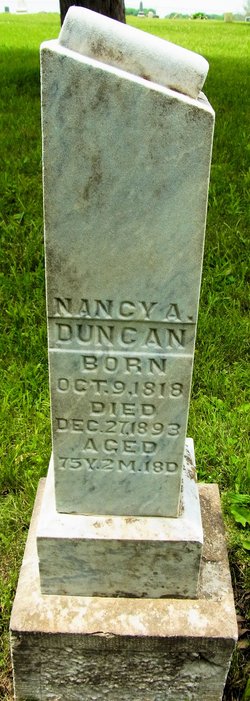
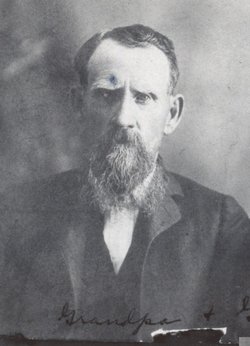
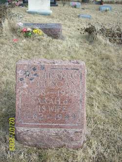
Nancy Ann Sharp Duncan
| Birth | : | 9 Oct 1818 Kentucky, USA |
| Death | : | 27 Dec 1893 Ray County, Missouri, USA |
| Burial | : | Gwynns Island Cemetery, Gwynn, Mathews County, USA |
| Coordinate | : | 37.4995782, -76.2943862 |
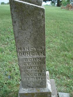
| Inscription | : | Aged: 75 Years, 2 Months, 18 Days |
frequently asked questions (FAQ):
-
Where is Nancy Ann Sharp Duncan's memorial?
Nancy Ann Sharp Duncan's memorial is located at: Gwynns Island Cemetery, Gwynn, Mathews County, USA.
-
When did Nancy Ann Sharp Duncan death?
Nancy Ann Sharp Duncan death on 27 Dec 1893 in Ray County, Missouri, USA
-
Where are the coordinates of the Nancy Ann Sharp Duncan's memorial?
Latitude: 37.4995782
Longitude: -76.2943862
Family Members:
Spouse
Children
Flowers:
Nearby Cemetories:
1. Gwynns Island Cemetery
Gwynn, Mathews County, USA
Coordinate: 37.4995782, -76.2943862
2. Hudgins - Edwards Cemetery
Gwynn, Mathews County, USA
Coordinate: 37.4998188, -76.2916481
3. Gwynn's Island Baptist Church
Gwynn, Mathews County, USA
Coordinate: 37.5049650, -76.2898350
4. Keeble Family Cemetery
Gwynn, Mathews County, USA
Coordinate: 37.5114705, -76.2919754
5. Marchant Cemetery
Cricket Hill, Mathews County, USA
Coordinate: 37.4870796, -76.3063278
6. Goshen Cemetery
Moon, Mathews County, USA
Coordinate: 37.4796900, -76.2991400
7. Hudgins Plantation Cemetery
Hudgins, Mathews County, USA
Coordinate: 37.4840874, -76.3138392
8. Powell-Winder Cemetery
Hudgins, Mathews County, USA
Coordinate: 37.4835197, -76.3133476
9. Powell Family Cemetery
Cricket Hill, Mathews County, USA
Coordinate: 37.4830900, -76.3129500
10. Powell Cemetery
Cricket Hill, Mathews County, USA
Coordinate: 37.4830600, -76.3129800
11. Holly Hill Cemetery
Hudgins, Mathews County, USA
Coordinate: 37.4799252, -76.3088840
12. Winder Cemetery
Cricket Hill, Mathews County, USA
Coordinate: 37.4793900, -76.3076900
13. Hudgins Cemetery
Hudgins, Mathews County, USA
Coordinate: 37.4799548, -76.3265496
14. Callis Family Cemetery
Redart, Mathews County, USA
Coordinate: 37.4663200, -76.2986600
15. Brooks-Hudgins Cemetery
Hallieford, Mathews County, USA
Coordinate: 37.4887800, -76.3350100
16. Green Cemetery
Hallieford, Mathews County, USA
Coordinate: 37.5014800, -76.3379600
17. Hodges Cemetery
Redart, Mathews County, USA
Coordinate: 37.4642780, -76.2951940
18. Trader Cemetery
Redart, Mathews County, USA
Coordinate: 37.4641110, -76.2959440
19. Brooks-Brownley Cemetery
Hudgins, Mathews County, USA
Coordinate: 37.4685968, -76.3185703
20. Payton Cemetery
Hudgins, Mathews County, USA
Coordinate: 37.4686302, -76.3207578
21. Mathews Baptist Church Cemetery
Hudgins, Mathews County, USA
Coordinate: 37.4709520, -76.3271860
22. Tabb Cemetery
Hudgins, Mathews County, USA
Coordinate: 37.4631185, -76.3164629
23. H. C. Smither Memorial Cemetery
Hudgins, Mathews County, USA
Coordinate: 37.4827995, -76.3407974
24. Atherton - Lewis Cemetery
Hallieford, Mathews County, USA
Coordinate: 37.4997200, -76.3471500

