
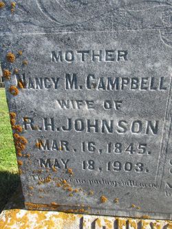
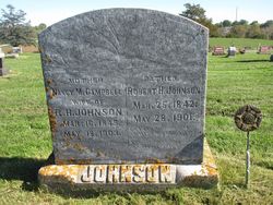
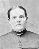
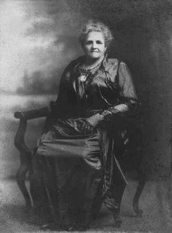
Nancy Marie Campbell Johnson
| Birth | : | 16 Mar 1845 Crawford County, Ohio, USA |
| Death | : | 18 May 1903 Decatur County, Iowa, USA |
| Burial | : | Atascadero Pine Mountain Cemetery, Atascadero, San Luis Obispo County, USA |
| Coordinate | : | 35.4960835, -120.6565582 |
| Plot | : | Section B, Lot 72 |
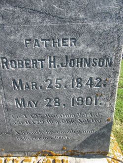
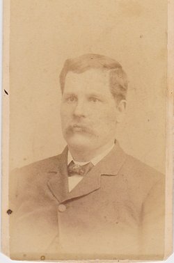
| Description | : | Married Robert Harrison Johnson on July 3, 1862. Mother of five; Paris F., Erastus O., Mary Isabel (Dorsey) and Ralph Johnson. Ralph's twin died. |
frequently asked questions (FAQ):
-
Where is Nancy Marie Campbell Johnson's memorial?
Nancy Marie Campbell Johnson's memorial is located at: Atascadero Pine Mountain Cemetery, Atascadero, San Luis Obispo County, USA.
-
When did Nancy Marie Campbell Johnson death?
Nancy Marie Campbell Johnson death on 18 May 1903 in Decatur County, Iowa, USA
-
Where are the coordinates of the Nancy Marie Campbell Johnson's memorial?
Latitude: 35.4960835
Longitude: -120.6565582
Family Members:
Parent
Spouse
Siblings
Children

Flowers:

My Great Grandmother.
Left by Anonymous on 12 Mar 2003
My 3rd great aunt.
Left by Anonymous on 20 May 2012

My great, great grandmother
Left by Anonymous on 03 Aug 2014

Perhaps they are not stars in the sky, but rather openings where our loved ones shine down to let us know they are happy. -Anonymous
Left by Anonymous on 23 Jul 2018


Nearby Cemetories:
1. Atascadero Pine Mountain Cemetery
Atascadero, San Luis Obispo County, USA
Coordinate: 35.4960835, -120.6565582
2. Chapel of the Roses Cemetery
Atascadero, San Luis Obispo County, USA
Coordinate: 35.5027340, -120.6881430
3. Dove Cemetery
San Luis Obispo County, USA
Coordinate: 35.4482231, -120.6344299
4. Templeton Cemetery
Templeton, San Luis Obispo County, USA
Coordinate: 35.5714455, -120.7022095
5. Santa Margarita Cemetery
Santa Margarita, San Luis Obispo County, USA
Coordinate: 35.3913994, -120.5880966
6. Creston Cemetery
Creston, San Luis Obispo County, USA
Coordinate: 35.5328640, -120.5121450
7. Saint James Episcopal Church Inurnment Garden
Paso Robles, San Luis Obispo County, USA
Coordinate: 35.6283460, -120.6929780
8. Paso Robles District Cemetery
Paso Robles, San Luis Obispo County, USA
Coordinate: 35.6424700, -120.7035000
9. Willow Creek Mennonite Cemetery
Wilson Corner, San Luis Obispo County, USA
Coordinate: 35.5890410, -120.8215860
10. Canet Cemetery
San Luis Obispo County, USA
Coordinate: 35.3522840, -120.7901660
11. Cayucos-Morro Bay District Cemetery
Cayucos, San Luis Obispo County, USA
Coordinate: 35.4371986, -120.8850021
12. Estrella Adobe Cemetery
Paso Robles, San Luis Obispo County, USA
Coordinate: 35.6975080, -120.6399460
13. St. Peter’s By-the-Sea Episcopal Church Memo
Morro Bay, San Luis Obispo County, USA
Coordinate: 35.3628700, -120.8467400
14. Adelaida Cemetery
Adelaida, San Luis Obispo County, USA
Coordinate: 35.5632085, -120.8956170
15. Mission San Luis Obispo Cemetery
San Luis Obispo, San Luis Obispo County, USA
Coordinate: 35.2806600, -120.6645200
16. Pleasant Valley Cemetery
San Miguel, San Luis Obispo County, USA
Coordinate: 35.7181892, -120.6228485
17. San Marcos Mennonite Cemetery
San Luis Obispo County, USA
Coordinate: 35.6874570, -120.7995160
18. Los Osos Valley Memorial Park
Los Osos, San Luis Obispo County, USA
Coordinate: 35.3053017, -120.8011017
19. Old Mission Cemetery
San Luis Obispo, San Luis Obispo County, USA
Coordinate: 35.2670660, -120.6692150
20. San Luis Cemetery
San Luis Obispo, San Luis Obispo County, USA
Coordinate: 35.2644192, -120.6712830
21. Adelaida Cemetery
San Luis Obispo County, USA
Coordinate: 35.6563988, -120.8728027
22. Ballagh Family Cemetery
Pozo, San Luis Obispo County, USA
Coordinate: 35.3695640, -120.4081780
23. San Miguel District Cemetery
San Miguel, San Luis Obispo County, USA
Coordinate: 35.7392006, -120.7013550
24. Mission San Miguel Cemetery
San Miguel, San Luis Obispo County, USA
Coordinate: 35.7452610, -120.6977370