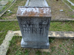
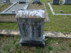
| Birth | : | 15 Nov 1876 |
| Death | : | 15 Jul 1971 |
| Burial | : | Prairie View Cemetery, Grangeville, Idaho County, USA |
| Coordinate | : | 45.9308205, -116.1129837 |
frequently asked questions (FAQ):
-
Where is Nannie Gregory Rampley's memorial?
Nannie Gregory Rampley's memorial is located at: Prairie View Cemetery, Grangeville, Idaho County, USA.
-
When did Nannie Gregory Rampley death?
Nannie Gregory Rampley death on 15 Jul 1971 in
-
Where are the coordinates of the Nannie Gregory Rampley's memorial?
Latitude: 45.9308205
Longitude: -116.1129837
Family Members:
Parent
Spouse
Siblings
Children
Flowers:
Nearby Cemetories:
1. Prairie View Cemetery
Grangeville, Idaho County, USA
Coordinate: 45.9308205, -116.1129837
2. Hillcrest Cemetery
Grangeville, Idaho County, USA
Coordinate: 45.9283860, -116.0824710
3. Mount Idaho Cemetery
Mount Idaho, Idaho County, USA
Coordinate: 45.9040000, -116.0723000
4. Fairview Cemetery
Grangeville, Idaho County, USA
Coordinate: 45.9759000, -116.0677000
5. Denver Cemetery
Denver, Idaho County, USA
Coordinate: 46.0088997, -116.2225037
6. Harpster Cemetery
Harpster, Idaho County, USA
Coordinate: 45.9927000, -115.9632000
7. Clearwater Cemetery
Clearwater, Idaho County, USA
Coordinate: 46.0153008, -115.8944016
8. Mount Zion Cemetery
Idaho County, USA
Coordinate: 46.1067009, -116.1046982
9. William Foster Cemetery
Cottonwood, Idaho County, USA
Coordinate: 46.0264430, -116.3276560
10. Stites IOOF Cemetery
Idaho County, USA
Coordinate: 46.0878000, -115.9853000
11. Battle Ridge Cemetery
Idaho County, USA
Coordinate: 46.0661000, -115.9180000
12. Stites Indian Church Cemetery
Stites, Idaho County, USA
Coordinate: 46.0998000, -115.9825000
13. Greencreek Cemetery
Greencreek, Idaho County, USA
Coordinate: 46.1000000, -116.2544000
14. Winona Cemetery
Idaho County, USA
Coordinate: 46.1300011, -116.1219025
15. Canfield Cemetery
Idaho County, USA
Coordinate: 45.8369000, -116.3695000
16. Cottonwood Community Cemetery
Cottonwood, Idaho County, USA
Coordinate: 46.0630989, -116.3463974
17. Saint Mary's Catholic Cemetery
Cottonwood, Idaho County, USA
Coordinate: 46.0637000, -116.3478000
18. Saint Gertrudes Monastery Cemetery
Cottonwood, Idaho County, USA
Coordinate: 46.0335000, -116.3951000
19. Monastery of Saint Gertrude Cemetery
Cottonwood, Idaho County, USA
Coordinate: 46.0335170, -116.3951490
20. Pine Grove Cemetery
Kooskia, Idaho County, USA
Coordinate: 46.1324997, -115.9710999
21. White Bird Cemetery
White Bird, Idaho County, USA
Coordinate: 45.7477989, -116.3116989
22. Miller Cemetery
Kooskia, Idaho County, USA
Coordinate: 46.1497002, -115.9927979
23. Nicodemus Cemetery
Kooskia, Idaho County, USA
Coordinate: 46.1467018, -115.9805984
24. Tahoe Cemetery
Kooskia, Idaho County, USA
Coordinate: 46.0957985, -115.8672028


