Nellie May Neal
| Birth | : | unknown |
| Death | : | 4 Sep 1877 Polk Township, Nodaway County, Missouri, USA |
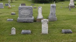
| Burial | : | East Lawn Cemetery, East Haven, New Haven County, USA |
| Coordinate | : | 41.2736015, -72.8664017 |
| Plot | : | Northeast Sec. 3, Row 5 |
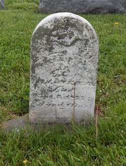
| Inscription | : | 11 month |
| Description | : | Nodaway Democrat (Maryville, Missouri), Thursday, September 13, 1877 DIED. NEIL – In Polk township, on September 4th, 1877, of whooping cough, Nellie May, infant daughter of John M. and M. E. Neil. The flowers which bloom in beauty along our pathway are recalled at the approach of the first autumnal cloud; in like manner this little bud has been taken that it may open in richer fragrance in the summer land of song. I take these little ones says he, And fold them to my breast; Protection they shall find in me, In me be ever blessed. L. F. Linn |
frequently asked questions (FAQ):
-
Where is Nellie May Neal's memorial?
Nellie May Neal's memorial is located at: East Lawn Cemetery, East Haven, New Haven County, USA.
-
When did Nellie May Neal death?
Nellie May Neal death on 4 Sep 1877 in Polk Township, Nodaway County, Missouri, USA
-
Where are the coordinates of the Nellie May Neal's memorial?
Latitude: 41.2736015
Longitude: -72.8664017
Family Members:
Parent
Siblings
Flowers:
Nearby Cemetories:
1. East Lawn Cemetery
East Haven, New Haven County, USA
Coordinate: 41.2736015, -72.8664017
2. Old Cemetery
East Haven, New Haven County, USA
Coordinate: 41.2747993, -72.8678970
3. Greenlawn Cemetery
East Haven, New Haven County, USA
Coordinate: 41.2742004, -72.8716965
4. Warshaver Relief Association Cemetery
East Haven, New Haven County, USA
Coordinate: 41.2752266, -72.8794785
5. Independent Rambam Lodge Cemetery
East Haven, New Haven County, USA
Coordinate: 41.2751312, -72.8797150
6. Young Israel of New Haven Cemetery
East Haven, New Haven County, USA
Coordinate: 41.2754364, -72.8796768
7. Independent New Haven Lodge Memorial
East Haven, New Haven County, USA
Coordinate: 41.2747421, -72.8800354
8. Congregation Beth Hamedrosh Hagodol Cemetery
East Haven, New Haven County, USA
Coordinate: 41.2753563, -72.8799438
9. Congregation Bikur Cholim Cemetery
East Haven, New Haven County, USA
Coordinate: 41.2753220, -72.8799973
10. Hebrew Burial and Free Loan Association Cemetery
East Haven, New Haven County, USA
Coordinate: 41.2754211, -72.8804245
11. Jewish Peoples Cemetery
East Haven, New Haven County, USA
Coordinate: 41.2684150, -72.8817720
12. Vilner Lodge Memorial Park
East Haven, New Haven County, USA
Coordinate: 41.2687110, -72.8822060
13. Wilcox Estate Burial Site
Short Beach, New Haven County, USA
Coordinate: 41.2568190, -72.8466180
14. Saint Mary Roman Catholic Cemetery
Branford, New Haven County, USA
Coordinate: 41.2796650, -72.8194050
15. Fair Haven Union Cemetery
New Haven, New Haven County, USA
Coordinate: 41.3114014, -72.8944016
16. Branford Center Cemetery
Branford, New Haven County, USA
Coordinate: 41.2813988, -72.8060989
17. Tabor Cemetery
Branford, New Haven County, USA
Coordinate: 41.2736015, -72.8011017
18. Mill Plain Cemetery
Branford, New Haven County, USA
Coordinate: 41.2924995, -72.7960968
19. Center Church on the Green Churchyard
New Haven, New Haven County, USA
Coordinate: 41.3077011, -72.9262009
20. Trinity Church on the Green Crypt and Columbarium
New Haven, New Haven County, USA
Coordinate: 41.3070970, -72.9274570
21. Saint Marys Church
New Haven, New Haven County, USA
Coordinate: 41.3119011, -72.9238968
22. Saint Agnes Cemetery
Branford, New Haven County, USA
Coordinate: 41.2907982, -72.7919006
23. Peabody Museum
New Haven, New Haven County, USA
Coordinate: 41.3156815, -72.9210129
24. Yale University Art Gallery
New Haven, New Haven County, USA
Coordinate: 41.3079987, -72.9300003

