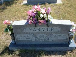
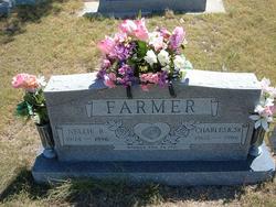
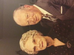
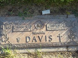
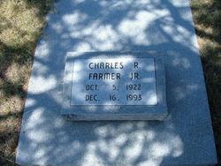
Nellie Rebecca Davis Farmer
| Birth | : | 16 Aug 1904 Horace, Greeley County, Kansas, USA |
| Death | : | 30 Dec 1996 Tribune, Greeley County, Kansas, USA |
| Burial | : | Pleasant Green Cemetery, Bradford, Gibson County, USA |
| Coordinate | : | 36.0382996, -88.6992035 |
frequently asked questions (FAQ):
-
Where is Nellie Rebecca Davis Farmer's memorial?
Nellie Rebecca Davis Farmer's memorial is located at: Pleasant Green Cemetery, Bradford, Gibson County, USA.
-
When did Nellie Rebecca Davis Farmer death?
Nellie Rebecca Davis Farmer death on 30 Dec 1996 in Tribune, Greeley County, Kansas, USA
-
Where are the coordinates of the Nellie Rebecca Davis Farmer's memorial?
Latitude: 36.0382996
Longitude: -88.6992035
Family Members:
Parent
Spouse
Siblings
Children
Flowers:
Nearby Cemetories:
1. Pleasant Green Cemetery
Bradford, Gibson County, USA
Coordinate: 36.0382996, -88.6992035
2. Patterson Cemetery
Skullbone, Gibson County, USA
Coordinate: 36.0603300, -88.7129100
3. Chicken Hill Cemetery
Idlewild, Gibson County, USA
Coordinate: 36.0310500, -88.7362300
4. Belews Chapel Cemetery
Bradford, Gibson County, USA
Coordinate: 36.0402985, -88.7397003
5. Republican Grove Cemetery
Trezevant, Carroll County, USA
Coordinate: 36.0235150, -88.6545770
6. Mount Pleasant Cemetery
Bradford, Gibson County, USA
Coordinate: 36.0677210, -88.7398220
7. Pratt Cemetery
Bradford, Gibson County, USA
Coordinate: 36.0163994, -88.7497025
8. Capps Cemetery #1
Weakley County, USA
Coordinate: 36.0842056, -88.6881638
9. Poplar Springs Cemetery
Milan, Gibson County, USA
Coordinate: 35.9935989, -88.7172012
10. Oak Grove Cemetery
Trezevant, Carroll County, USA
Coordinate: 36.0350060, -88.6398990
11. Bruff Cemetery
Skullbone, Gibson County, USA
Coordinate: 36.0572014, -88.7641983
12. Harmony Primitive Baptist Church Cemetery
Idlewild, Gibson County, USA
Coordinate: 36.0274700, -88.7712300
13. Stone Family Plot
Milan, Gibson County, USA
Coordinate: 35.9895350, -88.7436100
14. Mount Ararat Cemetery
Trezevant, Carroll County, USA
Coordinate: 36.0140960, -88.6293450
15. Pilgrims Rest Cemetery
Christmasville, Carroll County, USA
Coordinate: 36.0875015, -88.6521988
16. Holt Family Cemetery
Bradford, Gibson County, USA
Coordinate: 36.0822690, -88.7552980
17. Pleasant View Church of Christ Cemetery
Skullbone, Gibson County, USA
Coordinate: 36.0833810, -88.7619050
18. Pisgah Cemetery
Atwood, Carroll County, USA
Coordinate: 35.9766998, -88.6622009
19. Fowler Cemetery
Christmasville, Carroll County, USA
Coordinate: 36.0688030, -88.6226690
20. Trezevant Cemetery
Trezevant, Carroll County, USA
Coordinate: 36.0120400, -88.6195660
21. Walker Family Cemetery
Trezevant, Carroll County, USA
Coordinate: 36.0358510, -88.6130660
22. Williams Family Cemetery
Idlewild, Gibson County, USA
Coordinate: 36.0257400, -88.7846400
23. Fuqua Cemetery #2
Trezevant, Carroll County, USA
Coordinate: 36.0494520, -88.6123430
24. Walnut Grove Methodist Church Cemetery
Milan, Gibson County, USA
Coordinate: 35.9946518, -88.7714462

