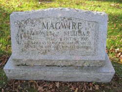
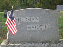
Nethelia Benedict “Net” Sherman Magwire
| Birth | : | 18 Aug 1913 Castleton, Rutland County, Vermont, USA |
| Death | : | 31 Aug 2003 Castleton, Rutland County, Vermont, USA |
| Burial | : | Beth-David Cemetery, Kenilworth, Union County, USA |
| Coordinate | : | 40.6805992, -74.2806015 |
| Description | : | Nethelia Magwire CASTLETON - Mrs. Nethelia Sherman Magwire (Net), 90, peacefully passed away, surrounded by her family, Sunday morning, August 31, 2003. She was a ten-year resident, with Alz-heimer's, of Mountain View Center Genesis Elder Care in Rutland, VT Net was born in Castleton, Vt August 18, 1913, the daughter of the late Frank and Hazel (Benedict) Sherman. She was a graduate of Fair Haven High School and Castleton Normal School now Castleton State College. She married her husband Mr. Raymond B. Magwire in Springfield, VT in 1936. She taught at schools in several Vermont towns including Barre, Plainfield, East... Read More |
frequently asked questions (FAQ):
-
Where is Nethelia Benedict “Net” Sherman Magwire's memorial?
Nethelia Benedict “Net” Sherman Magwire's memorial is located at: Beth-David Cemetery, Kenilworth, Union County, USA.
-
When did Nethelia Benedict “Net” Sherman Magwire death?
Nethelia Benedict “Net” Sherman Magwire death on 31 Aug 2003 in Castleton, Rutland County, Vermont, USA
-
Where are the coordinates of the Nethelia Benedict “Net” Sherman Magwire's memorial?
Latitude: 40.6805992
Longitude: -74.2806015
Family Members:
Parent
Spouse
Flowers:
Nearby Cemetories:
1. Beth-David Cemetery
Kenilworth, Union County, USA
Coordinate: 40.6805992, -74.2806015
2. Graceland Memorial Park
Kenilworth, Union County, USA
Coordinate: 40.6817017, -74.2743988
3. Connecticut Farms Presbyterian Church Cemetery
Union, Union County, USA
Coordinate: 40.6933327, -74.2733307
4. B'Nai Abraham Memorial Park
Union, Union County, USA
Coordinate: 40.6875800, -74.3058010
5. French-Richards Burying Ground
Springfield, Union County, USA
Coordinate: 40.6831300, -74.3173300
6. Hollywood Memorial Park
Union, Union County, USA
Coordinate: 40.7087470, -74.2652420
7. Calvary Lutheran Church Memorial Garden
Cranford, Union County, USA
Coordinate: 40.6570380, -74.3067660
8. Hollywood Cemetery
Union, Union County, USA
Coordinate: 40.7101410, -74.2570700
9. Cranford United Methodist Church Memorial Garden
Cranford, Union County, USA
Coordinate: 40.6507190, -74.3039990
10. Old Springfield Burying Ground
Springfield, Union County, USA
Coordinate: 40.7099380, -74.3118740
11. Springfield Emanuel United Methodist Cemetery
Springfield, Union County, USA
Coordinate: 40.7121400, -74.3095000
12. First Presbyterian Churchyard
Springfield, Union County, USA
Coordinate: 40.7117900, -74.3104500
13. Fairview Cemetery
Westfield, Union County, USA
Coordinate: 40.6674995, -74.3300018
14. Presbyterian Cemetery
Springfield, Union County, USA
Coordinate: 40.7141342, -74.3094940
15. Saint Stephens Episcopal Cemetery
Millburn, Essex County, USA
Coordinate: 40.7218018, -74.3153000
16. Saint Rose of Lima Catholic Church Cemetery
Short Hills, Essex County, USA
Coordinate: 40.7213600, -74.3175900
17. Morrow Memorial United Methodist Church Garden
Maplewood, Essex County, USA
Coordinate: 40.7304520, -74.2825750
18. Morrow Church Chapel Garden
Morris County, USA
Coordinate: 40.7306990, -74.2821070
19. Saint Walburga Monastery Burial Site
Elizabeth, Union County, USA
Coordinate: 40.6839140, -74.2138690
20. Clinton Cemetery
Irvington, Essex County, USA
Coordinate: 40.7206001, -74.2360992
21. First Presbyterian Churchyard
Elizabeth, Union County, USA
Coordinate: 40.6629105, -74.2152863
22. Saint Johns Episcopal Church Cemetery
Elizabeth, Union County, USA
Coordinate: 40.6642494, -74.2146225
23. Saint Georges Episcopal Church Memorial Garden
Maplewood, Essex County, USA
Coordinate: 40.7333590, -74.2797110
24. Saint Marys of the Assumption Cemetery
Elizabeth, Union County, USA
Coordinate: 40.6543900, -74.2198800


