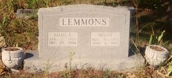
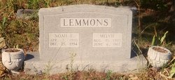
Noah Earl Lemmons
| Birth | : | 3 Apr 1910 Lawrence County, Arkansas, USA |
| Death | : | 25 Dec 1994 Noland, Randolph County, Arkansas, USA |
| Burial | : | McNeal Cemetery, Van Wert County, USA |
| Coordinate | : | 40.9757996, -84.7621994 |
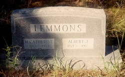
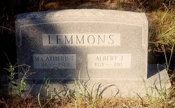
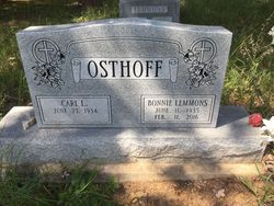
| Description | : | Noah Earl Lemmons, 84, of 1330 Crenshaw, Pocahontas, died at his home, Sunday, Dec. 25, 1994. He was born April 3, 1910, in Lawrence County, son of the late Albert and Katherine (Harp) Lemmons. His wife, Melvie Stringer Lemmons, preceeded him in death. He is survived by a son, Billy E. Lemmons of Pocahontas; two daughters, Bonnie Osthoff of Hatfield and Donna Jo Washburn of Pocahontas; 11 grandchildren; 16 great-grandchildren and one great-great-grandchild. Funeral services were held Tuesday afternoon in the Noland Church of Christ with A.G. Lemmons officiating. Burial followed in Lemmons Cemetery. Pallbearers were Roger and Chris Osthoff, Cole and Matt Lemmons,... Read More |
frequently asked questions (FAQ):
-
Where is Noah Earl Lemmons's memorial?
Noah Earl Lemmons's memorial is located at: McNeal Cemetery, Van Wert County, USA.
-
When did Noah Earl Lemmons death?
Noah Earl Lemmons death on 25 Dec 1994 in Noland, Randolph County, Arkansas, USA
-
Where are the coordinates of the Noah Earl Lemmons's memorial?
Latitude: 40.9757996
Longitude: -84.7621994
Family Members:
Parent
Spouse
Siblings
Children
Flowers:
Nearby Cemetories:
1. McNeal Cemetery
Van Wert County, USA
Coordinate: 40.9757996, -84.7621994
2. Dealey Cemetery
Payne, Paulding County, USA
Coordinate: 41.0038986, -84.7221985
3. Mentzer Cemetery
Convoy, Van Wert County, USA
Coordinate: 40.9312000, -84.7647000
4. Sugar Ridge Cemetery
Townley, Allen County, USA
Coordinate: 41.0036540, -84.8158160
5. Cooper Cemetery
Convoy, Van Wert County, USA
Coordinate: 40.9250250, -84.7846700
6. Flat Rock Evangelical Lutheran Cemetery
East Liberty, Allen County, USA
Coordinate: 40.9476900, -84.8243800
7. Brady-Finan Cemetery
Payne, Paulding County, USA
Coordinate: 41.0358910, -84.7666030
8. Sugar Ridge Cemetery
Convoy, Van Wert County, USA
Coordinate: 40.9382858, -84.6982346
9. IOOF Cemetery
Convoy, Van Wert County, USA
Coordinate: 40.9306330, -84.6990970
10. Hoffman Cemetery
Monroeville, Allen County, USA
Coordinate: 40.9511375, -84.8428955
11. Edwards Cemetery
Monroeville, Allen County, USA
Coordinate: 40.9737100, -84.8527770
12. Saint Rose de Lima Roman Catholic Cemetery
Monroeville, Allen County, USA
Coordinate: 40.9695358, -84.8597717
13. Masonic A and FM Cemetery
Monroeville, Allen County, USA
Coordinate: 40.9698296, -84.8599014
14. Monroeville Memorial Cemetery
Monroeville, Allen County, USA
Coordinate: 40.9664470, -84.8630490
15. Old Methodist Cemetery
Monroeville, Allen County, USA
Coordinate: 40.9776688, -84.8679199
16. Whittern Cemetery (Defunct)
Monroeville, Allen County, USA
Coordinate: 40.9717280, -84.8726420
17. Pancake-Richey-Reidenbach Cemetery
Convoy, Van Wert County, USA
Coordinate: 40.8880820, -84.7557020
18. Lehman Cemetery
Payne, Paulding County, USA
Coordinate: 41.0630989, -84.7442017
19. Clark Chapel Cemetery
Adams County, USA
Coordinate: 40.8991080, -84.8238250
20. Redeemer Lutheran Cemetery
Convoy, Van Wert County, USA
Coordinate: 40.8880000, -84.7220000
21. Kings-Bethlehem Cemetery
Van Wert County, USA
Coordinate: 40.8838997, -84.7842026
22. Saint Johns Cemetery
Van Wert County, USA
Coordinate: 40.8880997, -84.7174988
23. Brown Family Cemetery
Monroeville, Allen County, USA
Coordinate: 40.9426250, -84.8801670
24. Saint Johns Cemetery
Payne, Paulding County, USA
Coordinate: 41.0689011, -84.7322006

