
| Birth | : | 25 Sep 1913 Leonard, Shelby County, Missouri, USA |
| Death | : | 5 Sep 1998 Mount Pleasant, Henry County, Iowa, USA |
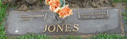
| Burial | : | Lebanon Cemetery, Chambersburg, Franklin County, USA |
| Coordinate | : | 39.9348900, -77.6813600 |
| Description | : | Missouri Marriage Records, 1805-2002 about Clyde Harris Name: Clyde Harris Marriage Date: 6 Oct 1937 Marriage Location: Shelbyville, Shelby, Missouri Marriage County: Shelby Spouse Name: Nola Bodwell ...Find A Grave contributor Norma Faller |
frequently asked questions (FAQ):
-
Where is Nola Irene Bodwell Harris's memorial?
Nola Irene Bodwell Harris's memorial is located at: Lebanon Cemetery, Chambersburg, Franklin County, USA.
-
When did Nola Irene Bodwell Harris death?
Nola Irene Bodwell Harris death on 5 Sep 1998 in Mount Pleasant, Henry County, Iowa, USA
-
Where are the coordinates of the Nola Irene Bodwell Harris's memorial?
Latitude: 39.9348900
Longitude: -77.6813600
Family Members:
Parent
Spouse

Siblings
Children
Flowers:


Nearby Cemetories:
1. Lebanon Cemetery
Chambersburg, Franklin County, USA
Coordinate: 39.9348900, -77.6813600
2. Corpus Christi Cemetery
Chambersburg, Franklin County, USA
Coordinate: 39.9380860, -77.6748680
3. First Evangelical Lutheran Church Cemetery
Chambersburg, Franklin County, USA
Coordinate: 39.9349823, -77.6633301
4. Zion Reformed Church Cemetery
Chambersburg, Franklin County, USA
Coordinate: 39.9331000, -77.6628000
5. Cedar Grove Cemetery
Chambersburg, Franklin County, USA
Coordinate: 39.9417000, -77.6644000
6. Saint James A.M.E. Church Cemetery
Chambersburg, Franklin County, USA
Coordinate: 39.9300460, -77.6626660
7. Pleasant View Mennonite Cemetery
Chambersburg, Franklin County, USA
Coordinate: 39.9247000, -77.6974000
8. First Evangelical United Brethren Church Cemetery
Chambersburg, Franklin County, USA
Coordinate: 39.9337240, -77.6603470
9. Falling Spring Presbyterian Church Cemetery
Chambersburg, Franklin County, USA
Coordinate: 39.9410670, -77.6615500
10. Trinity Episcopal Church Columbarium
Chambersburg, Franklin County, USA
Coordinate: 39.9362440, -77.6590820
11. Israel Benevolent Society Cemetery
Chambersburg, Franklin County, USA
Coordinate: 39.9340900, -77.6557900
12. Lincoln Cemetery
Chambersburg, Franklin County, USA
Coordinate: 39.9297500, -77.6450000
13. Park Avenue United Methodist Church Columbarium
Chambersburg, Franklin County, USA
Coordinate: 39.9491570, -77.6486410
14. Saint Paul United Methodist Church Columbarium
Chambersburg, Franklin County, USA
Coordinate: 39.9422500, -77.6409630
15. Stoufferstown Cemetery
Chambersburg, Franklin County, USA
Coordinate: 39.9277000, -77.6399000
16. Chambersburg Mennonite Cemetery
Chambersburg, Franklin County, USA
Coordinate: 39.9567000, -77.6453000
17. Franklin County Memorial Garden
Chambersburg, Franklin County, USA
Coordinate: 39.9307050, -77.6317550
18. Brinzer-Brainer Cemetery
Chambersburg, Franklin County, USA
Coordinate: 39.9636870, -77.6483340
19. Norland Cemetery
Chambersburg, Franklin County, USA
Coordinate: 39.9667400, -77.6372500
20. Falling Spring Reformed Mennonite Cemetery
Chambersburg, Franklin County, USA
Coordinate: 39.9155000, -77.6244000
21. Gipes Grove Cemetery
Chambersburg, Franklin County, USA
Coordinate: 39.8980740, -77.6412820
22. Crider Family Farm Cemetery
Chambersburg, Franklin County, USA
Coordinate: 39.9459000, -77.7463000
23. Shirk's Mennonite Cemetery
Chambersburg, Franklin County, USA
Coordinate: 39.9720190, -77.6319010
24. Rocky Spring Churchyard
Chambersburg, Franklin County, USA
Coordinate: 39.9886290, -77.6756130