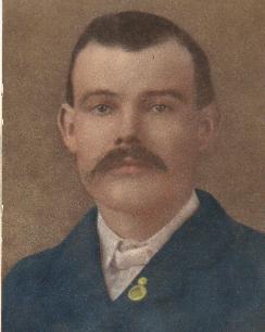
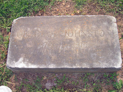
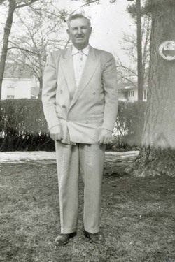
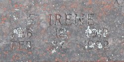
Obadiah “Bud” Johnston
| Birth | : | 27 Feb 1876 Salem, Dent County, Missouri, USA |
| Death | : | 10 Dec 1915 Prairie Grove, Washington County, Arkansas, USA |
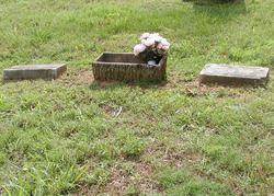
| Burial | : | Hilltop Cemetery, Pagosa Springs, Archuleta County, USA |
| Coordinate | : | 37.2714005, -107.0199966 |
| Description | : | According to his death certificate, he died of a heart attack after exertion with a team of horses. I had always heard that he was killed working with a green team. They broke for the barn and he was caught between the gate post and the machinery. The death certificate does not list any trauma, though if the trauma didn't kill him it might not have been mentioned, but states death came suddenly upon exertion and that he had a weak heart. |
frequently asked questions (FAQ):
-
Where is Obadiah “Bud” Johnston's memorial?
Obadiah “Bud” Johnston's memorial is located at: Hilltop Cemetery, Pagosa Springs, Archuleta County, USA.
-
When did Obadiah “Bud” Johnston death?
Obadiah “Bud” Johnston death on 10 Dec 1915 in Prairie Grove, Washington County, Arkansas, USA
-
Where are the coordinates of the Obadiah “Bud” Johnston's memorial?
Latitude: 37.2714005
Longitude: -107.0199966
Family Members:
Parent
Spouse
Siblings
Children
Flowers:
Nearby Cemetories:
1. Hilltop Cemetery
Pagosa Springs, Archuleta County, USA
Coordinate: 37.2714005, -107.0199966
2. Pagosa Springs Cemetery
Pagosa Springs, Archuleta County, USA
Coordinate: 37.2574000, -107.0197000
3. Eoff Ranch Cemetery
Archuleta County, USA
Coordinate: 37.2956660, -106.9996340
4. White Ranch Family Cemetery
Pagosa Springs, Archuleta County, USA
Coordinate: 37.3146340, -106.9009670
5. Altura Cemetery
Altura, Archuleta County, USA
Coordinate: 37.1698000, -107.1736000
6. Trujillo Cemetery
Trujillo, Archuleta County, USA
Coordinate: 37.0972519, -107.0471268
7. Juanita Cemetery
Juanita, Archuleta County, USA
Coordinate: 37.0291000, -107.1504000
8. Pagosa Juction Cemetery
Pagosa Junction, Archuleta County, USA
Coordinate: 37.0479000, -107.1962000
9. Frances Cemetery
Arboles, Archuleta County, USA
Coordinate: 37.1618291, -107.3252886
10. Talamante Cemetery
Edith, Archuleta County, USA
Coordinate: 37.0059300, -106.9051340
11. Mestas Cemetery
Arboles, Archuleta County, USA
Coordinate: 37.0054450, -107.2411880
12. Dulce Community Cemetery
Dulce, Rio Arriba County, USA
Coordinate: 36.9501980, -106.9878370
13. Carracas Cemetery
Rio Arriba County, USA
Coordinate: 36.9996986, -107.2491989
14. Jicarilla Apache Reform Church Cemetery
Dulce, Rio Arriba County, USA
Coordinate: 36.9357150, -106.9964150
15. Martinez Cemetery
Dulce, Rio Arriba County, USA
Coordinate: 36.9324989, -107.0160980
16. Wirt Cemetery
Dulce, Rio Arriba County, USA
Coordinate: 36.9289017, -107.0100021
17. Saint Francis Catholic Cemetery
Lumberton, Rio Arriba County, USA
Coordinate: 36.9331420, -106.9340410
18. Lobato Cemetery
Lumberton, Rio Arriba County, USA
Coordinate: 36.9311120, -106.9340730
19. Gomez Cemetery
Dulce, Rio Arriba County, USA
Coordinate: 36.9155998, -107.0014038
20. Arboles Cemetery
Arboles, Archuleta County, USA
Coordinate: 37.0484070, -107.4040290
21. Monero Cemetery
Monero, Rio Arriba County, USA
Coordinate: 36.9055580, -106.8543280
22. Santa Rosa Memorial
San Juan County, USA
Coordinate: 36.9998450, -107.4395140
23. Procarone Cemetery
Arboles, Archuleta County, USA
Coordinate: 37.0131670, -107.4600830
24. Bayfield Cemetery
Bayfield, La Plata County, USA
Coordinate: 37.2372017, -107.6033020

