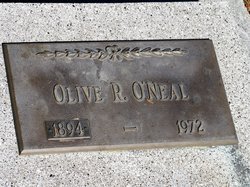
Olive R. Hulett O'Neal
| Birth | : | 27 Sep 1894 Pomeroy, Calhoun County, Iowa, USA |
| Death | : | 26 Dec 1972 Philip, Haakon County, South Dakota, USA |
| Burial | : | Harrison Township Cemetery, South Bloomfield, Pickaway County, USA |
| Coordinate | : | 39.7100029, -82.9895859 |
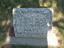
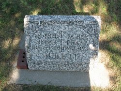
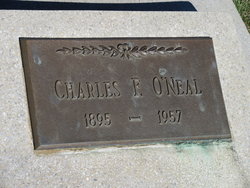
| Description | : | Olive R. O'Neal, 79, died Tuesday at a local nursing home. She was born September 27, 1893, at Pomeroy, IA, to Frank and Helen Hulett. Olive grew up in Iowa and came to South Dakota with her parents, and homesteaded at Philip. She married Charles F. O'Neal December 28 1916 at Philip. The couple ranched and farmed north of Philip until 1944, when they retired and moved to Philip. O'Neal died in 1957. Olive continued living in Philip until 1964, when she moved to Rapid City. She returned to Philip in 1971 to reside in a nursing home. Olive was a member of the... Read More |
frequently asked questions (FAQ):
-
Where is Olive R. Hulett O'Neal's memorial?
Olive R. Hulett O'Neal's memorial is located at: Harrison Township Cemetery, South Bloomfield, Pickaway County, USA.
-
When did Olive R. Hulett O'Neal death?
Olive R. Hulett O'Neal death on 26 Dec 1972 in Philip, Haakon County, South Dakota, USA
-
Where are the coordinates of the Olive R. Hulett O'Neal's memorial?
Latitude: 39.7100029
Longitude: -82.9895859
Family Members:
Parent
Spouse
Siblings
Children
Flowers:
Nearby Cemetories:
1. Harrison Township Cemetery
South Bloomfield, Pickaway County, USA
Coordinate: 39.7100029, -82.9895859
2. Frye Farm Cemetery
South Bloomfield, Pickaway County, USA
Coordinate: 39.6971110, -83.0047600
3. Conner Family Farm Cemetery
Ashville, Pickaway County, USA
Coordinate: 39.7097700, -82.9625420
4. Floral Hills Memory Gardens
Circleville, Pickaway County, USA
Coordinate: 39.6775000, -82.9687000
5. Ashville Cemetery
Ashville, Pickaway County, USA
Coordinate: 39.7150440, -82.9425720
6. James Borror Farm Cemetery
Pickaway County, USA
Coordinate: 39.7519690, -83.0144500
7. Stage Cemetery (Defunct)
Walnut Township, Pickaway County, USA
Coordinate: 39.6810750, -82.9403970
8. Caldwell Farm Cemetery
Commercial Point, Pickaway County, USA
Coordinate: 39.7539518, -83.0168503
9. Hoover Hill Cemetery
Ashville, Pickaway County, USA
Coordinate: 39.7098530, -82.9213610
10. Mount Herman Cemetery
Ashville, Pickaway County, USA
Coordinate: 39.7010994, -82.9214020
11. Press Peters Farm Cemetery
Commercial Point, Pickaway County, USA
Coordinate: 39.7496470, -83.0378710
12. Ira Hoover Cemetery
Walnut Township, Pickaway County, USA
Coordinate: 39.7294565, -82.9190150
13. Hott Farm Cemetery
Matville, Pickaway County, USA
Coordinate: 39.7198200, -83.0653970
14. Jackson Township Cemetery
Pickaway County, USA
Coordinate: 39.6508942, -83.0090714
15. A R Duvall Cemetery
Ashville, Pickaway County, USA
Coordinate: 39.7447850, -82.9235130
16. Bowsher Cemetery
Circleville, Pickaway County, USA
Coordinate: 39.6458959, -82.9643476
17. Old Herrenstine Cemetery
Circleville, Pickaway County, USA
Coordinate: 39.6536734, -83.0376842
18. McLaine Cemetery
Circleville, Pickaway County, USA
Coordinate: 39.6450980, -83.0168030
19. Presbyterian Cemetery
Commercial Point, Pickaway County, USA
Coordinate: 39.7609000, -83.0504600
20. Clayton Weaver Cemetery (Defunct)
Walnut Township, Pickaway County, USA
Coordinate: 39.7090320, -82.8993170
21. W C Morrison Farm Cemetery (Defunct)
Walnut Township, Pickaway County, USA
Coordinate: 39.6683030, -82.9159340
22. Burnley Family Cemetery
Commercial Point, Pickaway County, USA
Coordinate: 39.7692650, -83.0558040
23. Dry Run Cemetery
Ashville, Pickaway County, USA
Coordinate: 39.6680984, -82.9036026
24. C F Brinker Farm Cemetery (Defunct)
Walnut Township, Pickaway County, USA
Coordinate: 39.6675060, -82.9038640

