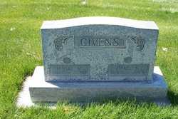
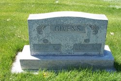
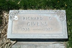
Opal B Brown Givens
| Birth | : | 27 Apr 1903 Bridgeport, Morrill County, Nebraska, USA |
| Death | : | 16 Oct 1996 Sterling, Logan County, Colorado, USA |
| Burial | : | Timaru Cemetery, Timaru, Timaru District, New Zealand |
| Coordinate | : | -44.4122320, 171.2574270 |
| Description | : | Opal B. Givens, 93, of Sterling, died Oct. 16, 1996 in Sterling. Visitation and viewing began at noon today at the Chaney-Walters Funeral Home. The funeral will be at 10 a.m. Friday at the Christ United Methodist Church with the Rev. T.L. Phillips officiating. Burial will be at Riverside Cemetery. Mrs. Givens was born April 27,1903 to Millard and Harriete (Pickerel) Brown in Bridgeport, Neb. She attended school in Bridgeport and graduated from high school there. She moved to Sterling in 1923. She married Jesse W. Givens on Oct. 18, 1925 in Sterling. She worked at the Platte Valley Title and Mortgage Company... Read More |
frequently asked questions (FAQ):
-
Where is Opal B Brown Givens's memorial?
Opal B Brown Givens's memorial is located at: Timaru Cemetery, Timaru, Timaru District, New Zealand.
-
When did Opal B Brown Givens death?
Opal B Brown Givens death on 16 Oct 1996 in Sterling, Logan County, Colorado, USA
-
Where are the coordinates of the Opal B Brown Givens's memorial?
Latitude: -44.4122320
Longitude: 171.2574270
Family Members:
Parent
Spouse
Siblings
Children
Flowers:
Nearby Cemetories:
1. Timaru Cemetery
Timaru, Timaru District, New Zealand
Coordinate: -44.4122320, 171.2574270
2. Salisbury Park Crematorium
Timaru, Timaru District, New Zealand
Coordinate: -44.4292400, 171.2080200
3. Pareora West Cemetery
Pareora West, Timaru District, New Zealand
Coordinate: -44.4383120, 171.1343000
4. Otaio Cemetery
Otaio, Waimate District, New Zealand
Coordinate: -44.5535220, 171.1790260
5. Whareki Cemetery
Temuka, Timaru District, New Zealand
Coordinate: -44.2558600, 171.2734500
6. Temuka Cemetery
Temuka, Timaru District, New Zealand
Coordinate: -44.2499010, 171.3014390
7. St. Mary's Church Cemetery
Esk Valley, Waimate District, New Zealand
Coordinate: -44.5244000, 171.0836000
8. Pleasant Point Cemetery
Pleasant Point, Timaru District, New Zealand
Coordinate: -44.2615490, 171.1237320
9. Burnett Family Cemetery
Cave, Timaru District, New Zealand
Coordinate: -44.3156830, 170.9457270
10. Saint Aidan's Churchyard
Geraldine, Timaru District, New Zealand
Coordinate: -44.1544420, 171.0980340
11. St David’s Anglican Churchyard
Mackenzie District, New Zealand
Coordinate: -44.1706380, 170.9887810
12. Geraldine Cemetery
Geraldine, Timaru District, New Zealand
Coordinate: -44.0982600, 171.2407000
13. Albury Cemetery
Albury, Mackenzie District, New Zealand
Coordinate: -44.2371220, 170.8736570
14. St. Anne's Churchyard
Geraldine, Timaru District, New Zealand
Coordinate: -44.0836111, 171.1994444
15. Waimate Lawn Cemetery
Waimate, Waimate District, New Zealand
Coordinate: -44.7401200, 171.0614100
16. Waimate Old Cemetery
Waimate, Waimate District, New Zealand
Coordinate: -44.7410700, 171.0601300
17. Te Waimatemate Urupā
Waimate, Waimate District, New Zealand
Coordinate: -44.7367311, 171.0277419
18. Woodbury Cemetery
Woodbury, Timaru District, New Zealand
Coordinate: -44.0360900, 171.2127000
19. Fairlie Cemetery
Fairlie, Mackenzie District, New Zealand
Coordinate: -44.1075700, 170.8301500
20. Arundel Cemetery
Arundel, Timaru District, New Zealand
Coordinate: -43.9785690, 171.2838900
21. Longbeach Estate Chapel
Longbeach, Ashburton District, New Zealand
Coordinate: -44.0941090, 171.6884504
22. Hinds Cemetery
Hinds, Ashburton District, New Zealand
Coordinate: -44.0075580, 171.5735400
23. Morven Cemetery
Morven, Waimate District, New Zealand
Coordinate: -44.8658369, 171.0852820
24. Cracroft Cemetery
Ruapuna, Ashburton District, New Zealand
Coordinate: -43.9341900, 171.2989500


