Opal Jeanette Marrington Kent
| Birth | : | 13 Feb 1911 Sac County, Iowa, USA |
| Death | : | 6 May 2002 Storm Lake, Buena Vista County, Iowa, USA |
| Burial | : | Schaller Cemetery, Schaller, Sac County, USA |
| Coordinate | : | 42.5046000, -95.3117600 |
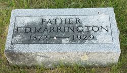
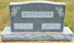
| Description | : | Opal Jeanette Marrington was born on February 13, 1911 in rural Sac County, the daughter of Edward and Harriet (Williamson) Marrington. She graduated from Schaller High School. She was married to Nolan Kent on June 18, 1929. He died in 1977. The couple farmed near Auburn before moving to Schaller. Opal worked for Schaller Popcorn Company more than 30 years. She moved to Lake View Manor Apartments in Storm Lake in 1997 and to Good Samaritan Center in Newell in March 2002. She was a member of Schaller United Methodist Church, she loved flower and vegetable gardening, she enjoyed fishing and was famous for her baking, her grandchildren especially loved her homemade pies. Opal is survived by her daughter, Maxine Dettmann and her husband, Bill of Newell; a son... Read More |
frequently asked questions (FAQ):
-
Where is Opal Jeanette Marrington Kent's memorial?
Opal Jeanette Marrington Kent's memorial is located at: Schaller Cemetery, Schaller, Sac County, USA.
-
When did Opal Jeanette Marrington Kent death?
Opal Jeanette Marrington Kent death on 6 May 2002 in Storm Lake, Buena Vista County, Iowa, USA
-
Where are the coordinates of the Opal Jeanette Marrington Kent's memorial?
Latitude: 42.5046000
Longitude: -95.3117600
Family Members:
Parent
Spouse
Siblings
Children
Flowers:
Nearby Cemetories:
1. Schaller Cemetery
Schaller, Sac County, USA
Coordinate: 42.5046000, -95.3117600
2. Saint Josephs Catholic Church Cemetery
Schaller, Sac County, USA
Coordinate: 42.5035000, -95.3095000
3. German Methodist Cemetery
Schaller, Sac County, USA
Coordinate: 42.5045000, -95.2481000
4. Chase Cemetery
Sac County, USA
Coordinate: 42.5036011, -95.2288971
5. Immanuel Reformed Cemetery
Schaller, Sac County, USA
Coordinate: 42.5396996, -95.2294006
6. Cook Center Cemetery
Schaller, Sac County, USA
Coordinate: 42.4432983, -95.2649994
7. Maple Valley Township Cemetery
Alta, Buena Vista County, USA
Coordinate: 42.5752600, -95.3199980
8. Galva Township Cemetery East
Galva, Ida County, USA
Coordinate: 42.5031110, -95.4083200
9. Saint Johns Lutheran Cemetery
Galva, Ida County, USA
Coordinate: 42.5187700, -95.4183300
10. Saint John Lutheran Cemetery
Hanover, Buena Vista County, USA
Coordinate: 42.6053467, -95.3725739
11. Galva Township Cemetery
Galva, Ida County, USA
Coordinate: 42.5031013, -95.4664001
12. Sacred Heart Cemetery
Early, Sac County, USA
Coordinate: 42.4650002, -95.1446991
13. Emmanuel Cemetery
Cook Township, Sac County, USA
Coordinate: 42.3993988, -95.2063980
14. Early Union Cemetery
Early, Sac County, USA
Coordinate: 42.4578018, -95.1425018
15. Protestant Union Cemetery
Early, Sac County, USA
Coordinate: 42.4294014, -95.1483002
16. Diamond Cemetery
Cherokee County, USA
Coordinate: 42.6156006, -95.4480972
17. Buena Vista Memorial Park Cemetery
Storm Lake, Buena Vista County, USA
Coordinate: 42.6539001, -95.2339020
18. Sac County Farm Cemetery
Early, Sac County, USA
Coordinate: 42.4295560, -95.1175190
19. Nemaha Cemetery
Nemaha, Sac County, USA
Coordinate: 42.5102997, -95.0905991
20. Richland Cemetery
Sac County, USA
Coordinate: 42.3544006, -95.2238998
21. Storm Lake Cemetery
Storm Lake, Buena Vista County, USA
Coordinate: 42.6352800, -95.1744400
22. Woodlawn Cemetery
Alta, Buena Vista County, USA
Coordinate: 42.6730600, -95.2908300
23. Holstein Cemetery
Holstein, Ida County, USA
Coordinate: 42.5119019, -95.5436020
24. Salem Reform Cemetery
Sac County, USA
Coordinate: 42.3555984, -95.1866989


