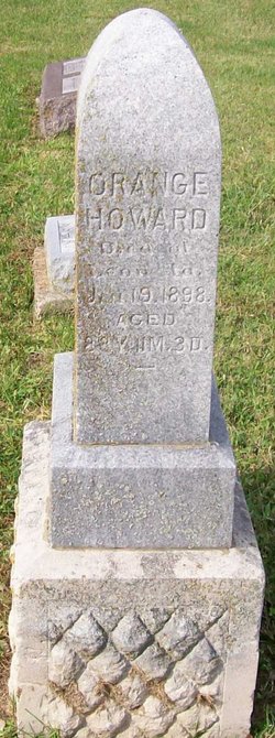
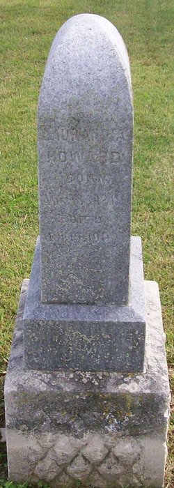
Orange Howard
| Birth | : | 16 Feb 1810 New Hampshire, USA |
| Death | : | 19 Jan 1898 |
| Burial | : | Ephesus Community Cemetery, Campbellton, Jackson County, USA |
| Coordinate | : | 30.9818000, -85.3532000 |
| Description | : | Died at Leon, Iowa. Aged 88Y 11M 3D |
frequently asked questions (FAQ):
-
Where is Orange Howard's memorial?
Orange Howard's memorial is located at: Ephesus Community Cemetery, Campbellton, Jackson County, USA.
-
When did Orange Howard death?
Orange Howard death on 19 Jan 1898 in
-
Where are the coordinates of the Orange Howard's memorial?
Latitude: 30.9818000
Longitude: -85.3532000
Family Members:
Spouse
Children
Flowers:
Nearby Cemetories:
1. Howard Family Cemetery
Jackson County, USA
Coordinate: 30.9786000, -85.3676000
2. Friendship Cemetery
Campbellton, Jackson County, USA
Coordinate: 30.9564900, -85.3484500
3. James W. Bruner Cemetery
Campbellton, Jackson County, USA
Coordinate: 30.9578120, -85.3788750
4. Campbellton Baptist Cemetery
Campbellton, Jackson County, USA
Coordinate: 30.9487000, -85.3954000
5. Ramah Baptist Church Cemetery
Houston County, USA
Coordinate: 31.0334454, -85.3304825
6. Registers Cemetery
Houston County, USA
Coordinate: 31.0002995, -85.4147034
7. Madrid City Cemetery
Madrid, Houston County, USA
Coordinate: 31.0310650, -85.3884811
8. Saint Marys Methodist Church Cemetery
Cottonwood, Houston County, USA
Coordinate: 31.0419640, -85.3602450
9. Saint Paul AME Church Cemetery
Campbellton, Jackson County, USA
Coordinate: 30.9431820, -85.4080250
10. Mount Zion Baptist Church Cemetery
Cottonwood, Houston County, USA
Coordinate: 31.0222111, -85.2943420
11. Madrid Baptist Church Cemetery
Madrid, Houston County, USA
Coordinate: 31.0355840, -85.4015600
12. Holy Neck Cemetery
Campbellton, Jackson County, USA
Coordinate: 30.9185674, -85.3073467
13. Pleasant Ridge Cemetery
Malone, Jackson County, USA
Coordinate: 30.9655080, -85.2663357
14. Cottonwood City Cemetery
Cottonwood, Houston County, USA
Coordinate: 31.0470104, -85.3054886
15. Registers Cemetery
Houston County, USA
Coordinate: 31.0296993, -85.4375000
16. Saint Phillips Cemetery
Houston County, USA
Coordinate: 31.0314007, -85.4385986
17. Gainer Cemetery
Browntown, Jackson County, USA
Coordinate: 30.9873960, -85.4587840
18. Union Hill Missionary Baptist Church Cemetery
Cottonwood, Houston County, USA
Coordinate: 31.0593359, -85.2872273
19. Saint Mary Missionary Baptist Church Cemetery
Jacobs, Jackson County, USA
Coordinate: 30.8949200, -85.4059460
20. Possum Trot Cemetery
Greenwood, Jackson County, USA
Coordinate: 30.8874269, -85.3204711
21. Snelling Cemetery
Cottondale, Jackson County, USA
Coordinate: 30.8866170, -85.3199390
22. Mount Zion Missionary Baptist Cemetery
Malone, Jackson County, USA
Coordinate: 30.9577200, -85.2401000
23. New Harmony Freewill Baptist Church Cemetery
Cottonwood, Houston County, USA
Coordinate: 31.0247580, -85.2452860
24. Hodgesville Baptist Church Cemetery
Dothan, Houston County, USA
Coordinate: 31.0837803, -85.3710785


