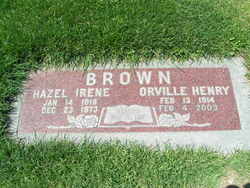
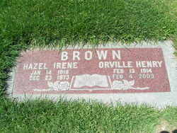
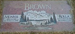
Orville Henry “Brownie” Brown
| Birth | : | 13 Feb 1914 Benson County, North Dakota, USA |
| Death | : | 4 Feb 2003 Wenatchee, Chelan County, Washington, USA |
| Burial | : | Pleasant View Cemetery, Carthage, Miner County, USA |
| Coordinate | : | 44.1693993, -97.6983032 |
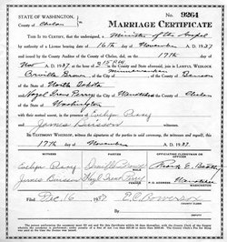
| Description | : | Orville Henry Brown "Brownie" of Wenatchee died Tuesday, February 4, 2003 at Central Washington Hospital. Orville was born February 13, 1914 to Henry and Lena Brown in Grahams Island, North Dakota, where he lived until moving to Wenatchee in the early 1930s. Orville worked for John Knowles Construction and various companies throughout the Pacific Northwest. He was an avid fisherman who enjoyed hunting and shooting the breeze. Orville married Hazel Irene Perry November 17, 1937. They had 5 children. He became a widower in 1973. He married Lois Minmer Chandler June 28, 1974 and they spent the last several winters traveling the... Read More |
frequently asked questions (FAQ):
-
Where is Orville Henry “Brownie” Brown's memorial?
Orville Henry “Brownie” Brown's memorial is located at: Pleasant View Cemetery, Carthage, Miner County, USA.
-
When did Orville Henry “Brownie” Brown death?
Orville Henry “Brownie” Brown death on 4 Feb 2003 in Wenatchee, Chelan County, Washington, USA
-
Where are the coordinates of the Orville Henry “Brownie” Brown's memorial?
Latitude: 44.1693993
Longitude: -97.6983032
Family Members:
Flowers:
Nearby Cemetories:
1. Pleasant View Cemetery
Carthage, Miner County, USA
Coordinate: 44.1693993, -97.6983032
2. Trinity Lutheran Cemetery New
Carthage, Miner County, USA
Coordinate: 44.1812172, -97.7092285
3. Sacred Heart Cemetery
Carthage, Miner County, USA
Coordinate: 44.1824989, -97.7089005
4. Trinity Lutheran Cemetery
Carthage, Miner County, USA
Coordinate: 44.1697006, -97.7403030
5. Esmond Cemetery
Esmond, Kingsbury County, USA
Coordinate: 44.2578000, -97.7728000
6. Prairie Flower Cemetery
Fedora, Miner County, USA
Coordinate: 44.0969009, -97.8169022
7. Cloverleaf Colony Cemetery
Howard, Miner County, USA
Coordinate: 44.1858368, -97.5361023
8. Morgans Cemetery
Miner County, USA
Coordinate: 44.0602989, -97.7707977
9. Dow Cemetery
Manchester, Kingsbury County, USA
Coordinate: 44.3112200, -97.6930700
10. Berton Cemetery
Miner County, USA
Coordinate: 44.1542015, -97.4903030
11. Saint Nicholas Cemetery
Roswell, Miner County, USA
Coordinate: 44.0057793, -97.6929626
12. IOOF Cemetery
Vilas, Miner County, USA
Coordinate: 44.0225067, -97.5940399
13. Lutheran Cemetery
Artesian, Sanborn County, USA
Coordinate: 44.0967700, -97.9117600
14. Belleview Cemetery
Howard, Miner County, USA
Coordinate: 44.1116080, -97.4686910
15. Roswell Cemetery
Roswell, Miner County, USA
Coordinate: 43.9939003, -97.6919022
16. Saint Peter Cemetery
De Smet, Kingsbury County, USA
Coordinate: 44.3046000, -97.5313000
17. Saint Anthony's Catholic Cemetery
Sanborn County, USA
Coordinate: 44.1478400, -97.9504400
18. Fedora Cemetery
Fedora, Miner County, USA
Coordinate: 43.9996986, -97.7906036
19. Norwegian Lutheran Cemetery
Sanborn County, USA
Coordinate: 44.0966988, -97.9332962
20. Immanuel Lutheran Cemetery
Belle Prairie Township, Beadle County, USA
Coordinate: 44.2341003, -97.9559021
21. Manchester Cemetery
Manchester, Kingsbury County, USA
Coordinate: 44.3701930, -97.7125530
22. Saint Johns Lutheran Cemetery
Howard, Miner County, USA
Coordinate: 44.0106010, -97.5105972
23. Graceland Cemetery
Howard, Miner County, USA
Coordinate: 44.0003014, -97.5289001
24. Saint Josephs Cemetery
Howard, Miner County, USA
Coordinate: 44.0092010, -97.5105972


