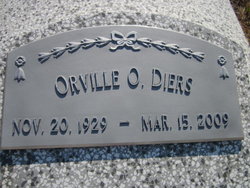
Orville O Diers
| Birth | : | 20 Nov 1929 Cuming County, Nebraska, USA |
| Death | : | 15 Mar 2009 Omaha, Douglas County, Nebraska, USA |
| Burial | : | Saint Andrew's Episcopal Church Cemetery, Bloomfield, Hartford County, USA |
| Coordinate | : | 41.8934593, -72.7584076 |
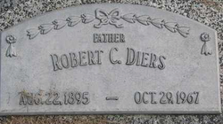
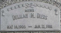
| Description | : | Orville O. was born November 20, 1929 on the family farm near Crowell in Cuming County, to Robert and Delilah Petz Diers. He attended country school and graduated from West Point High School with the class of 1949. Orville served in the US Army from October 4, 1951 until September 22, 1953, stationed mostly in Alaska. On June 29, 1958 he married Elizabeth Toelle at St. Mary's Catholic Church in West Point. The couple farmed for a year, then moved to Macon, Missouri where Orville worked as district manager for Archer Oil. The couple moved to Kansas City, Missouri where... Read More |
frequently asked questions (FAQ):
-
Where is Orville O Diers's memorial?
Orville O Diers's memorial is located at: Saint Andrew's Episcopal Church Cemetery, Bloomfield, Hartford County, USA.
-
When did Orville O Diers death?
Orville O Diers death on 15 Mar 2009 in Omaha, Douglas County, Nebraska, USA
-
Where are the coordinates of the Orville O Diers's memorial?
Latitude: 41.8934593
Longitude: -72.7584076
Family Members:
Parent
Siblings
Flowers:
Nearby Cemetories:
1. Saint Andrew's Episcopal Church Cemetery
Bloomfield, Hartford County, USA
Coordinate: 41.8934593, -72.7584076
2. Tariffville Cemetery
Tariffville, Hartford County, USA
Coordinate: 41.9079132, -72.7694473
3. Saint Bernard Cemetery
Tariffville, Hartford County, USA
Coordinate: 41.9084282, -72.7686005
4. Hartford Mutual Society Memorial Park
East Granby, Hartford County, USA
Coordinate: 41.9196815, -72.7742538
5. Beth Hillel Synagogue Memorial Park
East Granby, Hartford County, USA
Coordinate: 41.9218216, -72.7706451
6. Congregation Teferes Israel Memorial Park
East Granby, Hartford County, USA
Coordinate: 41.9217300, -72.7715912
7. East Granby Smallpox Cemetery
East Granby, Hartford County, USA
Coordinate: 41.9245000, -72.7491000
8. Simsbury United Methodist Church Memorial Garden
Simsbury, Hartford County, USA
Coordinate: 41.8760520, -72.8018120
9. Simsbury Cemetery
Simsbury, Hartford County, USA
Coordinate: 41.8749809, -72.8020782
10. First Church of Christ Memorial Garden
Simsbury, Hartford County, USA
Coordinate: 41.8706790, -72.8059490
11. Plank Hill Road Grave
Simsbury, Hartford County, USA
Coordinate: 41.8810640, -72.8134860
12. Holcomb Cemetery
East Granby, Hartford County, USA
Coordinate: 41.9371223, -72.7716751
13. East Granby Cemetery
East Granby, Hartford County, USA
Coordinate: 41.9416008, -72.7261963
14. Elmwood Cemetery
East Granby, Hartford County, USA
Coordinate: 41.9371986, -72.7146988
15. East Granby Congregational Church Memorial Garden
East Granby, Hartford County, USA
Coordinate: 41.9434330, -72.7239120
16. Mountain View Cemetery
Bloomfield, Hartford County, USA
Coordinate: 41.8330994, -72.7418976
17. Old Wintonbury Cemetery
Bloomfield, Hartford County, USA
Coordinate: 41.8335342, -72.7368927
18. Latimer Hill Cemetery
Bloomfield, Hartford County, USA
Coordinate: 41.8350296, -72.7289734
19. Old Poquonock Burying Ground
Windsor, Hartford County, USA
Coordinate: 41.8895950, -72.6741714
20. Elm Grove Cemetery
Windsor, Hartford County, USA
Coordinate: 41.8917007, -72.6727982
21. Saint Josephs Cemetery
Windsor, Hartford County, USA
Coordinate: 41.9136009, -72.6769028
22. The First Church Memorial Garden
Granby, Hartford County, USA
Coordinate: 41.9538918, -72.7891693
23. Granby Cemetery
Granby, Hartford County, USA
Coordinate: 41.9571991, -72.7913971
24. Saint Alban's Memorial Gardens
Simsbury, Hartford County, USA
Coordinate: 41.8539314, -72.8339996


