| Birth | : | 4 Dec 1946 Pine Bluff, Jefferson County, Arkansas, USA |
| Death | : | 20 Jul 2012 Pine Bluff, Jefferson County, Arkansas, USA |
| Burial | : | New Hope Cemetery, Rison, Cleveland County, USA |
| Coordinate | : | 33.9313850, -92.0950780 |
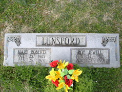
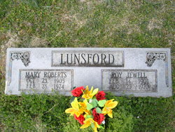
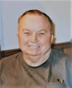
| Description | : | Pam Lunsford Wilder December 4, 1946 - July 20, 2012 Biography Pam Lunsford Wilder, age 65, of Pine Bluff, died Friday, July 20, 2012. She was born December 4, 1946 in Pine Bluff. Daughter of the late Roy Jewell Lunsford and Mary Melinda Roberts Lunsford. Mrs. Wilder was a retired factory worker and a faithful member of New Beginnings Baptist in Pine Bluff. She loved the outdoors and fishing. Mrs. Wilder was always helping and caring for others. She was a loving mother and loved her family dearly and everyone enjoyed her unique sense of humor. Mrs. Wilder was... Read More |
frequently asked questions (FAQ):
-
Where is Pam Lunsford Wilder's memorial?
Pam Lunsford Wilder's memorial is located at: New Hope Cemetery, Rison, Cleveland County, USA.
-
When did Pam Lunsford Wilder death?
Pam Lunsford Wilder death on 20 Jul 2012 in Pine Bluff, Jefferson County, Arkansas, USA
-
Where are the coordinates of the Pam Lunsford Wilder's memorial?
Latitude: 33.9313850
Longitude: -92.0950780
Family Members:
Parent
Siblings
Flowers:
Nearby Cemetories:
1. New Hope Cemetery
Rison, Cleveland County, USA
Coordinate: 33.9313850, -92.0950780
2. New Hope Original Cemetery
Cleveland County, USA
Coordinate: 33.9293400, -92.0942310
3. Lindsey Cemetery
Cleveland County, USA
Coordinate: 33.9241982, -92.1568985
4. Liberty Hill Cemetery
Rison, Cleveland County, USA
Coordinate: 33.8938790, -92.1497240
5. Bethlehem Cemetery
Rison, Cleveland County, USA
Coordinate: 33.9874510, -92.1180710
6. Macedonia Cemetery
Rison, Cleveland County, USA
Coordinate: 33.8689003, -92.1247025
7. Rutledge Cemetery
Cleveland County, USA
Coordinate: 33.9625830, -92.1672250
8. Harlow Cemetery
Cleveland County, USA
Coordinate: 33.9108009, -92.1766968
9. Cherry Cemetery
Cleveland County, USA
Coordinate: 33.8830986, -92.1577988
10. Rowell Cemetery
Rowell, Cleveland County, USA
Coordinate: 33.8923650, -92.0190570
11. Friendship Cemetery
Friendship, Cleveland County, USA
Coordinate: 33.9818993, -92.0291977
12. Varnell Cemetery
Rison, Cleveland County, USA
Coordinate: 33.9141998, -92.1847000
13. New Cemetery
Rison, Cleveland County, USA
Coordinate: 33.9385986, -92.1905975
14. Greenwood Cemetery
Rison, Cleveland County, USA
Coordinate: 33.9446983, -92.1900024
15. Humble Hope Cemetery
Cleveland County, USA
Coordinate: 33.9202995, -92.1932983
16. Wesley Chapel Cemetery
Cleveland County, USA
Coordinate: 34.0031610, -92.0409960
17. Union Hill Missionary Baptist Church Cemetery
Cleveland County, USA
Coordinate: 33.9839940, -92.1767140
18. John T Niven Cemetery
Rison, Cleveland County, USA
Coordinate: 33.9645050, -92.1960640
19. Harris Cemetery
Kedron, Cleveland County, USA
Coordinate: 34.0202510, -92.1141940
20. Mount Gillard Cemetery
Cleveland County, USA
Coordinate: 34.0107650, -92.0421610
21. Mount Zion Cemetery
Rison, Cleveland County, USA
Coordinate: 34.0281556, -92.1148653
22. Segrest Cemetery
Cleveland County, USA
Coordinate: 33.8470730, -92.0187810
23. Shady Grove Cemetery
Glendale, Lincoln County, USA
Coordinate: 33.9521000, -91.9699000
24. Niven - Watt Cemetery
Cleveland County, USA
Coordinate: 34.0209370, -92.1636200

