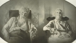
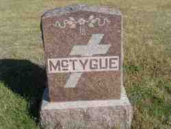
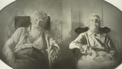
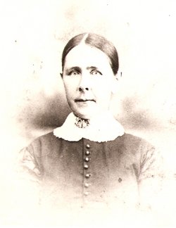
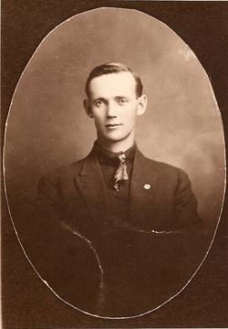
Patrick “Pat” McTygue
| Birth | : | 11 May 1838 Shrule, County Mayo, Ireland |
| Death | : | 7 Feb 1923 Eddyville, Dawson County, Nebraska, USA |
| Burial | : | St Peters Anglican Church Cemetery, Campbelltown, Campbelltown City, Australia |
| Coordinate | : | -34.0657650, 150.8180460 |
| Plot | : | Lot #8 - East Half |
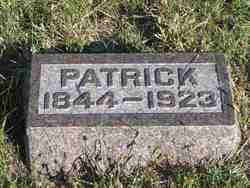
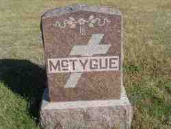
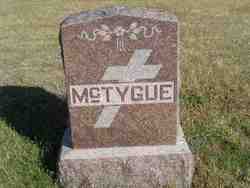
| Description | : | Patrick's headstone reads that he was born in 1844, I found his baptismal records in Shrule, County Mayo Ireland they have he was baptised in May 1838. The family lived in Cloonbanaun townland, just southwest of Shrule. Patrick was the youngest of five children of Michael McTygue and Bridget Purcell. The family has spelled their surname" Tigue, Tygue, Tighe & McTigue. McTygue, P., of Eddyville, NE, real estate and ranch owner, was born in County Mayo, Ireland son of Michael and Bridget (Purcell) McTygue. Mrs. McTygue, with the children, came to the United States locating in Connecticut.... Read More |
frequently asked questions (FAQ):
-
Where is Patrick “Pat” McTygue's memorial?
Patrick “Pat” McTygue's memorial is located at: St Peters Anglican Church Cemetery, Campbelltown, Campbelltown City, Australia.
-
When did Patrick “Pat” McTygue death?
Patrick “Pat” McTygue death on 7 Feb 1923 in Eddyville, Dawson County, Nebraska, USA
-
Where are the coordinates of the Patrick “Pat” McTygue's memorial?
Latitude: -34.0657650
Longitude: 150.8180460
Family Members:
Parent
Spouse
Siblings
Children
Flowers:
Nearby Cemetories:
1. St Peters Anglican Church Cemetery
Campbelltown, Campbelltown City, Australia
Coordinate: -34.0657650, 150.8180460
2. St. David's Presbyterian Church Cemetery
Campbelltown, Campbelltown City, Australia
Coordinate: -34.0662500, 150.8196800
3. St John's Catholic Church Cemetery
Campbelltown, Campbelltown City, Australia
Coordinate: -34.0718780, 150.8234480
4. Campbelltown Methodist Congregational
Campbelltown, Campbelltown City, Australia
Coordinate: -34.0762260, 150.8241000
5. Ingleburn RSL Soldiers Memorial Park
Ingleburn, Campbelltown City, Australia
Coordinate: -34.0094121, 150.8698700
6. Narellan Cemetery
Narellan, Camden Council, Australia
Coordinate: -34.0439610, 150.7331190
7. St. Mary's Anglican Church Cemetery
Denham Court, Campbelltown City, Australia
Coordinate: -33.9817100, 150.8431300
8. Saint John Anglican Churchyard Cemetery
Camden, Camden Council, Australia
Coordinate: -34.0565780, 150.6978230
9. Badgerys Creek Memorial Cemetery
Leppington, Camden Council, Australia
Coordinate: -33.9567900, 150.8371920
10. Camden Catholic Cemetery
Camden, Camden Council, Australia
Coordinate: -34.0666300, 150.6827500
11. Camden General Cemetery
Camden, Camden Council, Australia
Coordinate: -34.0713790, 150.6826360
12. Camden War Cemetery
Camden, Camden Council, Australia
Coordinate: -34.0716910, 150.6817480
13. Forest Lawn Memorial Park
Leppington, Camden Council, Australia
Coordinate: -33.9503100, 150.8435200
14. Cobbitty Anglican Church Cemetery
Cobbitty, Camden Council, Australia
Coordinate: -34.0159110, 150.6881090
15. Holy Innocents Cemetery
Rossmore, Liverpool City, Australia
Coordinate: -33.9435350, 150.7641028
16. Liverpool Cemetery and Crematorium
Liverpool, Liverpool City, Australia
Coordinate: -33.9195850, 150.9109280
17. Liverpool Apex Park
Liverpool, Liverpool City, Australia
Coordinate: -33.9193000, 150.9200000
18. Liverpool Pioneer Memorial Park
Liverpool, Liverpool City, Australia
Coordinate: -33.9172190, 150.9241740
19. Kemps Creek Cemetery and Crematorium
Kemps Creek, Liverpool City, Australia
Coordinate: -33.8958260, 150.7793870
20. Panania Diggers RSL Memorial Garden
Panania, Canterbury-Bankstown Council, Australia
Coordinate: -33.9543618, 150.9882449
21. St John's Anglican Church Cemetery
Badgerys Creek, Liverpool City, Australia
Coordinate: -33.8838500, 150.7427000
22. Greendale Catholic Cemetery
Greendale, Liverpool City, Australia
Coordinate: -33.9117040, 150.6534290
23. Greendale Anglican Church
Greendale, Liverpool City, Australia
Coordinate: -33.9096610, 150.6510140
24. St. James' Churchyard
Luddenham, Liverpool City, Australia
Coordinate: -33.8829580, 150.6918100

