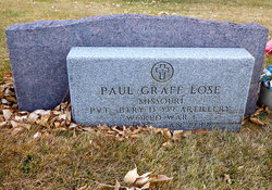
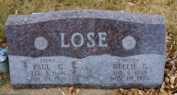
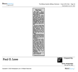
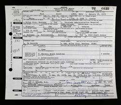
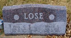
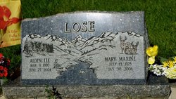
Paul Graff Lose
| Birth | : | 3 Feb 1896 Mercer County, Missouri, USA |
| Death | : | 29 Jan 1972 Miles City, Custer County, Montana, USA |
| Burial | : | Silver Lake Cemetery, Silver Lake, Cowlitz County, USA |
| Coordinate | : | 46.3199997, -122.7703018 |
| Description | : | Memorial managed by great-great-granddaughter. |
frequently asked questions (FAQ):
-
Where is Paul Graff Lose's memorial?
Paul Graff Lose's memorial is located at: Silver Lake Cemetery, Silver Lake, Cowlitz County, USA.
-
When did Paul Graff Lose death?
Paul Graff Lose death on 29 Jan 1972 in Miles City, Custer County, Montana, USA
-
Where are the coordinates of the Paul Graff Lose's memorial?
Latitude: 46.3199997
Longitude: -122.7703018
Family Members:
Parent
Spouse
Siblings
Children
Nearby Cemetories:
1. Silver Lake Cemetery
Silver Lake, Cowlitz County, USA
Coordinate: 46.3199997, -122.7703018
2. Tower Township Cemetery
Castle Rock, Cowlitz County, USA
Coordinate: 46.3648000, -122.7935000
3. Rosin Cemetery
Castle Rock, Cowlitz County, USA
Coordinate: 46.3231010, -122.8606033
4. IOOF Cemetery
Castle Rock, Cowlitz County, USA
Coordinate: 46.2757988, -122.8902969
5. Smith-Tucker Cemetery
Castle Rock, Cowlitz County, USA
Coordinate: 46.2398730, -122.8872470
6. Whittle and Hubbard Cemetery
Castle Rock, Cowlitz County, USA
Coordinate: 46.2736015, -122.9242020
7. Jackson Cemetery
Castle Rock, Cowlitz County, USA
Coordinate: 46.2694016, -122.9377975
8. Toledo Cemetery
Toledo, Lewis County, USA
Coordinate: 46.4425400, -122.8500500
9. Lone Hill Cemetery
Toledo, Lewis County, USA
Coordinate: 46.4571991, -122.7688980
10. Stockport Cemetery
Pleasant Hill, Cowlitz County, USA
Coordinate: 46.2120650, -122.8992730
11. Abel Ostrander Grave
Cowlitz County, USA
Coordinate: 46.1983320, -122.8979930
12. Saint Francis Xavier Cemetery
Toledo, Lewis County, USA
Coordinate: 46.4670300, -122.8229400
13. Vader Catholic Cemetery
Vader, Lewis County, USA
Coordinate: 46.4051000, -122.9697000
14. Seeborg Cemetery
Longview, Cowlitz County, USA
Coordinate: 46.2113000, -122.9625000
15. Ike Cemetery
Ethel, Lewis County, USA
Coordinate: 46.4925000, -122.7375000
16. Little Falls Cemetery
Vader, Lewis County, USA
Coordinate: 46.4105988, -122.9867020
17. Green Hills Memorial Gardens
Kelso, Cowlitz County, USA
Coordinate: 46.1632990, -122.8869860
18. Cowlitz View Memorial Gardens
Kelso, Cowlitz County, USA
Coordinate: 46.1530210, -122.8955570
19. Mount Saint Helens Memorial Grove
Skamania County, USA
Coordinate: 46.3268540, -122.4913040
20. Catlin Cemetery
Kelso, Cowlitz County, USA
Coordinate: 46.1507550, -122.9180490
21. Winlock Cemetery
Winlock, Lewis County, USA
Coordinate: 46.4898000, -122.9336000
22. Snow Cemetery
Lewis County, USA
Coordinate: 46.4552994, -123.0083008
23. Saint Urban Catholic Cemetery
Winlock, Lewis County, USA
Coordinate: 46.5177200, -122.8856500
24. Ethel Greenwood Cemetery
Ethel, Lewis County, USA
Coordinate: 46.5454280, -122.7145280

