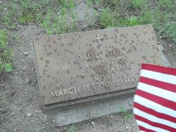
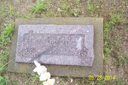
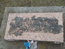
Paul Gua
| Birth | : | 15 Mar 1930 USA |
| Death | : | 9 May 1972 Kittitas County, Washington, USA |
| Burial | : | Sacred Heart Cemetery, Nespelem, Okanogan County, USA |
| Coordinate | : | 48.1790130, -118.9864370 |
| Description | : | US ARMY VETERAN- Korea == Social Security Death Index about Paul Gua Name: Paul Gua SSN: 538-26-____ Born: 15 Mar 1930 Died: May 1972 State (Year) SSN issued: Washington (Before 1951) == Washington Death Index, 1940-1996 about Paul Gua Name: Paul Gua Date of Death: 9 May 1972 Place of Death: Kittitas Residence: Okanogan Gender: Male Certificate: 011222 ==== |
frequently asked questions (FAQ):
-
Where is Paul Gua's memorial?
Paul Gua's memorial is located at: Sacred Heart Cemetery, Nespelem, Okanogan County, USA.
-
When did Paul Gua death?
Paul Gua death on 9 May 1972 in Kittitas County, Washington, USA
-
Where are the coordinates of the Paul Gua's memorial?
Latitude: 48.1790130
Longitude: -118.9864370
Family Members:
Parent
Siblings
Children
Flowers:
Nearby Cemetories:
1. Sacred Heart Cemetery
Nespelem, Okanogan County, USA
Coordinate: 48.1790130, -118.9864370
2. Jack Miller Cemetery
Okanogan County, USA
Coordinate: 48.1791600, -118.9861200
3. Nez Perce Cemetery
Nespelem, Okanogan County, USA
Coordinate: 48.1687530, -118.9774340
4. Nespelem City Cemetery
Nespelem, Okanogan County, USA
Coordinate: 48.1540460, -118.9959000
5. Norine Smith Cemetery
Nespelem, Okanogan County, USA
Coordinate: 48.1540770, -118.9971280
6. Timentwa Cemetery
Nespelem, Okanogan County, USA
Coordinate: 48.1678110, -118.9485300
7. Clark Family Cemetery
Nespelem, Okanogan County, USA
Coordinate: 48.2168730, -118.9747480
8. Little Bob Cemetery
Nespelem, Okanogan County, USA
Coordinate: 48.1352700, -118.9861100
9. Little Nespelem Cemetery
Okanogan County, USA
Coordinate: 48.1249400, -118.9766100
10. Stoakin Family Cemetery
Okanogan County, USA
Coordinate: 48.2207600, -118.8632700
11. Simpson Family Cemetery
Okanogan County, USA
Coordinate: 48.1119400, -118.8861200
12. Seaton Grove Cemetery
Okanogan County, USA
Coordinate: 48.0327800, -118.9644500
13. Kartar Cemetery
Okanogan County, USA
Coordinate: 48.2197100, -119.2694500
14. Keller Cemetery
Keller, Ferry County, USA
Coordinate: 48.0900232, -118.6928129
15. Mary Keller Cemetery
Keller, Ferry County, USA
Coordinate: 47.9550700, -118.8780200
16. Delrio Cemetery
Douglas County, USA
Coordinate: 48.0049700, -119.2333700
17. Spring Canyon Cemetery
Lincoln, Lincoln County, USA
Coordinate: 47.9302788, -118.9469452
18. Mary Hughes Cemetery
Keller, Ferry County, USA
Coordinate: 48.0405300, -118.6648100
19. Lucy Ignace Cemetery
Keller, Ferry County, USA
Coordinate: 48.0297400, -118.6713400
20. Sanpoil Cemetery
Keller, Ferry County, USA
Coordinate: 48.0331600, -118.6608800
21. Booher Grave
Riverside, Okanogan County, USA
Coordinate: 48.3409070, -119.3244000
22. Daniel Ignace Cemetery
Keller, Ferry County, USA
Coordinate: 47.9886200, -118.6805700
23. Felicite Cemetery
Ferry County, USA
Coordinate: 47.9582100, -118.6917400
24. Annie Kauffman Cemetery
Keller, Ferry County, USA
Coordinate: 47.9072800, -118.7464100

