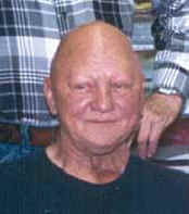
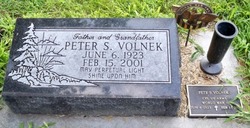
Peter Stanley Volnek
| Birth | : | 6 Jun 1923 Greeley County, Nebraska, USA |
| Death | : | 15 Feb 2001 Columbus, Platte County, Nebraska, USA |
| Burial | : | Red Hill Memorial Gardens, Mullins, Marion County, USA |
| Coordinate | : | 34.1679993, -79.2284012 |
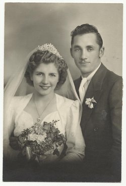
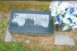
| Description | : | Son of Andrew & Clara (Niedbalski) Volnek Sr. As a boy he lived on a farm near Cedar Rapids, Nebraska and attended school in Greeley and Boone County. He served in the U.S. Army during WWII from 1943-1945. He married Phyllis Nowak on February 4, 1947 at Fullerton, Nebraska. Pete farmed near Fullerton for several years and then moved to Columbus where he was a mechanic at Columbus Oil, and Northside Motors. He drove a truck for Behlen Manufacturing for 30 years. He also owned and operated the Village Inn Cafe in Richland from 1968 until May of 1995 when he... Read More |
frequently asked questions (FAQ):
-
Where is Peter Stanley Volnek's memorial?
Peter Stanley Volnek's memorial is located at: Red Hill Memorial Gardens, Mullins, Marion County, USA.
-
When did Peter Stanley Volnek death?
Peter Stanley Volnek death on 15 Feb 2001 in Columbus, Platte County, Nebraska, USA
-
Where are the coordinates of the Peter Stanley Volnek's memorial?
Latitude: 34.1679993
Longitude: -79.2284012
Family Members:
Parent
Spouse
Siblings
Children
Flowers:
Nearby Cemetories:
1. Red Hill Memorial Gardens
Mullins, Marion County, USA
Coordinate: 34.1679993, -79.2284012
2. Nazarene Cemetery
Marion County, USA
Coordinate: 34.1699982, -79.2249985
3. Mullins Cemetery
Mullins, Marion County, USA
Coordinate: 34.1779000, -79.2148000
4. Gapway Baptist Church Cemetery
Gapway, Marion County, USA
Coordinate: 34.1583595, -79.2466202
5. Harrington Cemetery
Mullins, Marion County, USA
Coordinate: 34.1873150, -79.1923230
6. Lambert Cemetery
Marion County, USA
Coordinate: 34.1575012, -79.2718964
7. Martin Cemetery
Mullins, Marion County, USA
Coordinate: 34.1555060, -79.2720190
8. Progressive Church Of Our Lord Jesus Christ
Mullins, Marion County, USA
Coordinate: 34.2080820, -79.2370870
9. McMillan Cemetery
Mullins, Marion County, USA
Coordinate: 34.2092018, -79.2213974
10. Center UMC Cemetery
Mullins, Marion County, USA
Coordinate: 34.2075970, -79.1990020
11. Smith Cemetery
Mullins, Marion County, USA
Coordinate: 34.2097200, -79.2006600
12. Midway Cemetery
Mullins, Marion County, USA
Coordinate: 34.2002300, -79.1858600
13. Mill Creek Baptist Church Cemetery
Mullins, Marion County, USA
Coordinate: 34.2086800, -79.1921870
14. Mill Church Cemetery
Mullins, Marion County, USA
Coordinate: 34.2127310, -79.1910620
15. Smith Cemetery
Mullins, Marion County, USA
Coordinate: 34.1427994, -79.2869034
16. Gilchrist Cemetery
Nichols, Marion County, USA
Coordinate: 34.2057640, -79.1770880
17. Mayers Memorial Park
Mullins, Marion County, USA
Coordinate: 34.2205009, -79.2578964
18. Norton's Memorial Park
Mullins, Marion County, USA
Coordinate: 34.2211571, -79.2581635
19. Cedardale Cemetery
Mullins, Marion County, USA
Coordinate: 34.2211990, -79.2584991
20. Jordan Cemetery
Mullins, Marion County, USA
Coordinate: 34.1232800, -79.2747400
21. Lewis Cemetery
Horry County, USA
Coordinate: 34.1561400, -79.1581500
22. Old Field Cemetery
Marion County, USA
Coordinate: 34.2310982, -79.2394028
23. Smith-Waller Cemetery
Marion, Marion County, USA
Coordinate: 34.1535988, -79.3041992
24. Hill Crest Cemetery
Mullins, Marion County, USA
Coordinate: 34.2319300, -79.2380620

