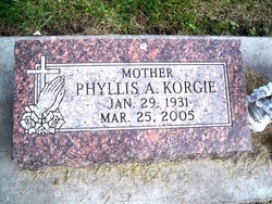
Phyllis Ann Thraen Korgie
| Birth | : | 29 Jan 1931 Harlan, Shelby County, Iowa, USA |
| Death | : | 25 Mar 2005 Columbus, Platte County, Nebraska, USA |
| Burial | : | Holy Trinity Churchyard, Wonston, City of Winchester, England |
| Coordinate | : | 51.1531280, -1.3194670 |
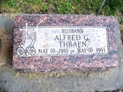
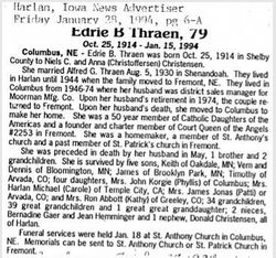
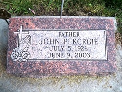
| Description | : | Daughter of Alfred & Edrie (Christensen) Thraen. During her childhood, her family moved to Columbus, NE where Phyllis graduated from St. Bonaventure H.S. in 1949. She married John P. Korgie August 19th, 1952 at St. Anthony Catholic Church in Columbus, NE. Together they founded the Data Center of Nebraska in 1968. Phyllis and her husband were active in the Knights of Columbus, American Legion, and Sertoma. She was a member of St. Anthony Catholic Church and served as a lector. Phyllis had a great love of life and lived it to the fullest. Phyllis and her husband enjoyed trips to Israel, Alaska, and... Read More |
frequently asked questions (FAQ):
-
Where is Phyllis Ann Thraen Korgie's memorial?
Phyllis Ann Thraen Korgie's memorial is located at: Holy Trinity Churchyard, Wonston, City of Winchester, England.
-
When did Phyllis Ann Thraen Korgie death?
Phyllis Ann Thraen Korgie death on 25 Mar 2005 in Columbus, Platte County, Nebraska, USA
-
Where are the coordinates of the Phyllis Ann Thraen Korgie's memorial?
Latitude: 51.1531280
Longitude: -1.3194670
Family Members:
Parent
Spouse
Children
Flowers:
Nearby Cemetories:
1. Holy Trinity Churchyard
Wonston, City of Winchester, England
Coordinate: 51.1531280, -1.3194670
2. Hunton Cemetery
City of Winchester, England
Coordinate: 51.1540300, -1.3133700
3. St. James' Churchyard
Wonston, City of Winchester, England
Coordinate: 51.1540400, -1.3132500
4. St. Mary and St. Michael Churchyard
Stoke Charity, City of Winchester, England
Coordinate: 51.1507600, -1.3026500
5. St Michael and All Angels Churchyard
Bullington, Test Valley Borough, England
Coordinate: 51.1684730, -1.3508250
6. St. Mary the Virgin Churchyard
Micheldever, City of Winchester, England
Coordinate: 51.1491220, -1.2683430
7. All Saints Churchyard
Barton Stacey, Test Valley Borough, England
Coordinate: 51.1679344, -1.3794169
8. Lovedon Lane Burial Ground
Kings Worthy, City of Winchester, England
Coordinate: 51.0994120, -1.2958180
9. All Saints Churchyard
East Stratton, City of Winchester, England
Coordinate: 51.1573920, -1.2275280
10. St Nicholas Churchyard
Longparish, Test Valley Borough, England
Coordinate: 51.1928000, -1.3917400
11. St Catherine Churchyard Extension
Littleton, City of Winchester, England
Coordinate: 51.0936165, -1.3538719
12. St Catherine of Alexandria church
Littleton, City of Winchester, England
Coordinate: 51.0935748, -1.3538420
13. St Mary Churchyard
Crawley, City of Winchester, England
Coordinate: 51.1112870, -1.3955080
14. Crawley Cemetery
Crawley, City of Winchester, England
Coordinate: 51.1093760, -1.3977960
15. St Mary Churchyard
Kings Worthy, City of Winchester, England
Coordinate: 51.0882590, -1.2977040
16. St Mary Churchyard
Tufton, Basingstoke and Deane Borough, England
Coordinate: 51.2185300, -1.3463600
17. St Swithun Churchyard
Headbourne Worthy, City of Winchester, England
Coordinate: 51.0851610, -1.3055710
18. St Swithun Churchyard
Martyr Worthy, City of Winchester, England
Coordinate: 51.0919540, -1.2648440
19. St Mary Churchyard
Easton, City of Winchester, England
Coordinate: 51.0873090, -1.2743220
20. St. Andrew's Churchyard
Hurstbourne Priors, Basingstoke and Deane Borough, England
Coordinate: 51.2174800, -1.3729100
21. St Mary the Less Churchyard
Chilbolton, Test Valley Borough, England
Coordinate: 51.1599200, -1.4364900
22. All Hallows Churchyard
Whitchurch, Basingstoke and Deane Borough, England
Coordinate: 51.2270580, -1.3427600
23. Whitchurch Cemetery
Whitchurch, Basingstoke and Deane Borough, England
Coordinate: 51.2270150, -1.3456120
24. St. Peter and Holy Cross Churchyard
Wherwell, Test Valley Borough, England
Coordinate: 51.1652250, -1.4416910

