
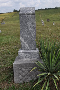
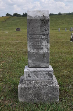
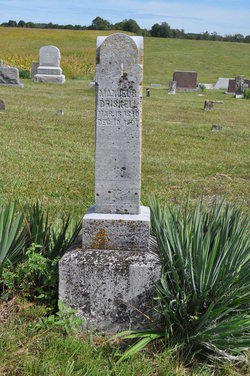
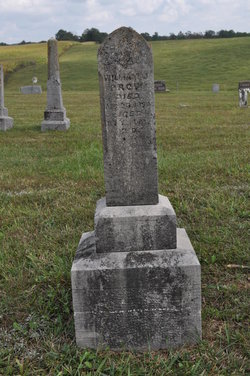
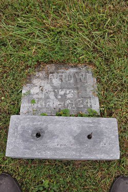
Polly Ann Driskell Prow
| Birth | : | 16 Mar 1827 Indiana, USA |
| Death | : | 19 Sep 1899 Washington County, Indiana, USA |
| Burial | : | Turtle Mountain Lutheran Cemetery, Carbury, Bottineau County, USA |
| Coordinate | : | 48.9219017, -100.5730972 |
| Description | : | Daughter of Robert and Catherine (Beck) Driskell. Wife of Christian Prow, married December 18, 1847. |
frequently asked questions (FAQ):
-
Where is Polly Ann Driskell Prow's memorial?
Polly Ann Driskell Prow's memorial is located at: Turtle Mountain Lutheran Cemetery, Carbury, Bottineau County, USA.
-
When did Polly Ann Driskell Prow death?
Polly Ann Driskell Prow death on 19 Sep 1899 in Washington County, Indiana, USA
-
Where are the coordinates of the Polly Ann Driskell Prow's memorial?
Latitude: 48.9219017
Longitude: -100.5730972
Family Members:
Parent
Spouse
Siblings

Children
Flowers:


Nearby Cemetories:
1. Turtle Mountain Lutheran Cemetery
Carbury, Bottineau County, USA
Coordinate: 48.9219017, -100.5730972
2. Emmanuel Lutheran Brethren Cemetery
Carbury, Bottineau County, USA
Coordinate: 48.9441872, -100.5558243
3. Bethesda Cemetery
Souris, Bottineau County, USA
Coordinate: 48.9648933, -100.6333923
4. Inherred Lutheran Cemetery
Bottineau, Bottineau County, USA
Coordinate: 48.9209404, -100.4674301
5. Mountain View Cemetery
Souris, Bottineau County, USA
Coordinate: 48.9014015, -100.6750031
6. Swedish Lutheran Cemetery
Souris, Bottineau County, USA
Coordinate: 48.9858055, -100.6212158
7. Manger Cemetery
Carbury, Bottineau County, USA
Coordinate: 48.9385986, -100.4113998
8. Mount Saint Mark Cemetery
Bottineau, Bottineau County, USA
Coordinate: 48.8347015, -100.4610977
9. Oak Creek Cemetery
Bottineau, Bottineau County, USA
Coordinate: 48.8197296, -100.4362532
10. Nordland Cemetery
Bottineau, Bottineau County, USA
Coordinate: 48.9307327, -100.3609695
11. Roth Grave Site
Roth, Bottineau County, USA
Coordinate: 48.9008369, -100.7966385
12. Goodlands Cemetery
Goodlands, Southwestern Census Division, Canada
Coordinate: 49.0874500, -100.6014700
13. Lesje Cemetery
Roth, Bottineau County, USA
Coordinate: 48.9664688, -100.8221359
14. Saint Paul Roman Catholic Cemetery
Deloraine, Southwestern Census Division, Canada
Coordinate: 49.0866860, -100.4711380
15. Vinje Cemetery
Bottineau, Bottineau County, USA
Coordinate: 48.8960000, -100.3040000
16. Fish Lake Cemetery
Bottineau, Bottineau County, USA
Coordinate: 48.9427986, -100.2919006
17. Turtle Mountain Adventist Cemetery
Bottineau, Bottineau County, USA
Coordinate: 48.9490000, -100.2756000
18. Zion Cemetery
Landa, Bottineau County, USA
Coordinate: 48.9375000, -100.8942032
19. Nedaros Cemetery
Landa, Bottineau County, USA
Coordinate: 48.7916985, -100.8407974
20. Landa Cemetery
Landa, Bottineau County, USA
Coordinate: 48.9077988, -100.9067001
21. Waskada Cemetery
Waskada, Southwestern Census Division, Canada
Coordinate: 49.0947200, -100.7806100
22. Salem Lutheran Cemetery
Bottineau, Bottineau County, USA
Coordinate: 48.9509315, -100.2387238
23. Mouse River Lutheran Cemetery
Landa, Bottineau County, USA
Coordinate: 48.8067741, -100.8635788
24. Tarsus Cemetery
Bottineau, Bottineau County, USA
Coordinate: 48.8036003, -100.2807999