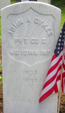
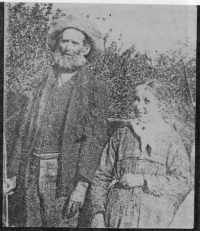
PVT John A. Dykes
| Birth | : | 1833 Greene County, Tennessee, USA |
| Death | : | 19 Jul 1898 Lane County, Oregon, USA |
| Burial | : | Our Lady of Visitation Cemetery, Benjamin River, Restigouche County, Canada |
| Coordinate | : | 47.9608470, -66.1677440 |
| Plot | : | GAR Plot |
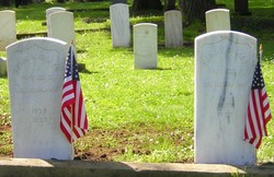
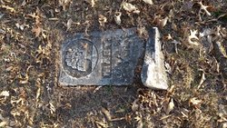
| Description | : | Union Civil War veteran. He orginally served in Company F, 36th Iowa Volunteer Infantry and was wounded and reported captured at the Battle of Mark's Mills, Arkansas on April 25, 1864. He escaped the Confederates and reenlisted in Company G, 46th Iowa Volunteer Infantry. The son of Joseph Dykes and Mary Brandon, he is buried next to his brother, fellow Iowa veteran Henry Dykes. This grave was unmarked for 109 years until a military headstone was obtained and placed by the Sons of Union Veterans of the Civil War in 2007. |
frequently asked questions (FAQ):
-
Where is PVT John A. Dykes's memorial?
PVT John A. Dykes's memorial is located at: Our Lady of Visitation Cemetery, Benjamin River, Restigouche County, Canada.
-
When did PVT John A. Dykes death?
PVT John A. Dykes death on 19 Jul 1898 in Lane County, Oregon, USA
-
Where are the coordinates of the PVT John A. Dykes's memorial?
Latitude: 47.9608470
Longitude: -66.1677440
Family Members:
Parent
Siblings
Flowers:
Nearby Cemetories:
1. Our Lady of Visitation Cemetery
Benjamin River, Restigouche County, Canada
Coordinate: 47.9608470, -66.1677440
2. New Mills Cemetery
New Mills, Restigouche County, Canada
Coordinate: 47.9682730, -66.1863330
3. Dalhousie Riverview Cemetery Extension
Dalhousie, Restigouche County, Canada
Coordinate: 47.9687720, -66.1871800
4. St. Joseph's Cemetery
Nash Creek, Restigouche County, Canada
Coordinate: 47.9212200, -66.0814300
5. St. Maria Goretti Catholic Cemetery
Lorne, Restigouche County, Canada
Coordinate: 47.8720790, -66.1266760
6. Saint Gabriel's Cemetery
Jacquet River, Restigouche County, Canada
Coordinate: 47.9156900, -66.0165100
7. The Meeting House Cemetery
Jacquet River, Restigouche County, Canada
Coordinate: 47.9179700, -66.0001400
8. St Francois-Xavier Cemetery
Charlo, Restigouche County, Canada
Coordinate: 48.0033690, -66.3383130
9. Old Carleton Cemetery
Carleton, Gaspesie-Iles-de-la-Madeleine Region, Canada
Coordinate: 48.1011100, -66.1086890
10. Crypte de l'église de Carleton-sur-Mer
Carleton-sur-Mer, Gaspesie-Iles-de-la-Madeleine Region, Canada
Coordinate: 48.1016010, -66.1082120
11. Carleton-sur-Mer Cimetière du Saint Joseph
Carleton-sur-Mer, Gaspesie-Iles-de-la-Madeleine Region, Canada
Coordinate: 48.1059810, -66.1077940
12. Cimetière (ancien) de St-Omer (Carleton-sur-Mer)
Carleton-sur-Mer, Gaspesie-Iles-de-la-Madeleine Region, Canada
Coordinate: 48.1106660, -66.2205170
13. Cimetière (nouveau) de St-Omer (Carleton-sur-Mer)
Carleton-sur-Mer, Gaspesie-Iles-de-la-Madeleine Region, Canada
Coordinate: 48.1126800, -66.2185330
14. New Carleton Cemetery
Carleton-sur-Mer, Gaspesie-Iles-de-la-Madeleine Region, Canada
Coordinate: 48.1126800, -66.2185330
15. Saint-Jean-Baptiste Cemetery
Dalhousie, Restigouche County, Canada
Coordinate: 48.0624667, -66.3675414
16. Dalhousie Cemetery
Dalhousie, Restigouche County, Canada
Coordinate: 48.0654500, -66.3682800
17. Riverside Cemetery
Dalhousie, Restigouche County, Canada
Coordinate: 48.0653900, -66.3685600
18. Saint-Jean-Baptiste Cemetery
Dalhousie, Restigouche County, Canada
Coordinate: 48.0494977, -66.3854513
19. Saint Mary's Anglican Churchyard
Dalhousie, Restigouche County, Canada
Coordinate: 48.0655480, -66.3756800
20. Eel River Crossing Cemetery
Eel River Crossing, Restigouche County, Canada
Coordinate: 48.0168600, -66.4195600
21. Saint John Bosco Cemetery
Dalhousie, Restigouche County, Canada
Coordinate: 48.0655975, -66.3940506
22. United Pentecostal Church New Life Cemetery
Dalhousie, Restigouche County, Canada
Coordinate: 48.0659670, -66.3989640
23. Old Pioneer Protestant Church
Belledune River, Restigouche County, Canada
Coordinate: 47.9102427, -65.8795417
24. Cimetière de Nouvelle
Nouvelle, Gaspesie-Iles-de-la-Madeleine Region, Canada
Coordinate: 48.1467090, -66.3164920

