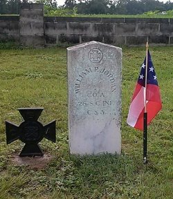
Pvt William Perry “Bill P.” Jordan
| Birth | : | 1822 Cedar Grove, Horry County, South Carolina, USA |
| Death | : | 1900 Cedar Grove, Horry County, South Carolina, USA |
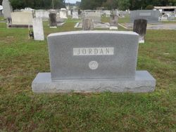
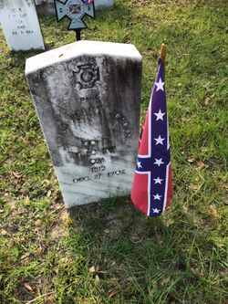
| Burial | : | Cedar Grove Baptist Church Cemetery, Conway, Horry County, USA |
| Coordinate | : | 33.8355904, -79.1778030 |
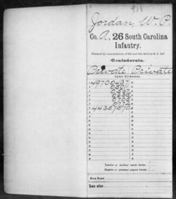
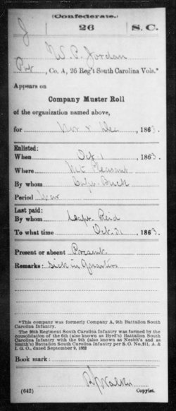
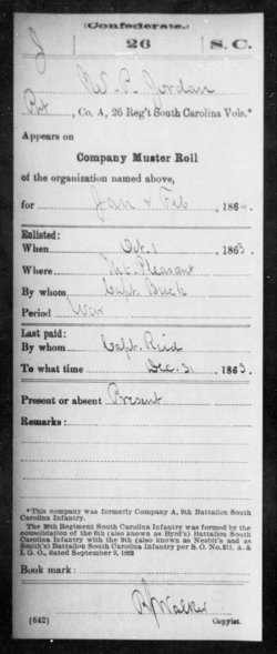
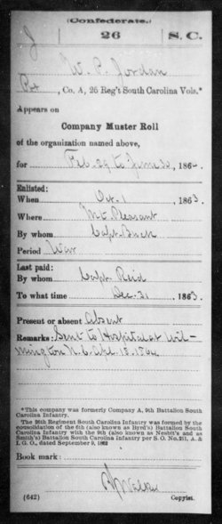
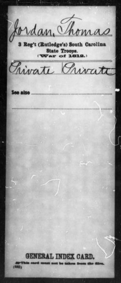
| Description | : | A Confederate Soldier, William P Jordan served in Co. A, 26th SC Infantry, CSA. He was the son of Thomas Jordan 1778-1855 & Mary Jordan. He married Frances A. Jordan about 1848. "Bill P." Jordan (as he was known) was wounded in the leg during the WBTS, as a bullet went straight through his calf on the back of his leg. Miraculously he did not lose his leg but walked with a limp from thence forward. He did survive the war & was a good farmer the remainder of his life. |
frequently asked questions (FAQ):
-
Where is Pvt William Perry “Bill P.” Jordan's memorial?
Pvt William Perry “Bill P.” Jordan's memorial is located at: Cedar Grove Baptist Church Cemetery, Conway, Horry County, USA.
-
When did Pvt William Perry “Bill P.” Jordan death?
Pvt William Perry “Bill P.” Jordan death on 1900 in Cedar Grove, Horry County, South Carolina, USA
-
Where are the coordinates of the Pvt William Perry “Bill P.” Jordan's memorial?
Latitude: 33.8355904
Longitude: -79.1778030
Family Members:
Parent
Spouse
Siblings
Children
Flowers:
Nearby Cemetories:
1. Cedar Grove Baptist Church Cemetery
Conway, Horry County, USA
Coordinate: 33.8355904, -79.1778030
2. C. Graham Family Cemetery
Juniper Bay, Horry County, USA
Coordinate: 33.8555780, -79.1631670
3. Freeworship Church Cemetery
Conway, Horry County, USA
Coordinate: 33.8561770, -79.1634110
4. Oak Grove Original Free Will Baptist Cemetery
Conway, Horry County, USA
Coordinate: 33.8539320, -79.1983510
5. Jordan Family Cemetery
Juniper Bay, Horry County, USA
Coordinate: 33.8602990, -79.1598650
6. Cane Branch AME Church Cemetery
Conway, Horry County, USA
Coordinate: 33.8066340, -79.1764460
7. Bunker Hill Cemetery
Horry County, USA
Coordinate: 33.8357690, -79.2212780
8. Pee Dee Freewill Baptist Church Cemetery
Conway, Horry County, USA
Coordinate: 33.8349390, -79.1340460
9. Juniper Bay Baptist Church Cemetery
Conway, Horry County, USA
Coordinate: 33.8719690, -79.1709130
10. Antioch United Methodist Church Cemetery
Conway, Horry County, USA
Coordinate: 33.8583000, -79.2128000
11. Dew Cemetery
Horry County, USA
Coordinate: 33.8006700, -79.1265320
12. High Point Baptist Church Cemetery
Conway, Horry County, USA
Coordinate: 33.8878690, -79.2173600
13. Skipper Spain Cemetery
Conway, Horry County, USA
Coordinate: 33.8610470, -79.1079260
14. Evergreen Original Freewill Baptist Cemetery
Conway, Horry County, USA
Coordinate: 33.8881989, -79.1177979
15. Westside Memorial Gardens
Conway, Horry County, USA
Coordinate: 33.8515200, -79.0917900
16. Brown Swamp United Methodist Cemetery
Conway, Horry County, USA
Coordinate: 33.8997993, -79.1328964
17. Pauley Swamp Baptist Church Cemetery
Dongola, Horry County, USA
Coordinate: 33.7571983, -79.1856003
18. Willow Springs United Methodist Campground Cemeter
Conway, Horry County, USA
Coordinate: 33.8245450, -79.0788440
19. Beverly Cemetery
Conway, Horry County, USA
Coordinate: 33.7536940, -79.1579210
20. Rogers Cemetery
Brittons Neck, Marion County, USA
Coordinate: 33.8417860, -79.2804410
21. Rose Hill Memorial Gardens
Conway, Horry County, USA
Coordinate: 33.8374329, -79.0745392
22. Woodbury Cemetery
Brittons Neck, Marion County, USA
Coordinate: 33.7928300, -79.2693500
23. Mount Hermon Baptist Church Cemetery
Galivants Ferry, Horry County, USA
Coordinate: 33.9129660, -79.2277850
24. Davis Cemetery
Conway, Horry County, USA
Coordinate: 33.8425240, -79.0711940

